
more stats
3,668 ft
Distance
93 ft
Climb
-93 ft
Descent
00:08:22
Avg time
-3 ft
Altitude change
652 ft
Altitude min
718 ft
Altitude max
655 ft
Altitude start
653 ft
Altitude end
-0.1%
Grade
-15.8%
Grade max
16.9%
Grade min
1,319 ft
Distance climb
1,260 ft
Distance down
1,073 ft
Distance flat
00:08:22
Avg time

Feeder Line Details

  • Activities
    • Mountain Bike
    • Winter Fat Bike
    • Hike
    • Trail Running
  • Riding Area
    Henry's Ridge Open Space
    Maple Valley, Washington
  • Difficulty Rating
  • Voted Difficulty
    Blue (5 votes)
  • Local Popularity
    70 in Mountain Biking [+]
    • 85 in Trail Running
    • 40 in Hiking
    • 5 in Winter Fat Biking
  • Global Ranking
    #85817 in Mountain Biking [+]
    • #279869 in Trail Running
    • #70905 in Hiking
  • Trail Type
    Singletrack
  • Bike Type
    AM, XC, Fat
  • Direction
    Both Directions[+]
    • Both Directions for Trail Running
    • Both Directions for Hiking
  • Climb Difficulty
    Blue
  • Physical Rating
    Moderate
  • Season
    Year round
  • Dogs Allowed
    Yes
  • eBike Allowed
  • TTFs on Trail
    Berm
  • Ride in Rain
    Yes
  • Land Owner
    King County

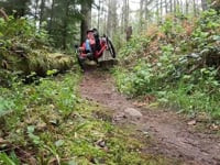
High speed descents, punchy uphill climbs, and, unlike most trails at Henry's Ridge, there are a few flagged surfaces to launch off of (if you want to). There is a cleared section during one of the climbs with a great view of Mount Rainier (on a clear day).

Access Info

Starts from the end of Iron Brigade, which you can enter from Water Tower Park in the Maple Ridge neighborhood.

Local Trail Association
Traditionally Indigenous Territory

Recent Activity on Trail

Past Week
  • 3 rides
  • 11 miles average
6 Months
  • 35 rides
  • 11 miles avg distance
All
  • 503 rides
  • Last: Sep 16, 2026
c1c2c3c4
January
February
March
April
May
June
July
August
September
October
November
December
update trails status or condition

Feeder Line Trail Reports

statusdatedescription
Sep 10, 2026 @ 5:36pm (America/Vancouver)
Sep 10, 2026
Jul 15, 2026 @ 11:25pm (America/Los_Angeles)
Jul 15, 2026
Mar 21, 2026 @ 7:46am (America/Vancouver)
Mar 21, 2026
Large tree down over trail at high point nearest the water tower.
Oct 15, 2025 @ 9:18pm (America/Los_Angeles)
Oct 15, 2025
Large tree down across trail, blocking trail
Jun 12, 2025 @ 5:34pm
Jun 12, 2025
Brushed clear and excellent.
more »
Status:
on Sep 10, 2026
Ideal
Avg: 4.07 (6 votes)
Your vote: 0

view (2,273)
close
      Directions to feeder-line trailhead (47.352750, -122.006120)

      Photos

      8 more »
      mtb
      143 |
      Jan 16, 2018 @ 5:52pm
      Jan 16, 2018
      mtb
      224 |
      Jan 16, 2018 @ 6:07pm
      Jan 16, 2018
      report
      mtb
      50 |
      Nov 24, 2024 @ 10:26am
      Nov 24, 2024
      report
      mtb
      33 |
      Oct 19, 2024 @ 1:57pm
      Oct 19, 2024

      Videos

      2 more »
      Feeder Line Trail at Henry's Ridge
      mtb
      5:36 | 237 | Dec 2, 2023 , Maple Valley
      Feeder Line @ Henry's Ridge - Plus trying to...
      mtb
      7:13 | 980 | Dec 17, 2018 , Maple Valley

      Routes with this trail

      14 miles 1,196 ft 20 Loop
      A fairly extensive tour of Henry's Ridge Open Space, that takes most blues and the few "blacks" from the...
      13 miles 1,167 ft 19
      This route links three sections of Henry's Ridge in a fluid 13 mile course.
      11 miles 1,043 ft 33 Out & Back
      Tried to make a fun tour of BDOS
      4.2
      6 Ratings
      5 50%
      4 33%
      3
      2 17%
      1

      4 Reviews & Comments

      jizgrey jizgrey
      Not sure why this is considered a black trail.
      dmcmul
      One tree down from last night’s high winds and some debris. Trail very dry.
      trailtrailers
      Fun trail, well maintained. More technical than others, but a great flow.

      We hope you've been enjoying Trailforks!

      Create a FREE account to view all trail reviews and much more.

      • By overdrive47 & contributors
      • #34196 - 2,798 views

      Frequently Asked Questions

      Where is Feeder Line located?
      Feeder Line is located in Henry's Ridge Open Space, Maple Valley, Washington, United States. It is part of the Henry's Ridge Open Space trail network. The trailhead is located at coordinates 47.35275, -122.00612.
      How hard is Feeder Line?
      Feeder Line is rated as Blue difficulty. The physical rating is Moderate. The average grade is 0.1%. The climb difficulty is rated Blue.
      What is the elevation gain for Feeder Line?
      Feeder Line has 93 ft of elevation gain. The trail has 93 ft of elevation descent. The elevation ranges from 652 ft to 718 ft.
      Is Feeder Line a point to point trail?
      Feeder Line is not a point to point trail. The direction is Both Directions. The trail type is singletrack.
      How long is Feeder Line?
      Feeder Line is 3,668 ft long. The trail type is singletrack.
      Are dogs allowed on Feeder Line?
      Yes, dogs are allowed on Feeder Line. Please keep dogs on a leash where required and clean up after them.
      When is the best time of year to ride Feeder Line?
      Feeder Line is best visited during: Year round.
      How do I access Feeder Line? Where is the closest parking trailhead?
      The closest parking and trailhead locations to Feeder Line are: View all parking locations in the area.
      How long does it take to ride Feeder Line?
      Based on recorded activities, it takes an average of 9 minutes to ride Feeder Line. The trail is 3,668 ft long. Actual times will vary based on fitness level, conditions, and pace. View recent activity logs for more details.
      How busy is Feeder Line?
      Feeder Line is a very popular trail. There have been 1,949 recorded activities on this trail. The trail has received 2,273 check-ins. View recent activity on this trail.

      Hit the Trail

      Open in App

      Get this trail on your phone instantly.

      open trail in app

      Download Trail

      Save to wishlist, Garmin & download.
      save the trail

      Find Related Routes

      Find routes and users activities that include this trail.
      find routes for this trail

      You must enter a description before submitting.