more stats
2,552 ft
Distance
37 ft
Climb
-146 ft
Descent
00:04:55
Avg time
-108 ft
Altitude change
1,762 ft
Altitude min
1,895 ft
Altitude max
1,875 ft
Altitude start
1,768 ft
Altitude end
-4.2%
Grade
-26.4%
Grade max
9.8%
Grade min
682 ft
Distance climb
1,532 ft
Distance down
243 ft
Distance flat
00:04:55
Avg time

Felicia Details

  • Activities
    • Mountain Bike
    • E-Bike
  • Riding Area
    Cumberland trail network
    Cumberland, British Columbia
  • Difficulty Rating
  • Local Popularity
    65 in Mountain Biking [+]
    • 65 in E-Biking
  • Global Ranking
    #14778 in Mountain Biking [+]
    • #44338 in E-Biking
  • Provincial Ranking
    #712 in Mountain Biking · British Columbia [+]
    • #3,068 in E-Biking
  • Trail Type
    Singletrack
  • Direction
    Downhill Primary
    Popular Direction Shown
  • Dogs Allowed
    Yes
  • eBike Allowed
    Yes up to Class 1

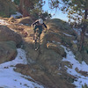
Felicia connects users between Race Rocks and Potluck. In keeping with the Race Rocks character and finding outstanding views down the Beaufort Range corridor, Felicia benches along a series of rock bluffs with a Black Diamond rating and enough exposure to keep you on your toes as you thread the trails course. You'll go past one of the biggest old growth trees in the network which stands proud, much like Big Lonely Doug in the Renfrew Valley. Felicia is a girl's name of Latin origin, meaning "lucky," "fortunate," and "happy."

Tags
ExposureOld-growth forest

Local Trail Association

Traditionally Indigenous Territory

Recent Activity on Trail

Past Week
  • 0 rides
  •  
6 Months
  • 214 rides
  • 20 miles avg distance
All
  • 788 rides
  • Last: Oct 16, 2026
c1c2c3c4
January
February
March
April
May
June
July
August
September
October
November
December
update trails status or condition

Felicia Trail Reports

Status:
on Apr 4, 2026
Ideal
Avg: 4.3 (7 votes)
Your vote: 0

view (2,903)
close
      Directions to felicia trailhead (49.583550, -125.073140)

      Photos

      20 more »
      mtb
      86 |
      Dec 29, 2024 @ 2:35pm
      Dec 29, 2024
      mtb
      74 |
      Dec 29, 2024 @ 2:35pm
      Dec 29, 2024
      mtb
      68 |
      Dec 29, 2024 @ 2:35pm
      Dec 29, 2024
      mtb
      285 |
      Jul 5, 2024 @ 10:02pm
      Jul 5, 2024

      Videos

      3 more »
      Felicia Connector Trail Cumberland
      mtb
      3:25 | 262 | Nov 4, 2024 , Cumberland
      Felicia Cumberland BC
      mtb
      19:32 | 303 | Aug 2, 2024 , Cumberland
      Felica
      ebike
      4:18 | 328 | Apr 6, 2025 , Cumberland

      Routes with this trail

      ★ 4.0 • 24 miles • 4,135 ft • 27 •
      Stage 5 Cumberland produced by Jeremy Grasby and supported by UROC.
      ★ 2.0 • 20 miles • 3,461 ft • 28 •
      BCBR Stage 1 2026.
      ★ 2.5 • 24 miles • 3,989 ft • 28 •
      BCBR Stage 5 Cumberland An XC spin on the well-developed UROC trails.
      4.6 ★★★★★
      7 Ratings
      5 ★ 71%
      4 ★ 14%
      3 ★ 14%
      2 ★
      1 ★

      2 Reviews & Comments

      hi-dr-nick hi-dr-nick
      Should’ve known what it would mean when this was recommended by an old head in the parking lot, other than one or two small spots it’s just a pedaly xc trail
      PhilipHYs6Ea
      Absolutely stunning trail. Thanks to the builders.

      We hope you've been enjoying Trailforks!

      Create a FREE account to view all trail reviews and much more.

      • By DougalBTF Pro UROC RCC & contributors
      • #543898 - 1,612 views

      Frequently Asked Questions

      ▼ Where is Felicia located?
      Felicia is located in Cumberland trail network, Cumberland, British Columbia, Canada. It is part of the Cumberland trail network trail network. The trailhead is located at coordinates 49.58355, -125.07314.
      ▼ How hard is Felicia?
      Felicia is rated as Black Diamond difficulty. The average grade is 4.2%.
      ▼ What is the elevation gain for Felicia?
      Felicia has 37 ft of elevation gain. The trail has 146 ft of elevation descent. The elevation ranges from 1,762 ft to 1,895 ft.
      ▼ Is Felicia a point to point trail?
      Felicia is not a point to point trail. The direction is Downhill Primary. The trail type is singletrack.
      ▼ How long is Felicia?
      Felicia is 2,552 ft long. The trail type is singletrack.
      ▼ Are dogs allowed on Felicia?
      Yes, dogs are allowed on Felicia. Please keep dogs on a leash where required and clean up after them.
      ▼ When is the best time of year to ride Felicia?
      Based on activity log data, the most popular months to ride Felicia are:
      • May (158 activities)
      • July (150 activities)
      • June (61 activities)
      Check the reports page for current trail conditions.
      ▼ How do I access Felicia? Where is the closest parking trailhead?
      The closest parking and trailhead locations to Felicia are: View all parking locations in the area.
      ▼ How long does it take to ride Felicia?
      Based on recorded activities, it takes an average of 5 minutes to ride Felicia. The trail is 2,552 ft long. Actual times will vary based on fitness level, conditions, and pace. View recent activity logs for more details.
      ▼ How busy is Felicia?
      Felicia is a moderately popular trail. There have been 2,899 recorded activities on this trail. The trail has received 2,903 check-ins. View recent activity on this trail.

      Hit the Trail

      Open in App

      Get this trail on your phone instantly.

      open trail in app

      Download Trail

      Save to wishlist, Garmin & download.
      save the trail

      Find Related Routes

      Find routes and users activities that include this trail.
      find routes for this trail

      You must enter a description before submitting.