Fernhill Loop Details
-
Activities
- Mountain Bike
- E-Bike
- Hike
- Trail Running
-
Riding AreaFernhill Trails
Queenstown -
Difficulty Rating
-
Hiking SAC ScaleT3 Demanding Mountain Hiking
-
Trail TypeSingletrack
-
Bike TypeAM, XC
-
DirectionBoth DirectionsPopular in reverse
-
Climb DifficultyBlack Diamond
-
Physical RatingHard
-
Trail VisibilitySometimes hard to follow
-
SeasonAll year
-
Alpine TrailYes
-
Dogs AllowedYes
-
eBike AllowedYes up to Class 1
-
TTFs on TrailDrop, Jump, Rock Garden
-
Global Ranking
-
Local Popularity70 in Mountain Biking [+]
- 40 in E-Biking
- 55 in Trail Running
- 95 in Hiking
-
Year Opened1990
-
Land Owner
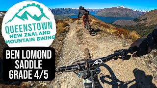
A classic Queenstown trail chock full of gnarly roots that started life as a DOC (govt) track, was shunted by DOC to the QLDC (local council) who the ignored it for a couple of years and closed it. Now licensed to QMTBC who will upgrade, extend and maintain it.
The west (Fernhill) side climb from the Wynyard bike park is a great way to access the McNearlyGnarly jump trail. The East (bike park) side has a great descent that links into Squid Run and there are awesome views from the top if you continue past the treeline where Beech As exits has a fantastic backcounty feel just minutes from the town center.
Access Info
Access from Wynyard Bike Park where the first 1.4km are nice and easy up to McNearlyGnarly but its gets steeper up until you get to the open to visit McGazzas bench and you'll have to push for about 30 mins. Also accessed via Beeched As where you can choose to descend the East side 'roots' into Squid Run or carry on round to Mcgazzas bench and down the west side to McNearlyGnarly
Disclaimer
Shared use track so be aware of walkers
Local Trail Association
-
Please consider joining or donating to the local trail association to supportdonate to earn trail karma!
trail development & maintenance.
Traditionally Indigenous Territory
More Stats for Fernhill Loop mountain bike trail trail
-
Altitude change25 ft
-
Altitude min1,615 ft
-
Altitude max3,061 ft
-
Altitude start1,615 ft
-
Altitude end1,640 ft
-
Grade0.1%
-
Grade max-72.3%
-
Grade min56.3%
-
Distance climb3 miles
-
Distance down2 miles
-
Distance flat1,932 ft
-
Avg time01:19:22
-
Avg reverse time01:16:30
- view trail stats
- Unknown
- Snow Groomed
- Snow Packed
- Snow Covered
- Snow Cover Partial
- Freeze/thaw Cycle
- Icy
- Prevalent Mud
- Wet
- Variable
- Ideal
- Dry
- Very Dry
The colour categories are based on what percentage of riders are riding a trail in its intended direction.
- > 96%
- > 90%
- > 80%
- > 70%
- > 50%
- < 50%
- bi-directional trail
- no data
- < 2 days
- < 1 week
- < 2 weeks
- < 1 month
- < 6 months
- > 6 months
- Downhill Only
- Downhill Primary
- Both Directions
- Uphill Primary
- Uphill Only
- One Direction
- Description
- Photos
- Description & Photos
- Videos
- most popular
- popular
- less popular
- not popular
- mountain biking recent
- mountain biking (>6 month)
- hiking (1 year)
- moto (1 year)
- Downhill Ski
- Backcountry Ski
- Nordic Ski
- Snowmobile
Save the current map location and zoom level as your default home location whenever this page is loaded.
SaveFernhill Loop Trail Reports
Recent Ridelog Activity on Trail
- 0 rides
- 14 rides
- 12 miles avg distance
- 36 rides
- Last: Jun 18, 2025
Photos
Routes with this trail
We hope you've been enjoying Trailforks!
Create a FREE account to view trail comments and much more.
Videos

Nearby Trails
- Fernhill Access Road 59 ft
- Lower Mcnearly Gnarly 59 ft
- Fingerling 164 ft
- Mini Dream Jump Line 367 ft
- Mini Dream Direct Access 564 ft
- By Brendhan
QMTBC & contributors
- #25721 - 27,288 views
- follow/subscribe
- login to download gpx or kml files.
You must enter a description before submitting.