3,941 ft
Distance
74 ft
Climb
-168 ft
Descent
00:03:43
Avg time

Fiori Details

  • Activities
    • Mountain Bike
    • E-Bike
    • Hike
    • Trail Running
  • Riding Area
    Campbell Mountain
    Penticton, British Columbia
  • AKA
    Campbell Classic, Classic Campbell
  • Difficulty Rating
  • Trail Type
    Singletrack
  • Bike Type
    AM, XC
  • Direction
    Both Directions
    Popular direction shown
  • Climb Difficulty
    Green
  • Physical Rating
    Moderate
  • Season
    After frost dries up
  • Dogs Allowed
    Yes
  • eBike Allowed
    Yes up to Class 1
  • Global Ranking
    #54841 in Mountain Biking [+]
    • #10591 in E-Biking
    • #4906 in Trail Running
    • #8623 in Hiking
  • Local Popularity
    95 in Mountain Biking [+]
    • 95 in E-Biking
    • 100 in Trail Running
    • 95 in Hiking

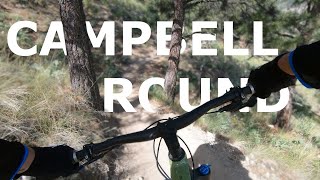
Used to have to ride road back around, now we have a single track that returns to the Yellow Gate at the road.
Many people ride/hike it in reverse.

Access Info

After climbing out of the Canyon you are on the dirt road the circumvents the mountain. Immediately where you popped out there will be a trail on the right just after the fence post.

Local Trail Association
More Stats for Fiori mountain bike trail trail
  • Altitude change
    -94 ft
  • Altitude min
    2,164 ft
  • Altitude max
    2,258 ft
  • Altitude start
    2,258 ft
  • Altitude end
    2,164 ft
  • Grade max
    -64.615%
  • Grade min
    63.467%
  • Distance climb
    1,129 ft
  • Distance down
    2,210 ft
  • Distance flat
    603 ft
  • Avg time
    00:03:43
  • Avg reverse time
    00:08:14
  • view trail stats
Status:
on Nov 12, 2024
Ideal
Avg: 3.77 (3 votes)
Your vote: 0

view (3,112)
close
3D
Trail Conditions
  • Unknown
  • Snow Groomed
  • Snow Packed
  • Snow Covered
  • Snow Cover Partial
  • Freeze/thaw Cycle
  • Icy
  • Prevalent Mud
  • Wet
  • Variable
  • Ideal
  • Dry
  • Very Dry
Trail Flow (Ridden Direction)
Trailforks scans users ridelogs to determine the most popular direction each trail is ridden. A good flowing trail network will have most trails flowing in a single direction according to their intension.
The colour categories are based on what percentage of riders are riding a trail in its intended direction.
  • > 96%
  • > 90%
  • > 80%
  • > 70%
  • > 50%
  • < 50%
  • bi-directional trail
  • no data
Trail Last Ridden
Trailforks scans ridelogs to determine the last time a trail was ridden.
  • < 2 days
  • < 1 week
  • < 2 weeks
  • < 1 month
  • < 6 months
  • > 6 months
Trail Ridden Direction
The intended direction a trail should be ridden.
  • Downhill Only
  • Downhill Primary
  • Both Directions
  • Uphill Primary
  • Uphill Only
  • One Direction
Contribute Details
Colors indicate trail is missing specified detail.
  • Description
  • Photos
  • Description & Photos
  • Videos
Trail Popularity ?
Trailforks scans ridelogs to determine which trails are ridden the most in the last 9 months. Trails are compared with nearby trails in the same city region with a possible 25 colour shades. Think of this as a heatmap, more rides = more kinetic energy = warmer colors.
  • most popular
  • popular
  • less popular
  • not popular
ATV/ORV/OHV Filter
Max Vehicle Width
inches
US Cell Coverage
Legend
cell carrier legend

Radar Time
x Activity Recordings
Trailforks users anonymized public ridelogs from the past 6 months.
  • mountain biking recent
  • mountain biking (>6 month)
  • hiking (1 year)
  • moto (1 year)
Activity Recordings
Trailforks users anonymized public skilogs from the past 12 months.
  • Downhill Ski
  • Backcountry Ski
  • Nordic Ski
  • Snowmobile
Winter Trails
Warning A routing network for winter maps does not exist. Selecting trails using the winter trails layer has been disabled.
x Missing Trails
Most Popular
Least Popular
Trails are colored based on popularity. The more popular a trail is, the more red. Less popular trails trend towards green.
Jump Magnitude Heatmap
Heatmap of where riders jump on trails. Zoom in to see individual jumps, click circles to view jump details.
Trails Deemphasized
Trails are shown in grey.
disable
Only show trails with NO bikes.
enable

Save the current map location and zoom level as your default home location whenever this page is loaded.

Save
      Directions to fiori trailhead (49.512110, -119.531890)
      update trails status or condition

      Fiori Trail Reports

      statusdatedescription
      Nov 12, 2024 @ 2:42pm
      Nov 12, 2024
      Apr 21, 2024 @ 9:21am
      Apr 21, 2024
      Dec 27, 2023 @ 12:45pm
      Dec 27, 2023
      I went back there a couple of days ago and pruned that northeast section, moved one of the big boulders and built a lower go-around to bypass the...
      Nov 7, 2023 @ 11:59am
      Nov 7, 2023
      Damaged and impassable for about 200m at South end due due recent service road grading covering the trail in multiple short sections.
      Aug 12, 2022 @ 7:57am
      Aug 12, 2022
      view all reports »

      Recent Ridelog Activity on Trail

      Past Week
      • 2 rides
      • 7 miles avg distance
      6 Months
      • 64 rides
      • 9 miles avg distance
      All
      • 596 rides
      • Last: Jul 14, 2025

      Photos

      more »
      195 |
      Nov 4, 2012 @ 8:46pm
      Nov 4, 2012
      165 |
      Nov 4, 2012 @ 8:47pm
      Nov 4, 2012
      187 |
      Nov 4, 2012 @ 8:47pm
      Nov 4, 2012
      171 |
      Nov 4, 2012 @ 8:48pm
      Nov 4, 2012

      Routes with this trail

      more »
      titledistance
      BCBR 2021 Stage 6 MTB Final23 miles
      Campbell Mt Circumnavigation6 miles
      Easy to Follow - Tourist Route8 miles
      Campbell Mtn. Loop8 miles

      Reviews / Comments

      No reviews yet, be the first to write a review or ask a question.
      Use trail reports to comment on trail conditions.


      We hope you've been enjoying Trailforks!

      Create a FREE account to view trail comments and much more.

      Videos

      more »
      FIORI Trail
      5:13 | 201 | Jun 17, 2020 , Penticton
      • By 1partatatimeTF Pro PACA & contributors
      • #17679 - 1,988 views

      You must enter a description before submitting.