



more stats
4.0 miles
Distance
366 ft
Climb
-738 ft
Descent
00:42:20
Avg time
-371 ft
Altitude change
6,268 ft
Altitude min
6,970 ft
Altitude max
6,639 ft
Altitude start
6,270 ft
Altitude end
-1.8%
Grade
-30.2%
Grade max
20.3%
Grade min
1 mile
Distance climb
3 miles
Distance down
1,066 ft
Distance flat
00:42:20
Avg time

Flagline (Middle) Details

  • Activities
    • Mountain Bike
    • Hike
    • Trail Running
  • Riding Area
  • Difficulty Rating
  • Voted Difficulty
    Blue (1 vote)
  • Local Popularity
    80 in Mountain Biking [+]
    • 40 in Trail Running
    • 50 in Hiking
  • Global Ranking
    #36956 in Mountain Biking [+]
    • #153553 in Trail Running
    • #147779 in Hiking
  • State Ranking
    #373 in Mountain Biking · Oregon [+]
    • #2,231 in Trail Running
    • #2,224 in Hiking
  • Trail Type
    Singletrack
  • Bike Type
    XC
  • Climb Difficulty
    Blue
  • Physical Rating
    Moderate
  • Season
    August 15 to ski season
  • eBike Allowed
  • Land Owner
    USFS - Deschutes Ranger District

Description from BendTrails:

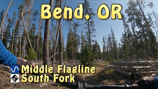
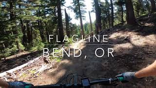
Middle Flagline is one of the more technical, long and fast downhills in the Bend area. The simple fact that this segment is closed for most of the summer makes it a highly anticipated route when August 15th rolls around — it’s pretty much guaranteed that the parking lot at Dutchman Sno Park will be loaded with cars on that morning

If you are thinking about riding this trail before it officially opens on August 15th, think again. The trail will be riddled with deadfall, and there is a full time Forest Service employee roaming the Bend Watershed in the summer.

While you can climb Middle Flagline from Swampy Lakes to reach the Metolius-Windego trail, 90% of riders will start at Dutchman and head downhill towards Bend. The popular “Bachelor to Bend” shuttle usually includes the Middle Flagline trail.

Another popular way to access Middle Flagline is to start at the Skyliner Sno Park, climb Northfork to Met-Win and loop back to your car — that route combines lots of XC climbing with ripping fast DH.

Tags
Shuttle access
Trail Supporters

Recent Activity on Trail

Past Week
  • 28 rides
  • 22 miles average
6 Months
  • 267 rides
  • 21 miles avg distance
All
  • 1,488 rides
  • Last: Oct 4, 2026
c1c2c3c4
January
February
March
April
May
June
July
August
September
October
November
December
update trails status or condition

Flagline (Middle) Trail Reports

statusdatedescription
Aug 16, 2026 @ 12:13pm (America/Los_Angeles)
Aug 16, 2026
reporter Flagline is officially open. COTA cleared all the deadfall and have cleaned up drains and sand piles! Enjoy!
Aug 15, 2026 @ 10:16am (America/Los_Angeles)
Aug 15, 2026
Riding great!
Aug 13, 2026 @ 8:28am (America/Los_Angeles)
Aug 13, 2026
May 26, 2026 @ 11:42am (America/Los_Angeles)
May 26, 2026
Closed until August 15th
Oct 9, 2025 @ 10:56am (America/Los_Angeles)
Oct 9, 2025
Standing water in spots but riding well
more »
Status:
on Aug 16, 2026
Ideal
Avg: 4.36 (16 votes)
Your vote: 0

view (5,804)
close
      Directions to flagline-middle trailhead (44.024310, -121.657360)

      Photos

      22 more »
      mtb
      125 |
      Sep 6, 2025 @ 9:46am
      Sep 6, 2025
      mtb
      160 |
      Sep 6, 2025 @ 9:46am
      Sep 6, 2025
      mtb
      185 |
      Sep 1, 2025 @ 11:08am
      Sep 1, 2025
      mtb
      161 |
      Oct 7, 2023 @ 5:06pm
      Oct 7, 2023

      Videos

      3 more »
      Last Tracks for the season? Snowy Flagline Lap
      mtb
      3:48 | 198 | Oct 25, 2023 , Bend
      youtuber Middle Flagline
      mtb
      11:52 | 317 | Nov 2, 2022 , Bend
      Flagline Trail
      mtb
      9:03 | 1483 | Aug 18, 2020 , Bend

      Routes with this trail

      ★ 4.0 • 30 miles • 1,997 ft • 13 •
      Here in Bend the Whole Chimichanga offers a unique and unparalleled downhill experience of Central Oregon,...
      ★ 5.0 • 14 miles • 1,681 ft • 5 • Loop •
      This is a loop including Middle and Lower Flagline. From Dutchman Snopark, head north to the top of Middle...
      ★ 3.5 • 19 miles • 2,688 ft • 11 • Loop •
      Best of Bend in one loop - bad ass ride that will take it out of you
      4.5 ★★★★★
      16 Ratings
      5 ★ 69%
      4 ★ 13%
      3 ★ 19%
      2 ★
      1 ★

      7 Reviews & Comments

      marknelsen1969 marknelsen1969
      Great fun for intermediate rider. No long technical sections, but enough to grab your attention
      Ppower09
      Snow already and at least 4 inches in section. Fun but slow. Probably done for the year.
      bizango-x bizango-x
      Super fun trail. A bit of tech compared to a lot of trails in Bend. Rode it from Upper Flagline to Lower Flagline and that seemed to be the best direction.

      We hope you've been enjoying Trailforks!

      Create a FREE account to view all trail reviews and much more.

      • By gbearce2001TF Pro & contributors
      • #30107 - 9,350 views

      Frequently Asked Questions

      ▼ Where is Flagline (Middle) located?
      Flagline (Middle) is located in Mt. Bachelor Parking Lot, Bend, Oregon, United States. It is part of the Mt. Bachelor Parking Lot trail network. The trailhead is located at coordinates 44.02431, -121.65736.
      ▼ How hard is Flagline (Middle)?
      Flagline (Middle) is rated as Blue difficulty. The physical rating is Moderate. The average grade is 1.8%. The climb difficulty is rated Blue.
      ▼ What is the elevation gain for Flagline (Middle)?
      Flagline (Middle) has 366 ft of elevation gain. The trail has 738 ft of elevation descent. The elevation ranges from 6,268 ft to 6,970 ft.
      ▼ How long is Flagline (Middle)?
      Flagline (Middle) is 4.0 miles long. The trail type is singletrack.
      ▼ Are dogs allowed on Flagline (Middle)?
      There is no information about dogs being allowed on Flagline (Middle). Check with local trail managers or the trail page for the latest access rules.
      ▼ When is the best time of year to ride Flagline (Middle)?
      Flagline (Middle) is best visited during: August 15 to ski season.
      ▼ How do I access Flagline (Middle)? Where is the closest parking trailhead?
      The closest parking and trailhead locations to Flagline (Middle) are: View all parking locations in the area.
      ▼ How long does it take to ride Flagline (Middle)?
      Based on recorded activities, it takes an average of 42 minutes to ride Flagline (Middle). The trail is 4.0 miles long. Actual times will vary based on fitness level, conditions, and pace. View recent activity logs for more details.
      ▼ How busy is Flagline (Middle)?
      Flagline (Middle) is a very popular trail. There have been 5,930 recorded activities on this trail. The trail has received 5,804 check-ins. View recent activity on this trail.

      Hit the Trail

      Open in App

      Get this trail on your phone instantly.

      open trail in app

      Download Trail

      Save to wishlist, Garmin & download.
      save the trail

      Find Related Routes

      Find routes and users activities that include this trail.
      find routes for this trail

      You must enter a description before submitting.



