938 ft
Distance
-35 ft
Descent
1,293 ft
High Point
Flow Thru Details
-
Activities
- Mountain Bike
- E-Bike
-
Riding AreaThe Hydrocut
Kitchener-Waterloo, Ontario -
Difficulty Rating
-
Trail TypeSingletrack
-
Bike TypeAM, XC, Fat, Adaptive MTB
-
DirectionOne Direction
-
Climb DifficultyGreen
-
Physical RatingModerate
-
Trail VisibilityAlways easy to follow
-
eBike AllowedYes up to Class 1
-
TTFs on TrailBerm, Bridge, Drop, Jump, Pump Track
-
Local Popularity100 in Mountain Biking [+]
- 100 in E-Biking
-
Year Opened2024
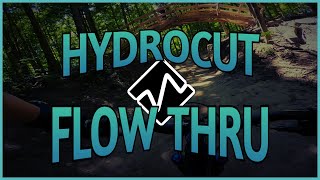
Flow down the first over under trail at The Hydrocut. Flow Thru has large berms and multiple medium to large jumps. Some optional lines can be found if you look for them. Ride under the first ever Divinci Bridge on a trail system.
Local Trail Association
-
Please consider joining or donating to the local trail association to supportdonate to earn trail karma!
trail development & maintenance.
More Stats for Flow Thru mountain bike trail trail
-
Altitude change-36 ft
-
Altitude min1,257 ft
-
Altitude start1,293 ft
-
Altitude end1,257 ft
-
Grade-3.9%
-
Grade max-14.3%
-
Grade min1.5%
-
Distance climb59 ft
-
Distance down535 ft
-
Distance flat243 ft
- view trail stats
close
3D
Trail Conditions
- Unknown
- Snow Groomed
- Snow Packed
- Snow Covered
- Snow Cover Partial
- Freeze/thaw Cycle
- Icy
- Prevalent Mud
- Wet
- Variable
- Ideal
- Dry
- Very Dry
Trail Flow (Ridden Direction)
Trailforks scans users ridelogs to determine the most popular direction each trail is ridden. A good flowing trail network will have most trails flowing in a single direction according to their intension.
The colour categories are based on what percentage of riders are riding a trail in its intended direction.
- > 96%
- > 90%
- > 80%
- > 70%
- > 50%
- < 50%
- bi-directional trail
- no data
Trail Last Ridden
Trailforks scans ridelogs to determine the last time a trail was ridden.
- < 2 days
- < 1 week
- < 2 weeks
- < 1 month
- < 6 months
- > 6 months
Trail Ridden Direction
The intended direction a trail should be ridden.
- Downhill Only
- Downhill Primary
- Both Directions
- Uphill Primary
- Uphill Only
- One Direction
Contribute Details
Colors indicate trail is missing specified detail.
- Description
- Photos
- Description & Photos
- Videos
Trail Popularity ?
Trailforks scans ridelogs to determine which trails are ridden the most in the last 9 months.
Trails are compared with nearby trails in the same city region with a possible 25 colour shades.
Think of this as a heatmap, more rides = more kinetic energy = warmer colors.
- most popular
- popular
- less popular
- not popular
ATV/ORV/OHV Filter
Max Vehicle Width
inches
US Cell Coverage
Legend
Radar Time
x
Activity Recordings
Trailforks users anonymized public ridelogs from the past 6 months.
- mountain biking recent
- mountain biking (>6 month)
- hiking (1 year)
- moto (1 year)
Activity Recordings
Trailforks users anonymized public skilogs from the past 12 months.
- Downhill Ski
- Backcountry Ski
- Nordic Ski
- Snowmobile
Winter Trails
Warning
A routing network for winter maps does not exist. Selecting trails using the winter trails layer has been disabled.
x
Missing Trails
Most Popular
Least Popular
Trails are colored based on popularity. The more popular a trail is, the more red. Less popular trails trend towards green.
Jump Magnitude Heatmap
Heatmap of where riders jump on trails. Zoom in to see individual jumps, click circles to view jump details.
Trails Deemphasized
Trails are shown in grey.
Only show trails with NO bikes.
Save the current map location and zoom level as your default home location whenever this page is loaded.
Save
Directions to flow-thru trailhead
(43.427710, -80.583170)
update trails status or condition
Flow Thru Trail Reports
view all reports »
Recent Ridelog Activity on Trail
Past Week
- 20 rides
- 11 miles avg distance
6 Months
- 103 rides
- 11 miles avg distance
All
- 671 rides
- Last: May 20, 2025
Photos
more »
We hope you've been enjoying Trailforks!
Create a FREE account to view trail comments and much more.
Videos
more »
Nearby Trails
- Dino Trucking 0 ft
- Ridgeline 0 ft
- Cp Rail 0 ft
- Blue Angel 184 ft
- Grass Hopper 374 ft
- follow/subscribe
- login to download gpx or kml files.
You must enter a description before submitting.