
more stats
1.7 miles
Distance
141 ft
Climb
-143 ft
Descent
00:15:00
Avg time
-2 ft
Altitude change
1,669 ft
Altitude min
1,710 ft
Altitude max
1,710 ft
Altitude start
1,709 ft
Altitude end
-18.1%
Grade max
13.6%
Grade min
2,480 ft
Distance climb
2,293 ft
Distance down
4,281 ft
Distance flat
00:15:00
Avg time

Flowage Details

  • Activities
    • Mountain Bike
    • E-Bike
    • Winter Fat Bike
  • Riding Area
    WinMan Trails
    Manitowish Waters, Wisconsin
  • Difficulty Rating
  • Voted Difficulty
    Blue (1 vote)
  • Local Popularity
    90 in Mountain Biking [+]
    • 95 in E-Biking
    • 100 in Winter Fat Biking
  • Global Ranking
    #32560 in Mountain Biking [+]
    • #11801 in E-Biking
    • #83 in Winter Fat Biking
  • State Ranking
    #341 in Mountain Biking · Wisconsin [+]
    • #49 in E-Biking
    • #1 in Winter Fat Biking
  • Blaze Color
  • Trail Type
    Singletrack
  • Bike Type
    AM, XC, Fat
  • Direction
    One Direction
    Popular Direction Shown
  • Climb Difficulty
    Green
  • Physical Rating
    Moderate
  • Trail Visibility
    Always easy to follow
  • Dogs Allowed
    Yes
  • eBike Allowed
    Yes up to Class 1
  • TTFs on Trail
    Bridge, Drop, Jump, Gap Jump, Rock Garden, Skinny
  • Land Owner
    WinMan Trails

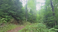
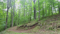
A cross country trail for all riders with moderate drops and jumps, big berms and a few fast sections.

Tags

Local Trail Association

Recent Activity on Trail

Past Week
  • 1 rides
  • 9 miles average
6 Months
  • 185 rides
  • 12 miles avg distance
All
  • 704 rides
  • Last: Oct 31, 2026
update trails status or condition

Flowage Trail Reports

Status:
on Aug 17, 2026
Dry
Avg: 4.35 (11 votes)
Your vote: 0

view (3,203)
close
      Directions to flowage trailhead (46.191050, -89.881770)

      Photos

      4 more »
      mtb
      101 |
      Sep 8, 2024 @ 9:22pm
      Sep 8, 2024
      mtb
      192 |
      Aug 25, 2021 @ 4:55am
      Aug 25, 2021
      mtb
      194 |
      Sep 30, 2020 @ 6:01pm
      Sep 30, 2020
      mtb
      181 |
      Nov 16, 2019 @ 6:49pm
      Nov 16, 2019

      Videos

      2 more »
      Double towards end of Flowage
      mtb
      0:05 | 57 | Aug 24, 2021 , Manitowish Waters
      Rock drop on Flowage
      mtb
      0:06 | 47 | Aug 24, 2021 , Manitowish Waters

      Routes with this trail

      8 miles • 421 ft • 7 • Loop •
      A favorite path through Winman to ride a many of the biggest jumps as possible. It pulls together some of...
      5 miles • 314 ft • 6 • Loop •
      A tour of some of the best rocky tech, jumps, bridges and drops that WinMan has to offer.
      10 miles • 635 ft • 6 • Loop •
      A fun tour of WinMan that mixes flow, a bit of tech and all around good times on the trial.
      4.6 ★★★★★
      11 Ratings
      5 ★ 82%
      4 ★ 9%
      3 ★
      2 ★
      1 ★ 9%

      2 Reviews & Comments

      mikewendricks mikewendricks
      This place rocks! Kids have a place to shred too!
      fatbottomgirl
      Wow! This entire trail system, as well as the facilities, are excellent!! Great trail design. Very well maintained trails and facilities. This trail was a favorite.

      We hope you've been enjoying Trailforks!

      Create a FREE account to view all trail reviews and much more.

      • By jlb77TF Pro & contributors
      • #66848 - 1,653 views

      Frequently Asked Questions

      ▼ Where is Flowage located?
      Flowage is located in WinMan Trails, Manitowish Waters, Wisconsin, United States. It is part of the WinMan Trails trail network. The trailhead is located at coordinates 46.19105, -89.88177.
      ▼ How hard is Flowage?
      Flowage is rated as Blue difficulty. The physical rating is Moderate. The climb difficulty is rated Green.
      ▼ What is the elevation gain for Flowage?
      Flowage has 141 ft of elevation gain. The trail has 143 ft of elevation descent. The elevation ranges from 1,669 ft to 1,710 ft.
      ▼ Is Flowage a point to point trail?
      Yes, Flowage is a point to point trail. The direction is One Direction. The trail type is singletrack.
      ▼ How long is Flowage?
      Flowage is 1.7 miles long. The trail type is singletrack.
      ▼ Are dogs allowed on Flowage?
      Yes, dogs are allowed on Flowage. Please keep dogs on a leash where required and clean up after them.
      ▼ How do I access Flowage? Where is the closest parking trailhead?
      The closest parking and trailhead locations to Flowage are: View all parking locations in the area.
      ▼ How long does it take to ride Flowage?
      Based on recorded activities, it takes an average of 15 minutes to ride Flowage. The trail is 1.7 miles long. Actual times will vary based on fitness level, conditions, and pace. View recent activity logs for more details.
      ▼ How busy is Flowage?
      Flowage is a very popular trail. There have been 3,090 recorded activities on this trail. The trail has received 3,203 check-ins. View recent activity on this trail.

      Hit the Trail

      Open in App

      Get this trail on your phone instantly.

      open trail in app

      Download Trail

      Save to wishlist, Garmin & download.
      save the trail

      Find Related Routes

      Find routes and users activities that include this trail.
      find routes for this trail

      You must enter a description before submitting.

