more stats
932 ft
Distance
2 ft
Climb
-63 ft
Descent
00:01:28
Avg time
-61 ft
Altitude change
1,826 ft
Altitude min
1,886 ft
Altitude max
1,886 ft
Altitude start
1,827 ft
Altitude end
-6.5%
Grade
-23.7%
Grade max
2.4%
Grade min
118 ft
Distance climb
692 ft
Distance down
121 ft
Distance flat
00:01:28
Avg time

Forest-Jump Details

  • Activities
    • Mountain Bike
    • E-Bike
  • Riding Area
  • Difficulty Rating
  • Local Popularity
    100 in Mountain Biking [+]
    • 90 in E-Biking
  • Global Ranking
    #128778 in Mountain Biking [+]
    • #43571 in E-Biking
  • Trail Type
    Singletrack
  • Bike Type
    AM
  • Direction
    Downhill Only
    Popular Direction Shown
  • Dogs Allowed
    Yes
  • eBike Allowed
    Yes up to Class 1
  • TTFs on Trail
    Berm, Jump

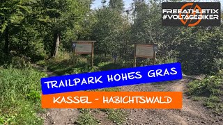
Start: Mittelstation
Streckenlänge: 0,4 km
max. Schwierigkeit: mittelschwer (orange)

Auf der Jumpline erwarten Dich diverse Tables und Sprungelemente, die aber auch alle überrollt werden können. Dieser Trail mündet auf der Cow-Meadow-Flowtrail und führt über die Rinderweide zur Talstation des Liftes. Von hier aus gelangst Du mit dem Lift (abhängig von dessen Öffnung) zur Bergstation oder Du fährst über den Waldpfad und die Forststraßen zurück Richtung Roter Stollen.

Local Trail Association

Recent Activity on Trail

Past Week
  • 1 rides
  • 8 miles average
6 Months
  • 2 rides
  • 22 miles avg distance
All
  • 12 rides
  • Last: Jun 28, 2026
c1c2c3c4
January
February
March
April
May
June
July
August
September
October
November
December
update trails status or condition

Forest-Jump Trail Reports

no reports have been added for Forest-Jump yet, add a trail report.
Trail reports are used to indicate a trails current condition and inform builders and other riders about any issues on a trail.
Status:
no votes yet
Your vote: 0

view (234)
close
3D
Trail Conditions
  • Unknown
  • Snow Groomed
  • Snow Packed
  • Snow Covered
  • Snow Cover Partial
  • Freeze/thaw Cycle
  • Icy
  • Prevalent Mud
  • Wet
  • Variable
  • Ideal
  • Dry
  • Very Dry
Trail Flow (Ridden Direction)
Trailforks scans users ridelogs to determine the most popular direction each trail is ridden. A good flowing trail network will have most trails flowing in a single direction according to their intension.
The colour categories are based on what percentage of riders are riding a trail in its intended direction.
  • > 96%
  • > 90%
  • > 80%
  • > 70%
  • > 50%
  • < 50%
  • bi-directional trail
  • no data
Trail Last Ridden
Trailforks scans ridelogs to determine the last time a trail was ridden.
  • < 2 days
  • < 1 week
  • < 2 weeks
  • < 1 month
  • < 6 months
  • > 6 months
Trail Ridden Direction
The intended direction a trail should be ridden.
  • Downhill Only
  • Downhill Primary
  • Both Directions
  • Uphill Primary
  • Uphill Only
  • One Direction
Contribute Details
Colors indicate trail is missing specified detail.
  • Description
  • Photos
  • Description & Photos
  • Videos
Trail Popularity ?
Trailforks scans ridelogs to determine which trails are ridden the most in the last 9 months. Trails are compared with nearby trails in the same city region with a possible 25 colour shades. Think of this as a heatmap, more rides = more kinetic energy = warmer colors.
  • most popular
  • popular
  • less popular
  • not popular
ATV/ORV/OHV Filter
Max Vehicle Width
inches
US Cell Coverage
Legend
cell carrier legend

Radar Time
Activity Recordings
Trailforks uses anonymized public activity data. ?
Activity Recordings
Trailforks uses anonymized public activity data. ?
Personal Heatmap
Activity Types
all / none
Options
2
Date range month
Winter Trails
Warning A routing network for winter maps does not exist. Selecting trails using the winter trails layer has been disabled.
Missing Trails
Most Popular
Least Popular
Trails are colored based on popularity. The more popular a trail is, the more red. Less popular trails trend towards green.
Jump Magnitude Heatmap
Heatmap of where riders jump on trails. Zoom in to see individual jumps, click circles to view jump details.
BC Backroad Status

Service Road Atlas is a free to use, community-driven service for viewing and creating reports on the numerous back-country service roads around B.C. and Alberta.

map legend
Slope Aspect
Direction the slope faces
Flat N NE E SE S SW W NW
Trails Deemphasized
Trails are shown in grey.
disable
Only show trails with no bike usage.
Enable
Suggested Layers
Based on selected activity type

    Save the current map location and zoom level as your default home location whenever this page is loaded.

    Save
        Directions to forestjump trailhead (51.308300, 9.362190)

        Photos

        3 more »
        42 |
        Sep 9, 2024 @ 1:23pm
        Sep 9, 2024
        38 |
        Sep 7, 2024 @ 10:45am
        Sep 7, 2024
        37 |
        Aug 31, 2024 @ 1:21pm
        Aug 31, 2024

        Videos

        1 more »
        EMTB - Bikepark Habichtswald bei Kassel -...
        9:53 | 92 | Nov 5, 2024 , Kassel

        Reviews / Comments

        No reviews yet, be the first to write a review or ask a question.
        Use trail reports to comment on trail conditions.


        We hope you've been enjoying Trailforks!

        Create a FREE account to view trail comments and much more.

        • By DonPromilloKSTF Pro & contributors
        • #660158 - 295 views

        Frequently Asked Questions About Forest-Jump

        Where is Forest-Jump located?
        Forest-Jump is located in TrailPark Hohes Gras, Kassel, Germany. It is part of the TrailPark Hohes Gras trail network. The trailhead is located at coordinates 51.3083, 9.36219.
        How hard is Forest-Jump?
        Forest-Jump is rated as Blue difficulty. The average grade is 6.5%.
        What is the elevation gain for Forest-Jump?
        Forest-Jump has 2 ft of elevation gain. The trail has 63 ft of elevation descent. The elevation ranges from 1,826 ft to 1,886 ft.
        Is Forest-Jump a point to point trail?
        Yes, Forest-Jump is a point to point trail. The direction is Downhill Only. The trail type is singletrack.

        Hit the Trail

        Open in App

        Get this trail on your phone instantly.
        open trail in app

        Download Trail

        Save to wishlist, Garmin & download.
        save the trail

        Find Related Routes

        Find routes and users activities that include this trail.
        find routes for this trail

        You must enter a description before submitting.