
more stats
3.2 miles
Distance
1,129 ft
Climb
-142 ft
Descent
00:40:46
Avg time
986 ft
Altitude change
2,083 ft
Altitude min
3,071 ft
Altitude max
2,083 ft
Altitude start
3,071 ft
Altitude end
5.9%
Grade
-31%
Grade max
37.6%
Grade min
2 miles
Distance climb
2,533 ft
Distance down
1,713 ft
Distance flat
00:40:46
Avg time

Full Frontal Details

  • Activities
    • Mountain Bike
    • Winter Fat Bike
    • Hike
    • Trail Running
  • Riding Area
    Conkle Mountain
    Summerland, British Columbia
  • Difficulty Rating
  • Local Popularity
    100 in Mountain Biking heatmap [+]
    • 95 in Trail Running
    • 100 in Hiking
    • 5 in Winter Fat Biking
  • Global Ranking
    #33238 in Mountain Biking [+]
    • #91687 in Trail Running
    • #84705 in Hiking
    • #3591 in Winter Fat Biking
  • Provincial Ranking
    #1,641 in Mountain Biking · British Columbia [+]
    • #5,290 in Trail Running
    • #4,460 in Hiking
    • #302 in Winter Fat Biking
  • Trail Type
    Singletrack
  • Bike Type
    AM, XC, Fat
  • Direction
    Uphill Primary
    Popular Direction Shown
  • Climb Difficulty
    Blue
  • Physical Rating
    Hard
  • Season
    March-November
  • Dogs Allowed
    Yes
  • TTFs on Trail
    Rock Face
  • Ride in Rain
    Yes

As the primary climb up the east side of Conkle, this trail gets a fair bit of traffic and maintenance. Grades are forgiving and the views get more spectacular as the elevation increases. Includes two "false summits" before ascending to the top ridge and a choice of descents. It can also be used as a descent, but isn't recommended, as you're likely to meet lots of riders and hikers coming up.

The name is a reference to the legendary naked hiking guy who used to be seen often on this trail.

Access Info

Good parking is available just off Bathville between the rodeo grounds and the Steam Train station (west trailhead) -- please use this lot if you can. Parking at the end of Fenwick has caused congestion and issues with neighbours, so avoid it if possible.

Tags
Rock slabsSummit

Local Trail Association

Recent Activity on Trail

Past Week
  • 2 rides
  • 8 miles average
6 Months
  • 167 rides
  • 7 miles avg distance
All
  • 726 rides
  • Last: Nov 21, 2026
c1c2c3c4
January
February
March
April
May
June
July
August
September
October
November
December
Status:
on Sep 4, 2026
Ideal
Avg: 4.26 (13 votes)
Your vote: 0

view (3,831)
close
      Directions to full-frontal trailhead (49.582600, -119.701690)

      Photos

      23 more »
      mtb
      142 |
      Jul 11, 2021 @ 1:03pm
      Jul 11, 2021
      mtb
      264 |
      Jun 30, 2018 @ 2:32pm
      Jun 30, 2018
      mtb
      263 |
      Jun 30, 2018 @ 2:32pm
      Jun 30, 2018
      mtb
      251 |
      Jun 9, 2018 @ 6:48pm
      Jun 9, 2018

      Videos

      1 more »
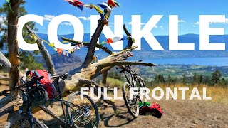
      Full Frontal - Mt. Conkle, Summerland
      mtb
      7:29 | 820 | Aug 24, 2020 , Summerland

      Routes with this trail

      more »
      ★ 3.0 • 24 miles • 3,639 ft • 9 • Loop •
      Test of Humanity, ride to Conkle and back.
      4.4 ★★★★★
      13 Ratings
      5 ★ 62%
      4 ★ 15%
      3 ★ 23%
      2 ★
      1 ★

      2 Reviews & Comments

      StillTrying StillTrying
      This is a great blue trail. In good shape today - dry, as expected, but continues to be a Summerland favourite.
      taouin taouin
      Nice trail. BUT SOME SIGNAGE WOULD BE NICE.

      We hope you've been enjoying Trailforks!

      Create a FREE account to view all trail reviews and much more.

      • By Bricklin69TF Pro & contributors
      • #40220 - 6,218 views

      Frequently Asked Questions

      ▼ Where is Full Frontal located?
      Full Frontal is located in Conkle Mountain, Summerland, British Columbia, Canada. It is part of the Conkle Mountain trail network. The trailhead is located at coordinates 49.5826, -119.70169.
      ▼ How hard is Full Frontal?
      Full Frontal is rated as Blue difficulty. The physical rating is Hard. The average grade is 5.9%. The climb difficulty is rated Blue.
      ▼ What is the elevation gain for Full Frontal?
      Full Frontal has 1,129 ft of elevation gain. The trail has 142 ft of elevation descent. The elevation ranges from 2,083 ft to 3,071 ft.
      ▼ Is Full Frontal a point to point trail?
      Full Frontal is not a point to point trail. The direction is Uphill Primary. The trail type is singletrack.
      ▼ How long is Full Frontal?
      Full Frontal is 3.2 miles long. The trail type is singletrack.
      ▼ Are dogs allowed on Full Frontal?
      Yes, dogs are allowed on Full Frontal. Please keep dogs on a leash where required and clean up after them.
      ▼ When is the best time of year to ride Full Frontal?
      Full Frontal is best visited during: March-November.
      ▼ How do I access Full Frontal? Where is the closest parking trailhead?
      The closest parking and trailhead locations to Full Frontal are: View all parking locations in the area.
      ▼ How long does it take to ride Full Frontal?
      Based on recorded activities, it takes an average of 41 minutes to ride Full Frontal. The trail is 3.2 miles long. Actual times will vary based on fitness level, conditions, and pace. View recent activity logs for more details.
      ▼ How busy is Full Frontal?
      Full Frontal is a very popular trail. There have been 3,745 recorded activities on this trail. The trail has received 3,831 check-ins. View recent activity on this trail.

      Hit the Trail

      Open in App

      Get this trail on your phone instantly.

      open trail in app

      Download Trail

      Save to wishlist, Garmin & download.
      save the trail

      Find Related Routes

      Find routes and users activities that include this trail.
      find routes for this trail

      You must enter a description before submitting.