


Open in App
Get this trail on your phone instantly.

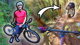
Entrance to this trail is hidden to stop dirt bikes. The first hundred meters of the trail is a steep hike-a-bike down the mountain. Once on the trail the first 25% has several ups and downs with short hike-a-bike sections. Large portions of the trail are nice and loamy. There are some steep switchbacks and a surprisingly large amount of pedalling on the trail as it winds around the hillside rather than heading straight down.
There is not many features on the trail, there is one drop in the middle and a fairly wide log ride at the bottom.
| c1 | c2 | c3 | c4 |
|---|---|---|---|
January | February | March | April |
May | June | July | August |
September | October | November | December |

Service Road Atlas is a free to use, community-driven service for viewing and creating reports on the numerous back-country service roads around B.C. and Alberta.
Save the current map location and zoom level as your default home location whenever this page is loaded.
Save
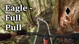
 Rock Face Log Ride Bridge Drop Drop Log Ride Log Ride Rock Face Rock Face Rock Face Rock Face Rock Face Rock Face Rock Face Drop Rock Face

 Drop Ladder Bridge
We hope you've been enjoying Trailforks!
Create a FREE account to view trail comments and much more.
You must enter a description before submitting.

