
more stats
1.0 mile
Distance
133 ft
Climb
-146 ft
Descent
00:07:25
Avg time
-13 ft
Altitude change
4,895 ft
Altitude min
4,987 ft
Altitude max
4,914 ft
Altitude start
4,902 ft
Altitude end
-0.2%
Grade
-20.8%
Grade max
19.4%
Grade min
2,746 ft
Distance climb
2,037 ft
Distance down
594 ft
Distance flat
00:07:25
Avg time

Gambel Details

  • Activities
    • Mountain Bike
    • E-Bike
    • Gravel Bike
    • Adaptive Bike
    • Hike
    • Trail Running
  • Riding Area
    Valley Vista
    Pleasant Grove, Utah
  • Difficulty Rating
  • Local Popularity
    95 in Mountain Biking heatmap [+]
    • 90 in E-Biking
    • 5 in Trail Running
    • 45 in Hiking
    • 5 in Adaptive Biking
    • 90 in Gravel Biking
  • Global Ranking
    #50504 in Mountain Biking [+]
    • #17707 in E-Biking
    • #308608 in Trail Running
    • #149912 in Hiking
    • #1437 in Adaptive Biking
    • #2452 in Gravel Biking
  • State Ranking
    #925 in Mountain Biking · Utah [+]
    • #240 in E-Biking
    • #5,560 in Trail Running
    • #3,579 in Hiking
    • #147 in Adaptive Biking
    • #27 in Gravel Biking
  • Trail Type
    Singletrack
  • Bike Type
    AM, XC, Adaptive MTB, Gravel
  • Direction
    One Direction
    Popular Direction Shown
  • Climb Difficulty
    Blue
  • Physical Rating
    Moderate
  • Dogs Allowed
    Yes
  • eBike Allowed
    Yes up to Class 1
  • Land Owner
    Pleasant Grove City

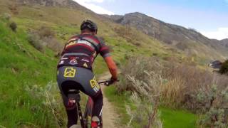
This loop is just a bit more difficult than the Soft Rock Trail, but mostly pretty flowy and easy. This is really the last easy trail before you do the upper loops. Cowley's Curse down can get pretty rocky, so if you want to keep it fun for the kids, stay down here for a while. The trail swoops up and down pretty good, and there are some nice big berms to help keep the speed up.

One little spot to catch a bit of air, but you have to pedal hard, even going down on this trail to keep that fast flow going. Good trail to practice berms and pump skills.

Adaptive Bike Info
aMTB Blue Rating: Intermediate features and steeper terrain.

Narrow in spots, some off-camber. Generally wide enough to fit a 36 inch adaptive bike using the overhang onto the cut of the trail.

There is a hi centerpoint with a pinch and half camber move all in the same location. Many riders will struggle with this.

Tags
BermsFlowyRocky

Trail Supporters

Local Trail Association

Traditionally Indigenous Territory

Recent Activity on Trail

Past Week
  • 5 rides
  • 11 miles average
6 Months
  • 242 rides
  • 12 miles avg distance
All
  • 1,874 rides
  • Last: Nov 13, 2026
c1c2c3c4
January
February
March
April
May
June
July
August
September
October
November
December
Status:
on Oct 17, 2026
Ideal
Avg: 3.87 (18 votes)
Your vote: 0

view (13,638)
close
      Directions to gambel trailhead (40.380030, -111.727260)

      Photos

      9 more »
      mtb
      253 |
      Jun 5, 2018 @ 10:22am
      Jun 5, 2018
      mtb
      302 |
      Jul 30, 2016 @ 10:01pm
      Jul 30, 2016
      mtb
      137 |
      Jun 21, 2021 @ 11:01am
      Jun 21, 2021
      mtb
      207 |
      Jun 5, 2018 @ 10:23am
      Jun 5, 2018

      Videos

      1 more »
      Valley Vista Trail System
      mtb
      1218 | Oct 10, 2017 , Pleasant Grove

      Routes with this trail

      more »
      ★ 4.0 • 4 miles • 447 ft • 13 • Loop •
      Typical route through Valley Vista. After Tufa, an alternative would be to hit Cowley's Curse again...
      ★ 5.0 • 11 miles • 1,691 ft • 15 • Loop •
      This ride starts and ends the Wade Springs Trailhead parking lot. The real singletrack starts and ends at...
      5 miles • 472 ft • 6 •
      Beginner trail that adds to the Valley Vista Loop Beginner. Adds on Fault Line. Omits Tufa for the full...
      3.9 ★★★★★
      18 Ratings
      5 ★ 22%
      4 ★ 50%
      3 ★ 22%
      2 ★
      1 ★ 6%

      5 Reviews & Comments

      whittgu3 whittgu3
      This is possibly the worst trail system I have ever ridden. The switchbacks literally go uphill on the downhill. If you like pedaling up only two pedal up half of the downhill and go slow on the rest of it then this is the trail for you.
      CodyLundgreen
      The downhill part of Gambel has the best flow of any of the little trails connected to it. Didn’t have to pedal much. Very fun and pretty mellow downhill flow
      Tytyanan3
      There is a dead deer around one of the counters that needs to be removed

      We hope you've been enjoying Trailforks!

      Create a FREE account to view all trail reviews and much more.

      • By toddTF Pro Trailforks & contributors
      • #62978 - 2,820 views

      Frequently Asked Questions

      ▼ Where is Gambel located?
      Gambel is located in Valley Vista, Pleasant Grove, Utah, United States. It is part of the Valley Vista trail network. The trailhead is located at coordinates 40.38003, -111.72726.
      ▼ How hard is Gambel?
      Gambel is rated as Blue difficulty. The physical rating is Moderate. The average grade is 0.2%. The climb difficulty is rated Blue.
      ▼ What is the elevation gain for Gambel?
      Gambel has 133 ft of elevation gain. The trail has 146 ft of elevation descent. The elevation ranges from 4,895 ft to 4,987 ft.
      ▼ Is Gambel a point to point trail?
      Yes, Gambel is a point to point trail. The direction is One Direction. The trail type is singletrack.
      ▼ How long is Gambel?
      Gambel is 1.0 mile long. The trail type is singletrack.
      ▼ Are dogs allowed on Gambel?
      Yes, dogs are allowed on Gambel. Please keep dogs on a leash where required and clean up after them.
      ▼ When is the best time of year to ride Gambel?
      Based on activity log data, the most popular months to ride Gambel are:
      • June (122 activities)
      • July (118 activities)
      • August (102 activities)
      Check the reports page for current trail conditions.
      ▼ How do I access Gambel? Where is the closest parking trailhead?
      The closest parking and trailhead locations to Gambel are: View all parking locations in the area.
      ▼ How long does it take to ride Gambel?
      Based on recorded activities, it takes an average of 7 minutes to ride Gambel. The trail is 1.0 mile long. Actual times will vary based on fitness level, conditions, and pace. View recent activity logs for more details.
      ▼ How busy is Gambel?
      Gambel is a very popular trail. There have been 12,139 recorded activities on this trail. The trail has received 13,638 check-ins. View recent activity on this trail.

      Hit the Trail

      Open in App

      Get this trail on your phone instantly.

      open trail in app

      Download Trail

      Save to wishlist, Garmin & download.
      save the trail

      Find Related Routes

      Find routes and users activities that include this trail.
      find routes for this trail

      You must enter a description before submitting.