more stats
466 ft
Distance
-38 ft
Descent
00:01:24
Avg time
-38 ft
Altitude change
1,653 ft
Altitude min
1,691 ft
Altitude max
1,691 ft
Altitude start
1,654 ft
Altitude end
-8.2%
Grade
-26.3%
Grade max
-1.2%
Grade min
466 ft
Distance down
00:01:24
Avg time

Gaps Details

  • Activities
    • Mountain Bike
    • E-Bike
    • Hike
    • Trail Running
  • Riding Area
    Alice Lake & Highlands
    Squamish, British Columbia
  • Difficulty Rating
  • Voted Difficulty
    Proline (2 votes)
  • Local Popularity
    80 in Mountain Biking heatmap [+]
    • 90 in E-Biking
    • 35 in Trail Running
    • 40 in Hiking
  • Global Ranking
    #13101 in Mountain Biking [+]
    • #18479 in E-Biking
    • #157006 in Trail Running
    • #155474 in Hiking
  • Provincial Ranking
    #646 in Mountain Biking · British Columbia [+]
    • #1,228 in E-Biking
    • #9,706 in Trail Running
    • #9,779 in Hiking
  • Trail Type
    Singletrack
  • Bike Type
    DH, AM
  • Direction
    Downhill Only
    Popular Direction Shown
  • Trail Visibility
    Always easy to follow
  • Dogs Allowed
    Yes
  • eBike Allowed
  • TTFs on Trail
    Drop, Gap Jump, Other

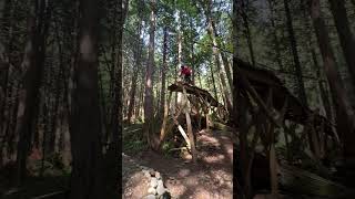
This trail has 3 main features. A massive drop at the start into a big gap and then into a hip.

Access Info

Very easy to find. Cuts right off of Hot Tuna. There is a trail sign at the start, and the big drop is right at the start to.

Tags
DropsJumps

Local Trail Association

Traditionally Indigenous Territory

Recent Activity on Trail

Past Week
  • 0 rides
  •  
6 Months
  • 81 rides
  • 15 miles avg distance
All
  • 430 rides
  • Last: Nov 3, 2026
c1c2c3c4
January
February
March
April
May
June
July
August
September
October
November
December
update trails status or condition

Gaps Trail Reports

statusdatedescription
Apr 18, 2026 @ 7:57pm (America/Vancouver)
Apr 18, 2026
Apr 23, 2025 @ 4:03pm
Apr 23, 2025
Accidentally treed a Mama bear and two VERY teeny cubs this afternoon (April 23rd) at around the 600m elevation mark where you switchback into the...
Feb 3, 2025 @ 7:23pm
Feb 3, 2025
reporter
Oct 7, 2023 @ 5:00am
Oct 7, 2023
Jul 15, 2023 @ 5:08am
Jul 15, 2023
more »
Status:
on Apr 18, 2026
Ideal
Avg: 3.99 (2 votes)
Your vote: 0

view (2,993)
close
      Directions to gaps-460468 trailhead (49.791550, -123.086910)

      Photos

      10 more »
      mtb
      144 |
      Apr 4, 2025 @ 9:58pm
      Apr 4, 2025
      mtb
      144 |
      Apr 4, 2025 @ 9:58pm
      Apr 4, 2025
      mtb
      126 |
      Apr 2, 2025 @ 11:02pm
      Apr 2, 2025
      mtb
      161 |
      Apr 2, 2025 @ 11:02pm
      Apr 2, 2025

      Videos

      4 more »
      youtuber Hot Tuna | Single Black trail | Squamish, BC
      mtb
      4:42 | 258 | Apr 20, 2026 , Squamish
      Hot Tuna Gaps - Pro Line Squamish
      mtb
      0:30 | 644 | May 26, 2024 , Squamish
      HOT TUNA | Black trail | Squamish - Alice Lake
      mtb
      4:05 | 584 | Dec 16, 2023 , Squamish
      First Time Riding Hot Tuna And Mikies Magic |...
      mtb
      10:15 | 1059 | Sep 17, 2021 , Squamish

      Routes with this trail

      more »
      11 miles • 2,102 ft • 8 •
      Nice loop around the Alice Lake area taking in the best blue trails and a couple of blacks.
      12 miles • 2,184 ft • 8 •
      Hot Tuna > All About Yew > Cliff's Corners > Border Patrol > Rollercoaster
      ★ 3.0 • 20 miles • 3,262 ft • 13 •
      30km Mashiter Loop in Squamish
      4.0 ★★★★★
      2 Ratings
      5 ★
      4 ★ 100%
      3 ★
      2 ★
      1 ★

      1 Review & Comments

      MediumSend MediumSend
      This is no joke. Lots of blind entrances and boosty jumps. Very cool, but wouldn't advise hitting it blind!

      We hope you've been enjoying Trailforks!

      Create a FREE account to view all trail reviews and much more.

      • By 1mtblife & contributors
      • #460468 - 3,209 views

      Frequently Asked Questions

      ▼ Where is Gaps located?
      Gaps is located in Alice Lake & Highlands, Squamish, British Columbia, Canada. It is part of the Alice Lake & Highlands trail network. The trailhead is located at coordinates 49.79155, -123.08691.
      ▼ How hard is Gaps?
      Gaps is rated as Proline difficulty. The average grade is 8.2%.
      ▼ What is the elevation gain for Gaps?
      The trail has 38 ft of elevation descent. The elevation ranges from 1,653 ft to 1,691 ft.
      ▼ Is Gaps a point to point trail?
      Yes, Gaps is a point to point trail. The direction is Downhill Only. The trail type is singletrack.
      ▼ How long is Gaps?
      Gaps is 466 ft long. The trail type is singletrack.
      ▼ Are dogs allowed on Gaps?
      Yes, dogs are allowed on Gaps. Please keep dogs on a leash where required and clean up after them.
      ▼ When is the best time of year to ride Gaps?
      Based on activity log data, the most popular months to ride Gaps are:
      • September (47 activities)
      • July (46 activities)
      • June (38 activities)
      Check the reports page for current trail conditions.
      ▼ How do I access Gaps? Where is the closest parking trailhead?
      The closest parking and trailhead locations to Gaps are: View all parking locations in the area.
      ▼ How long does it take to ride Gaps?
      Based on recorded activities, it takes an average of 1 minute to ride Gaps. The trail is 466 ft long. Actual times will vary based on fitness level, conditions, and pace. View recent activity logs for more details.
      ▼ How busy is Gaps?
      Gaps is a very popular trail. There have been 2,577 recorded activities on this trail. The trail has received 2,993 check-ins. View recent activity on this trail.

      Hit the Trail

      Open in App

      Get this trail on your phone instantly.

      open trail in app

      Download Trail

      Save to wishlist, Garmin & download.
      save the trail

      Find Related Routes

      Find routes and users activities that include this trail.
      find routes for this trail

      You must enter a description before submitting.