
more stats
4,350 ft
Distance
109 ft
Climb
-103 ft
Descent
00:07:26
Avg time
6 ft
Altitude change
84 ft
Altitude min
194 ft
Altitude max
84 ft
Altitude start
92 ft
Altitude end
0.1%
Grade
-17.9%
Grade max
19.8%
Grade min
2,054 ft
Distance climb
2,044 ft
Distance down
253 ft
Distance flat
00:07:26
Avg time

GC2018 Loop 3 Details

  • Activities
    • Mountain Bike
    • E-Bike
    • Adaptive Bike
  • Riding Area
  • Ref Number
    #8
  • AKA
    Comm Games loop 3
  • Difficulty Rating
  • Voted Difficulty
    Blue (4 votes)
  • Local Popularity
    95 in Mountain Biking [+]
    • 90 in E-Biking
    • 5 in Adaptive Biking
  • Global Ranking
    #36009 in Mountain Biking [+]
    • #2910 in E-Biking
    • #611 in Adaptive Biking
  • National Ranking
    #1,728 in Mountain Biking · Australia [+]
    • #66 in E-Biking
    • #33 in Adaptive Biking
  • Trail Type
    Singletrack
  • Bike Type
    AM, XC, Adaptive MTB
  • Direction
    One Direction
  • Trail Visibility
    Always easy to follow
  • eBike Allowed
    Yes up to Class 1
  • TTFs on Trail
    Berm, Drop, Jump
  • Year Opened
    2017
  • Land Owner
  • OSM Way

GC2018 Commonwealth Games loop 3, starting from fireroad

Adaptive Bike Info
aMTB Blue Rating: Intermediate features and steeper terrain.

A couple of drops, rocks and jumps but all are rollable or have a B Line around

Tags
BermsDropsJumps

Local Trail Association

Traditionally Indigenous Territory

Recent Activity on Trail

Past Week
  • 0 rides
  •  
6 Months
  • 67 rides
  • 12 miles avg distance
All
  • 1,448 rides
  • Last: Oct 13, 2026
c1c2c3c4
January
February
March
April
May
June
July
August
September
October
November
December
update trails status or condition

GC2018 Loop 3 Trail Reports

statusdatedescription
Sep 28, 2026 @ 5:00am (Australia/Brisbane)
Sep 27, 2026
Rebuild on the down is premium. Dry, firm, flowy and fun as
Sep 13, 2026 @ 8:17am (Australia/Brisbane)
Sep 12, 2026
Sep 12, 2026 @ 9:36am (Australia/Brisbane)
Sep 11, 2026
Hero dirt?!
Sep 10, 2026 @ 4:12pm (Australia/Brisbane)
Sep 9, 2026
Berms a bit dusty, not bad though
Aug 21, 2026 @ 4:34pm (Australia/Brisbane)
Aug 20, 2026
Runs much better after the new work, good job fellas!
more »
Status:
on Sep 28, 2026
Ideal
Avg: 3.76 (11 votes)
Your vote: 0

view (9,249)
close
      Directions to gc2018-loop-3 trailhead (-27.984680, 153.336250)

      Photos

      No photos have been added for GC2018 Loop 3 yet, add a photo.

      Videos

      6 more »
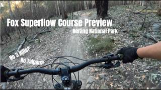
      Fox Superflow Nerang 2026 Course Preview
      mtb
      8:29 | 13 | Oct 14, 2026 , Gold Coast
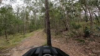
      GC2018 Loop 3 (Com Games track) - Nerang MTB Park
      mtb
      6:49 | 510 | Oct 28, 2022 , Gold Coast
      GC2018 Loop 3 (Downhill Only) - Nerang...
      mtb
      0:46 | 806 | Sep 15, 2020 , Gold Coast
      GC2018 Loop 3 - Nerang National Park -...
      mtb
      6:02 | 592 | Jul 27, 2020 , Gold Coast

      Routes with this trail

      ★ 2.0 • 9 miles • 1,229 ft • 10 •
      Suggested loop while Happy Valley closed
      26 miles • 3,163 ft • 19 •
      Zaak's 40k solo route. Covers many of the best Nerang trails with a bit of climbing and plenty of rocky flow.
      26 miles • 3,163 ft • 55 •
      Zaak's 40k solo route. Covers many of the best Nerang trails with a bit of climbing and plenty of rocky flow.
      3.7 ★★★★★
      11 Ratings
      5 ★ 27%
      4 ★ 27%
      3 ★ 36%
      2 ★
      1 ★ 9%

      10 Reviews & Comments

      aknapp47 aknapp47
      Recently been renovated and the second half is currently running the best it has for years, still definetely not a black tho
      Davidmanion
      Not a black diamond trail currently more like a green. One small drop of about 400mm, no jumps a few berms but nothing a 6yr old wouldn't be intimated about. The local crew has been working on this trail smoothing it out for green trail riders.
      aknapp47 aknapp47
      Would of been a great flow trail back in the days, but due to years of a lack of maintenance the trail has became all rutted (not braking bumps but erosion). Disappointing really.

      We hope you've been enjoying Trailforks!

      Create a FREE account to view all trail reviews and much more.

      • By jarrad-felsTF Pro & contributors
      • #143367 - 2,842 views

      Frequently Asked Questions

      ▼ Where is GC2018 Loop 3 located?
      GC2018 Loop 3 is located in Nerang National Park, Gold Coast, Australia. It is part of the Nerang National Park trail network. The trailhead is located at coordinates -27.98468, 153.33625.
      ▼ How hard is GC2018 Loop 3?
      GC2018 Loop 3 is rated as Black Diamond difficulty. The average grade is 0.1%.
      ▼ What is the elevation gain for GC2018 Loop 3?
      GC2018 Loop 3 has 109 ft of elevation gain. The trail has 103 ft of elevation descent. The elevation ranges from 84 ft to 194 ft.
      ▼ Is GC2018 Loop 3 a point to point trail?
      Yes, GC2018 Loop 3 is a point to point trail. The direction is One Direction. The trail type is singletrack.
      ▼ How long is GC2018 Loop 3?
      GC2018 Loop 3 is 4,350 ft long. The trail type is singletrack.
      ▼ Are dogs allowed on GC2018 Loop 3?
      There is no information about dogs being allowed on GC2018 Loop 3. Check with local trail managers or the trail page for the latest access rules.
      ▼ How do I access GC2018 Loop 3? Where is the closest parking trailhead?
      The closest parking and trailhead locations to GC2018 Loop 3 are: View all parking locations in the area.
      ▼ How long does it take to ride GC2018 Loop 3?
      Based on recorded activities, it takes an average of 7 minutes to ride GC2018 Loop 3. The trail is 4,350 ft long. Actual times will vary based on fitness level, conditions, and pace. View recent activity logs for more details.
      ▼ How busy is GC2018 Loop 3?
      GC2018 Loop 3 is a very popular trail. There have been 5,658 recorded activities on this trail. The trail has received 9,249 check-ins. View recent activity on this trail.

      Hit the Trail

      Open in App

      Get this trail on your phone instantly.

      open trail in app

      Download Trail

      Save to wishlist, Garmin & download.
      save the trail

      Find Related Routes

      Find routes and users activities that include this trail.
      find routes for this trail

      You must enter a description before submitting.