more stats
1,759 ft
Distance
26 ft
Climb
-26 ft
Descent
00:02:48
Avg time
-1 ft
Altitude change
4,642 ft
Altitude min
4,668 ft
Altitude max
4,663 ft
Altitude start
4,662 ft
Altitude end
-0.1%
Grade
-10.6%
Grade max
9.4%
Grade min
679 ft
Distance climb
659 ft
Distance down
423 ft
Distance flat
00:02:48
Avg time

Get In Details

  • Activities
    • Mountain Bike
    • E-Bike
    • Winter Fat Bike
    • Hike
    • Trail Running
  • Riding Area
    Canmore Nordic Centre
    Canmore, Alberta
  • Difficulty Rating
  • Local Popularity
    80 in Mountain Biking [+]
    • 65 in E-Biking
    • 80 in Trail Running
    • 55 in Hiking
  • Global Ranking
    #46748 in Mountain Biking [+]
    • #48696 in Trail Running
    • #114809 in Hiking
  • Trail Type
    Singletrack
  • Bike Type
    AM, XC, Fat, CX
  • Direction
    Both Directions
    Popular Direction Shown
  • Climb Difficulty
    Green
  • Physical Rating
    Moderate
  • Trail Visibility
    Always easy to follow
  • Family Friendly
    Yes
  • Dogs Allowed
    Yes
  • eBike Allowed
  • Land Owner
    Alberta Parks

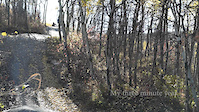
Get In is an ideal trail for riders just getting used to the idea of singletrack. None of the climbs are very long, and there are lots of turns to build skills. It's not a total snooze for more advanced riders, making it a good warm-up.

Trail has a climb to a road junction, a descent to another road junction, and then a winding trail through the trees.

Access Info

Ride from the stadium toward the biathlon range, and stay to the left. There should be a small green sign saying "Get In".

Recent Activity on Trail

Past Week
  • 7 rides
  • 9 miles average
6 Months
  • 31 rides
  • 9 miles avg distance
All
  • 507 rides
  • Last: Jul 3, 2026
c1c2c3c4
January
February
March
April
May
June
July
August
September
October
November
December
update trails status or condition

Get In Trail Reports

statusdatedescription
Sep 29, 2025 @ 10:03am (America/Creston)
Sep 29, 2025
Sep 14, 2025 @ 12:34pm (America/Edmonton)
Sep 14, 2025
Aug 2, 2025 @ 1:21pm
Aug 2, 2025
May 19, 2025 @ 2:09pm
May 19, 2025
May 2, 2025 @ 7:27pm
May 2, 2025
Getting to the start of the trail is very wet near the shooting area, but the trail itself is perfect
more »
Status:
on Sep 29, 2025
Dry
Avg: 3.91 (6 votes)
Your vote: 0

view (2,812)
close
3D
Trail Conditions
  • Unknown
  • Snow Groomed
  • Snow Packed
  • Snow Covered
  • Snow Cover Partial
  • Freeze/thaw Cycle
  • Icy
  • Prevalent Mud
  • Wet
  • Variable
  • Ideal
  • Dry
  • Very Dry
Trail Flow (Ridden Direction)
Trailforks scans users ridelogs to determine the most popular direction each trail is ridden. A good flowing trail network will have most trails flowing in a single direction according to their intension.
The colour categories are based on what percentage of riders are riding a trail in its intended direction.
  • > 96%
  • > 90%
  • > 80%
  • > 70%
  • > 50%
  • < 50%
  • bi-directional trail
  • no data
Trail Last Ridden
Trailforks scans ridelogs to determine the last time a trail was ridden.
  • < 2 days
  • < 1 week
  • < 2 weeks
  • < 1 month
  • < 6 months
  • > 6 months
Trail Ridden Direction
The intended direction a trail should be ridden.
  • Downhill Only
  • Downhill Primary
  • Both Directions
  • Uphill Primary
  • Uphill Only
  • One Direction
Contribute Details
Colors indicate trail is missing specified detail.
  • Description
  • Photos
  • Description & Photos
  • Videos
Trail Popularity ?
Trailforks scans ridelogs to determine which trails are ridden the most in the last 9 months. Trails are compared with nearby trails in the same city region with a possible 25 colour shades. Think of this as a heatmap, more rides = more kinetic energy = warmer colors.
  • most popular
  • popular
  • less popular
  • not popular
ATV/ORV/OHV Filter
Max Vehicle Width
inches
US Cell Coverage
Legend
cell carrier legend

Radar Time
Activity Recordings
Trailforks uses anonymized public activity data. ?
Activity Recordings
Trailforks uses anonymized public activity data. ?
Personal Heatmap
Activity Types
all / none
Options
2
Date range month
Winter Trails
Warning A routing network for winter maps does not exist. Selecting trails using the winter trails layer has been disabled.
Missing Trails
Most Popular
Least Popular
Trails are colored based on popularity. The more popular a trail is, the more red. Less popular trails trend towards green.
Jump Magnitude Heatmap
Heatmap of where riders jump on trails. Zoom in to see individual jumps, click circles to view jump details.
BC Backroad Status

Service Road Atlas is a free to use, community-driven service for viewing and creating reports on the numerous back-country service roads around B.C. and Alberta.

map legend
Slope Aspect
Direction the slope faces
Flat N NE E SE S SW W NW
Trails Deemphasized
Trails are shown in grey.
disable
Only show trails with no bike usage.
Enable
Suggested Layers
Based on selected activity type

    Save the current map location and zoom level as your default home location whenever this page is loaded.

    Save
        Directions to get-in trailhead (51.094170, -115.387550)

        Photos

        No photos have been added for Get In yet, add a photo.

        Videos

        3 more »
        Get In / Get out Loop from Baby Beluga
        10:19 | 299 | Jul 19, 2023 , Canmore
        My Three minute year
        3:00 | 128 | Oct 21, 2012 , Canmore
        steve f*cking up
        0:25 | 697 | Aug 28, 2009 , Canmore

        Routes with this trail

        5.0 8 miles 1,114 ft 8
        Fast and flowy single track that will keep you on your toes. Some of the best trails the Canmore Nordic...
        3 miles 253 ft 4
        Canmore Nordic Centre 5km 65m Green
        3.5 11 miles 1,484 ft 16 Loop Race
        One of the great things about the CNCPP is that there is a great number of trails throughout the venue....

        1 Review & Comments


        We hope you've been enjoying Trailforks!

        Create a FREE account to view trail comments and much more.

        • By pinkrobe & contributors
        • #41419 - 3,018 views

        Frequently Asked Questions About Get In

        Where is Get In located?
        Get In is located in Canmore Nordic Centre, Canmore, Alberta, Canada. It is part of the Canmore Nordic Centre trail network. The trailhead is located at coordinates 51.09417, -115.38755.
        How hard is Get In?
        Get In is rated as Green difficulty. The physical rating is Moderate. The average grade is 0.1%. The climb difficulty is rated Green.
        What is the elevation gain for Get In?
        Get In has 26 ft of elevation gain. The trail has 26 ft of elevation descent. The elevation ranges from 4,642 ft to 4,668 ft.
        Is Get In a point to point trail?
        Get In is not a point to point trail. The direction is Both Directions. The trail type is singletrack.

        Hit the Trail

        Open in App

        Get this trail on your phone instantly.
        open trail in app

        Download Trail

        Save to wishlist, Garmin & download.
        save the trail

        Find Related Routes

        Find routes and users activities that include this trail.
        find routes for this trail

        You must enter a description before submitting.