more stats
331 ft
Distance
-11 ft
Descent
00:01:09
Avg time
-11 ft
Altitude change
2,159 ft
Altitude min
2,170 ft
Altitude max
2,170 ft
Altitude start
2,159 ft
Altitude end
-3.5%
Grade
-11.5%
Grade max
-1.2%
Grade min
331 ft
Distance down
00:01:09
Avg time

Get Me Down Details

  • Activities
    • Mountain Bike
    • Hike
    • Trail Running
  • Riding Area
    Mill Creek Ravine
    Northwest Edmonton, Alberta
  • Difficulty Rating
  • Voted Difficulty
    Double Black Diamond (3 votes)
  • Local Popularity
    40 in Mountain Biking heatmap [+]
    • 25 in Trail Running
    • 5 in Hiking
  • Global Ranking
    #89659 in Mountain Biking [+]
    • #158230 in Trail Running
    • #296337 in Hiking
  • Provincial Ranking
    #1,321 in Mountain Biking · Alberta [+]
    • #3,190 in Trail Running
    • #4,026 in Hiking
  • Hiking SAC Scale
    T2 Mountain Hiking
  • Trail Type
    Singletrack
  • Bike Type
    DH, AM
  • Direction
    Downhill Only
    Popular Direction Shown
  • Climb Difficulty
    Blue
  • Physical Rating
    Moderate
  • Trail Visibility
    Sometimes hard to follow
  • Season
    During Summer (Wouldn't recommend winter)
  • Dogs Allowed
    Yes
  • TTFs on Trail
    Drop, Jump, Gap Jump, Rock Garden, Other
  • Land Owner
    GYBiking

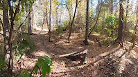
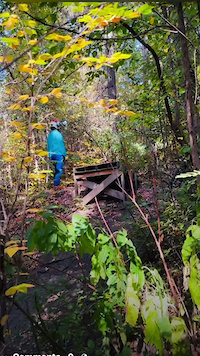
Starts with a rooty downhill into a fairly large gap jump, then into a root drop and a large wooden drop. Connects with Luger Slope after that to go up a small rocky climb back to the double-track.

Access Info

Take Luger Slope trail, and take a hard right just before you start to go down the hill. Entrance is a bit hard to spot, but once one the trail it's easy to follow.

Disclaimer

Large drops and jumps on trail, high level of skill needed.

Local Trail Association

Recent Activity on Trail

Past Week
  • 0 rides
  •  
6 Months
  • 12 rides
  • 13.8 km avg distance
All
  • 197 rides
  • Last: Oct 14, 2026
c1c2c3c4
January
February
March
April
May
June
July
August
September
October
November
December
update trails status or condition

Get Me Down Trail Reports

statusdatedescription
Jul 16, 2024 @ 9:34pm
Jul 16, 2024
New step down rips. Way better than the old gap jump
Jun 9, 2024 @ 8:00pm
Jun 9, 2024
The first jump has been tweaked. Its now more of a step down and has a longer distance to the landing. Rides much better now!
Nov 23, 2023 @ 4:38pm
Nov 23, 2023
Shredder
Jul 8, 2023 @ 10:43pm
Jul 8, 2023
Good but a bit muddy at the bottom
Jun 4, 2023 @ 8:37am
Jun 4, 2023
A bit of mud at the bottom but good otherwise
more »
Status:
on Jul 16, 2024
Ideal
Avg: 4.39 (4 votes)
Your vote: 0

view (1,257)
close
      Directions to get-me-down trailhead (53.514500, -113.471170)

      Photos

      21 more »
      mtb
      191 |
      Nov 7, 2021 @ 7:54pm
      Nov 7, 2021
      mtb
      204 |
      Oct 11, 2021 @ 5:11pm
      Oct 11, 2021
      mtb
      220 |
      Oct 11, 2021 @ 5:11pm
      Oct 11, 2021
      mtb
      206 |
      Oct 11, 2021 @ 5:11pm
      Oct 11, 2021

      Videos

      8 more »
      youtuber Get Me Down l Sessions
      mtb
      0:04 | 630 | Jul 25, 2021 , Northwest Edmonton
      youtuber Luger Slope and Get me Down trails: videos by...
      mtb
      0:36 | 579 | Sep 10, 2021 , Northwest Edmonton
      Sunday Session on wooden jumps and drops
      mtb
      0:24 | 43 | Oct 6, 2025 , Northwest Edmonton
      Wooden drop l Different lines with Sigaleps MTB
      mtb
      0:42 | 37 | Sep 28, 2025 , Northwest Edmonton

      Trail Lists

      5.0 ★★★★★
      4 Ratings
      5 ★ 100%
      4 ★
      3 ★
      2 ★
      1 ★

      5 Reviews & Comments

      dirtbaggraeme
      Leave it alone boys, not every trail needs to be documented. Stop adding trails, stop Changng grades. I'm talking to you millcreekmtb
      millcreekmtb
      The root drop is overgrown from so many people going around, but the new wood drop looks great

      We hope you've been enjoying Trailforks!

      Create a FREE account to view all trail reviews and much more.

      • By YounkShack & contributors
      • #59964 - 2,610 views

      Frequently Asked Questions

      ▼ Where is Get Me Down located?
      Get Me Down is located in Mill Creek Ravine, Northwest Edmonton, Alberta, Canada. It is part of the Mill Creek Ravine trail network. The trailhead is located at coordinates 53.5145, -113.47117.
      ▼ How hard is Get Me Down?
      Get Me Down is rated as Double Black Diamond difficulty. The physical rating is Moderate. The average grade is 3.5%. The climb difficulty is rated Blue.
      ▼ What is the elevation gain for Get Me Down?
      The trail has 11 ft of elevation descent. The elevation ranges from 2,159 ft to 2,170 ft.
      ▼ Is Get Me Down a point to point trail?
      Yes, Get Me Down is a point to point trail. The direction is Downhill Only. The trail type is singletrack.
      ▼ How long is Get Me Down?
      Get Me Down is 331 ft long. The trail type is singletrack.
      ▼ Are dogs allowed on Get Me Down?
      Yes, dogs are allowed on Get Me Down. Please keep dogs on a leash where required and clean up after them.
      ▼ When is the best time of year to ride Get Me Down?
      Based on activity log data, the most popular months to ride Get Me Down are:
      • May (14 activities)
      • September (11 activities)
      • October (10 activities)
      Check the reports page for current trail conditions.
      ▼ How do I access Get Me Down? Where is the closest parking trailhead?
      The closest parking and trailhead locations to Get Me Down are: View all parking locations in the area.
      ▼ How long does it take to ride Get Me Down?
      Based on recorded activities, it takes an average of 1 minute to ride Get Me Down. The trail is 331 ft long. Actual times will vary based on fitness level, conditions, and pace. View recent activity logs for more details.
      ▼ How busy is Get Me Down?
      Get Me Down is a moderately popular trail. There have been 410 recorded activities on this trail. The trail has received 1,257 check-ins. View recent activity on this trail.

      Hit the Trail

      Open in App

      Get this trail on your phone instantly.

      open trail in app

      Download Trail

      Save to wishlist, Garmin & download.
      save the trail

      Find Related Routes

      Find routes and users activities that include this trail.
      find routes for this trail

      You must enter a description before submitting.