
more stats
1,486 ft
Distance
-162 ft
Descent
00:01:39
Avg time
-162 ft
Altitude change
949 ft
Altitude min
1,111 ft
Altitude max
1,111 ft
Altitude start
948 ft
Altitude end
-10.9%
Grade
-26.5%
Grade max
0.6%
Grade min
1,211 ft
Distance down
276 ft
Distance flat
00:01:39
Avg time

Giddyup Details

  • Activities
    • Mountain Bike
    • E-Bike
    • Hike
    • Trail Running
  • Riding Area
    HammerFest
    Parksville, British Columbia
  • Difficulty Rating
  • Local Popularity
    90 in Mountain Biking [+]
    • 80 in E-Biking
    • 60 in Trail Running
    • 75 in Hiking
  • Global Ranking
    #97286 in Mountain Biking [+]
    • #30806 in E-Biking
    • #144237 in Trail Running
    • #140297 in Hiking
  • Provincial Ranking
    #4,930 in Mountain Biking · British Columbia [+]
    • #2,085 in E-Biking
    • #8,461 in Trail Running
    • #8,091 in Hiking
  • Trail Type
    Singletrack
  • Direction
    Downhill Primary
    Popular Direction Shown
  • eBike Allowed
  • Land Owner
    Mosaic Forest Management

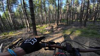
Nice flowy trail that is aged to perfection. Leads into Dead Horses (more fun).

Tags
BridgesFlowy

Local Trail Association

Traditionally Indigenous Territory

Recent Activity on Trail

Past Week
  • 2 rides
  • 8 miles average
6 Months
  • 276 rides
  • 15 miles avg distance
All
  • 835 rides
  • Last: Oct 23, 2026
update trails status or condition

Giddyup Trail Reports

statusdatedescription
Apr 26, 2026 @ 8:52am (America/Vancouver)
Apr 26, 2026
reporter Boulder moved. Good.
Apr 12, 2026 @ 3:58pm (America/Vancouver)
Apr 12, 2026
Some deeper ruts, one large boulder dislodged below the left side jump nearer the top, kinda freaky pointy should be moved, we blew by it
Nov 19, 2025 @ 10:26am (America/Vancouver)
Nov 19, 2025
reporter Top is good but still sketchy. Not a heck of flow. Bottom half is good.
Jul 5, 2025 @ 10:36am
Jul 5, 2025
Top is sketchy, bottom good
Jun 23, 2025 @ 11:02am
Jun 23, 2025
Oh so dry, ball bearings!
more »
Status:
on Apr 26, 2026
Ideal
Avg: 3.22 (7 votes)
Your vote: 0

view (1,924)
close
      Directions to giddyup trailhead (49.234950, -124.376780)

      Photos

      4 more »
      mtb
      95 |
      Feb 22, 2022 @ 1:27pm
      Feb 22, 2022
      mtb
      168 |
      Aug 2, 2016 @ 10:18pm
      Aug 2, 2016
      report
      mtb
      52 |
      Jun 7, 2025 @ 8:49pm
      Jun 7, 2025
      report
      mtb
      55 |
      Jun 7, 2025 @ 8:49pm
      Jun 7, 2025

      Videos

      4 more »
      More exploring out at HammerFest | Parksville, BC
      mtb
      11:59 | 32 | May 30, 2026 , Parksville
      Hammerfest 2025 Island Cup Enduro Race #2
      mtb
      33:57 | 182 | May 16, 2025 , Parksville
      GET DIALED: GiddyUp Bike Suspension Setup
      mtb
      6:05 | 5102 | Dec 22, 2014 , Parksville
      GiddyUp Bikes Press Release
      mtb
      9:04 | 21045 | Sep 23, 2014 , Parksville

      Routes with this trail

      ★ 3.0 • 20 miles • 3,602 ft • 39 •
      BCBR 2026 Stage 4 at Hammerfest, a brand new stage location located near Parksville, BC. Racers are going...
      20 miles • 3,634 ft • 43 •
      Draft 1 Stage 4 Hammerfest part of the final seven day epic BCBR 20th Anniversary edition.
      ★ 5.0 • 14 miles • 3,136 ft • 37 • Race •
      The Arrowsmith Cycling Club is excited to be hosting another epic Island Cup Enduro. Get ready to...
      2.6 ★★★★★
      7 Ratings
      5 ★
      4 ★ 29%
      3 ★ 14%
      2 ★ 43%
      1 ★ 14%

      Reviews / Comments

      No reviews yet, be the first to write a review or ask a question.
      Use trail reports to comment on trail conditions.


      We hope you've been enjoying Trailforks!

      Create a FREE account to view all trail reviews and much more.

      • By canadakaTF Pro Trailforks & contributors
      • #29735 - 3,364 views

      Frequently Asked Questions

      ▼ Where is Giddyup located?
      Giddyup is located in HammerFest, Parksville, British Columbia, Canada. It is part of the HammerFest trail network. The trailhead is located at coordinates 49.23495, -124.37678.
      ▼ How hard is Giddyup?
      Giddyup is rated as Blue difficulty. The average grade is 10.9%.
      ▼ What is the elevation gain for Giddyup?
      The trail has 162 ft of elevation descent. The elevation ranges from 949 ft to 1,111 ft.
      ▼ Is Giddyup a point to point trail?
      Giddyup is not a point to point trail. The direction is Downhill Primary. The trail type is singletrack.
      ▼ How long is Giddyup?
      Giddyup is 1,486 ft long. The trail type is singletrack.
      ▼ Are dogs allowed on Giddyup?
      There is no information about dogs being allowed on Giddyup. Check with local trail managers or the trail page for the latest access rules.
      ▼ How do I access Giddyup? Where is the closest parking trailhead?
      The closest parking and trailhead locations to Giddyup are: View all parking locations in the area.
      ▼ How long does it take to ride Giddyup?
      Based on recorded activities, it takes an average of 2 minutes to ride Giddyup. The trail is 1,486 ft long. Actual times will vary based on fitness level, conditions, and pace. View recent activity logs for more details.
      ▼ How busy is Giddyup?
      Giddyup is a very popular trail. There have been 1,900 recorded activities on this trail. The trail has received 1,924 check-ins. View recent activity on this trail.

      Hit the Trail

      Open in App

      Get this trail on your phone instantly.

      open trail in app

      Download Trail

      Save to wishlist, Garmin & download.
      save the trail

      Find Related Routes

      Find routes and users activities that include this trail.
      find routes for this trail

      You must enter a description before submitting.