

more stats
1.0 mile
Distance
66 ft
Climb
-448 ft
Descent
00:14:59
Avg time
-382 ft
Altitude change
2,802 ft
Altitude min
3,202 ft
Altitude max
3,184 ft
Altitude start
2,802 ft
Altitude end
-6.951%
Grade
-24.887%
Grade max
14.577%
Grade min
856 ft
Distance climb
4,019 ft
Distance down
614 ft
Distance flat
00:14:59
Avg time

Golden Gate (upper) Details

  • Activities
    • Mountain Bike
    • Horse
    • Hike
    • Trail Running
  • Riding Area
    Tucson Mountain Park
    Tucson, Arizona
  • Difficulty Rating
  • Voted Difficulty
    Black Diamond (1 vote)
  • Local Popularity
    60 in Mountain Biking [+]
    • 5 in Trail Running
    • 70 in Hiking
    • 5 in Horseback
  • Global Ranking
    #114207 in Mountain Biking [+]
    • #343543 in Trail Running
    • #128846 in Hiking
    • #24006 in Horseback
  • State Ranking
    #1,691 in Mountain Biking · Arizona [+]
    • #4,579 in Trail Running
    • #2,527 in Hiking
    • #972 in Horseback
  • Trail Type
    Singletrack
  • Bike Type
    AM
  • Direction
    Downhill Primary
    Popular Direction Shown
  • Dogs Allowed
    Yes
  • eBike Allowed
  • TTFs on Trail
    Rock Garden
  • Land Owner
    Pima County

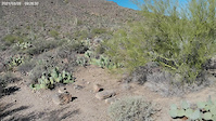
Upper Golden Gate (to Rattlesnake) is one of the more technical trails in the Tucson Mountain Park. Great if you enjoy technical rock features and steps.

Tags
Rock gardens
Local Trail Association
Traditionally Indigenous Territory

Recent Activity on Trail

Past Week
  • 0 rides
  •  
6 Months
  • 3 rides
  • 15 miles avg distance
All
  • 111 rides
  • Last: Sep 16, 2026
update trails status or condition

Golden Gate (upper) Trail Reports

statusdatedescription
Dec 25, 2024 @ 10:14am
Dec 25, 2024
Jun 6, 2024 @ 11:03pm
Jun 6, 2024
Loose rocks on upper portion…
Sep 14, 2023 @ 7:55am
Sep 14, 2023
Yetman up and over to Upper Golden Gate is absolute trash currently - washed out, sandy, giant rocks, lots of veg in the trail. Golden Gate is...
Jan 6, 2023 @ 2:57am
Jan 6, 2023
Apr 24, 2022 @ 10:51am
Apr 24, 2022
Step downs a little eroded and loose in the turns but overall good.
more »
Status:
on Dec 25, 2024
Very Dry
Avg: 3.76 (11 votes)
Your vote: 0

view (612)
close
      Directions to golden-gate-upper trailhead (32.212740, -111.099900)

      Photos

      16 more »
      mtb
      172 |
      Mar 7, 2022 @ 8:22pm
      Mar 7, 2022
      mtb
      185 |
      Mar 7, 2022 @ 8:22pm
      Mar 7, 2022
      mtb
      233 |
      Feb 22, 2020 @ 8:23am
      Feb 22, 2020
      mtb
      253 |
      Jan 27, 2018 @ 8:21am
      Jan 27, 2018

      Videos

      1 more »
      Upper Golden Gate, Top to Bottom
      mtb
      9:03 | 229 | Mar 31, 2021 , Tucson

      Trail Lists

      Routes with this trail

      ★ 4.0 • 30 miles • 2,508 ft • 38 • Loop •
      A longer ride from the main Starr Pass TH, including Golden Gate and Brown Mountain, some of the more...
      23 miles • 1,778 ft • 12 • Loop •
      Nice pedal from Tucson Mtn Estates area. One section of road up to Yetman trailhead. Stunning views. Can...
      19 miles • 1,896 ft • 9 • Out & Back •
      This is definitely a route for experienced riders and should be avoided when temperatures are over 90...
      3.7 ★★★★★
      11 Ratings
      5 ★ 18%
      4 ★ 45%
      3 ★ 27%
      2 ★
      1 ★ 9%

      5 Reviews & Comments

      Josephcain4 Josephcain4
      Downhill was waaay more fun than anticipated! I really enjoyed it, but it's definitely a hard trail. Total kudos to those who climb it. Lots of tight twisty drops, but all roll-able. Very technical with some punchy climbs mixed into the drops. Only problem is that there's no fun way to get to this trail. It'd be super cool to see an addition from the Crain Junction on Sarasota.
      Ampfrog Ampfrog
      Spontaneously decided to ride this uphill, first time on the trail, now understand why it is listed as primarily downhill. Emphasis on steps... for most of the trail, 10-20", some back-to-back-to-back staircase style. Would recommend being able to at least handle rolling up one to two steps easily/consistently or most of the trail will be hike-a-bike. The longer staircases are more rare, so don't need that level of tech skill to enjoy the climb unless trying to clean it.

      When heading up, the first half is not too insane, rode probably 85-90% of it. The next 30-40% of the trail got much steeper with more sustained steps/staircases (plus was getting tired), ended up hopping on and off the bike a lot, and the last 10-20% of the trail was more ridable again.

      Insane workout between the tech and elevation gain. The gnarly drop down David Yetman trail immediately after was a nice reward.
      jeffgicklhorn jeffgicklhorn
      The upper part of Golden Gate (to Rattlensnake) is one of the more technical trails in TMP. Great if you enjoy chunky technical terrain.

      We hope you've been enjoying Trailforks!

      Create a FREE account to view all trail reviews and much more.

      • By toddTF Pro Trailforks & contributors
      • #15328 - 3,461 views

      Frequently Asked Questions

      ▼ Where is Golden Gate (upper) located?
      Golden Gate (upper) is located in Tucson Mountain Park, Tucson, Arizona, United States. It is part of the Tucson Mountain Park trail network. The trailhead is located at coordinates 32.21274, -111.0999.
      ▼ How hard is Golden Gate (upper)?
      Golden Gate (upper) is rated as Black Diamond difficulty. The average grade is 6.951%.
      ▼ What is the elevation gain for Golden Gate (upper)?
      Golden Gate (upper) has 66 ft of elevation gain. The trail has 448 ft of elevation descent. The elevation ranges from 2,802 ft to 3,202 ft.
      ▼ Is Golden Gate (upper) a point to point trail?
      Golden Gate (upper) is not a point to point trail. The direction is Downhill Primary. The trail type is singletrack.
      ▼ How long is Golden Gate (upper)?
      Golden Gate (upper) is 1.0 mile long. The trail type is singletrack.
      ▼ Are dogs allowed on Golden Gate (upper)?
      Yes, dogs are allowed on Golden Gate (upper). Please keep dogs on a leash where required and clean up after them.
      ▼ How do I access Golden Gate (upper)? Where is the closest parking trailhead?
      The closest parking and trailhead locations to Golden Gate (upper) are: View all parking locations in the area.
      ▼ How long does it take to ride Golden Gate (upper)?
      Based on recorded activities, it takes an average of 15 minutes to ride Golden Gate (upper). The trail is 1.0 mile long. Actual times will vary based on fitness level, conditions, and pace. View recent activity logs for more details.
      ▼ How busy is Golden Gate (upper)?
      Golden Gate (upper) is a moderately popular trail. There have been 607 recorded activities on this trail. The trail has received 612 check-ins. View recent activity on this trail.

      Hit the Trail

      Open in App

      Get this trail on your phone instantly.

      open trail in app

      Download Trail

      Save to wishlist, Garmin & download.
      save the trail

      Find Related Routes

      Find routes and users activities that include this trail.
      find routes for this trail

      You must enter a description before submitting.