4,150 ft
Distance
49 ft
Climb
-790 ft
Descent
00:22:59
Avg time
Supporters, Builders, Maintainers & Land Managers of Green Monster Trail
  • Maxim Arsenault
    Builder

Green Monster Details

  • Activities
    • Mountain Bike
    • E-Bike
    • Hike
    • Trail Running
  • Riding Area
    Westside - Rainbow
    Whistler, British Columbia
  • Difficulty Rating
  • Voted Difficulty
    Double Black Diamond (2 votes)
  • Trail Type
    Singletrack
  • Bike Type
    AM
  • Direction
    Downhill Primary
    Popular direction shown
  • Physical Rating
    Extreme
  • Dogs Allowed
    Yes
  • eBike Allowed
    Yes up to Class 1
  • TTFs on Trail
    Drop, Jump, Gap Jump, Ladder Bridge, Rock Face, Rock Garden, Roller Coaster
  • Global Ranking
    #1589 in Mountain Biking [+]
    • #14792 in E-Biking
    • #7852 in Trail Running
    • #25912 in Hiking
  • Local Popularity
    75 in Mountain Biking [+]
    • 70 in E-Biking
    • 80 in Trail Running
    • 70 in Hiking

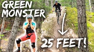
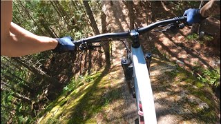
A string of serious rock faces, all very ridable but best ridden in prime conditions, and not for the faint hearted. Some good singletrack descending linking them all together

This trail is unsanctioned.

More Stats for Green Monster mountain bike trail trail
  • Altitude change
    -741 ft
  • Altitude min
    2,280 ft
  • Altitude max
    3,035 ft
  • Altitude start
    3,021 ft
  • Altitude end
    2,280 ft
  • Grade
    -17.857%
  • Grade max
    -55.416%
  • Grade min
    32.622%
  • Distance climb
    462 ft
  • Distance down
    3,628 ft
  • Distance flat
    61 ft
  • Avg time
    00:22:59
  • Avg reverse time
    00:17:11
  • view trail stats
Status:
on Jan 24, 2025
Snow Covered
Avg: 4.74 (48 votes)
Your vote: 0

view (2,900)
close
3D
Trail Conditions
  • Unknown
  • Snow Groomed
  • Snow Packed
  • Snow Covered
  • Snow Cover Partial
  • Freeze/thaw Cycle
  • Icy
  • Prevalent Mud
  • Wet
  • Variable
  • Ideal
  • Dry
  • Very Dry
Trail Flow (Ridden Direction)
Trailforks scans users ridelogs to determine the most popular direction each trail is ridden. A good flowing trail network will have most trails flowing in a single direction according to their intension.
The colour categories are based on what percentage of riders are riding a trail in its intended direction.
  • > 96%
  • > 90%
  • > 80%
  • > 70%
  • > 50%
  • < 50%
  • bi-directional trail
  • no data
Trail Last Ridden
Trailforks scans ridelogs to determine the last time a trail was ridden.
  • < 2 days
  • < 1 week
  • < 2 weeks
  • < 1 month
  • < 6 months
  • > 6 months
Trail Ridden Direction
The intended direction a trail should be ridden.
  • Downhill Only
  • Downhill Primary
  • Both Directions
  • Uphill Primary
  • Uphill Only
  • One Direction
Contribute Details
Colors indicate trail is missing specified detail.
  • Description
  • Photos
  • Description & Photos
  • Videos
Trail Popularity ?
Trailforks scans ridelogs to determine which trails are ridden the most in the last 9 months. Trails are compared with nearby trails in the same city region with a possible 25 colour shades. Think of this as a heatmap, more rides = more kinetic energy = warmer colors.
  • most popular
  • popular
  • less popular
  • not popular
ATV/ORV/OHV Filter
Max Vehicle Width
inches
US Cell Coverage
Legend
cell carrier legend

Radar Time
x Activity Recordings
Trailforks users anonymized public ridelogs from the past 6 months.
  • mountain biking recent
  • mountain biking (>6 month)
  • hiking (1 year)
  • moto (1 year)
Activity Recordings
Trailforks users anonymized public skilogs from the past 12 months.
  • Downhill Ski
  • Backcountry Ski
  • Nordic Ski
  • Snowmobile
Winter Trails
Warning A routing network for winter maps does not exist. Selecting trails using the winter trails layer has been disabled.
x Missing Trails
Most Popular
Least Popular
Trails are colored based on popularity. The more popular a trail is, the more red. Less popular trails trend towards green.
Jump Magnitude Heatmap
Heatmap of where riders jump on trails. Zoom in to see individual jumps, click circles to view jump details.
Trails Deemphasized
Trails are shown in grey.
disable
Only show trails with NO bikes.
enable

Save the current map location and zoom level as your default home location whenever this page is loaded.

Save
      Directions to green-monster trailhead (50.150400, -122.978800)

      Recent Ridelog Activity on Trail

      Past Week
      • 0 rides
      •  
      6 Months
      • 9 rides
      • 10 miles avg distance
      All
      • 299 rides
      • Last: Dec 25, 2024

      Photos

      more »
      2,009 |
      Mar 3, 2015 @ 10:32am
      Mar 3, 2015
      3,481 |
      Jun 28, 2013 @ 12:21am
      Jun 28, 2013
      41 |
      Jun 29, 2024 @ 11:40pm
      Jun 29, 2024
      190 |
      Jun 16, 2023 @ 1:58pm
      Jun 16, 2023

      Trail Lists

      Routes with this trail

      titledistance
      WORCA TOONIE Virtual Thriller Sept 18 - 23, 20234 miles

      Trail Products

      5 Reviews & Comments


      We hope you've been enjoying Trailforks!

      Create a FREE account to view trail comments and much more.

      Videos

      more »
      youtuber The Biggest Rock Slab She Has Ever Ridden? |...
      12:52 | 1674 | Jun 10, 2019 , Whistler
      youtuber Whistler Trails are Built Different
      8:48 | 394 | Aug 17, 2023 , Whistler
      youtuber Mountain Biking 'Green Monster' in the...
      1462 | Jul 14, 2017 , Whistler
      youtuber Facing My Arch-Enemy in Whistler????
      10:15 | 779 | Oct 29, 2020 , Whistler
      • #6871 - 30,220 views

      You must enter a description before submitting.