1.6 miles
Distance
298 ft
Climb
-283 ft
Descent
00:20:11
Avg time
Supporters, Builders, Maintainers & Land Managers of Grumpy's Loop Trail
USFSLand Manager
Mountain Bike the TetonsMaintainer
Grumpy's Loop Details
-
Activities
- Mountain Bike
- Hike
- Trail Running
- Snowshoe
-
Riding AreaSouthern Valley Trails / Mike Harris
Victor, Idaho -
Difficulty Rating
-
Trail TypeSingletrack
-
Snow GroomingBackcountry
-
Bike TypeXC, Fat, Gravel
-
DirectionBoth Directions
-
Climb DifficultyBlue
-
Physical RatingModerate
-
SeasonApril - Dec
-
Dogs AllowedYes
-
eBike Allowed
-
Global Ranking
-
Local Popularity90 in Mountain Biking [+]
- 90 in Trail Running
- 5 in Hiking
- 5 in Snowshoeing
-
Land ManagerCaribou-Targhee National Forest, Teton Basin Ranger District
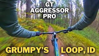
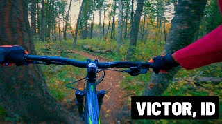
A great intermediate loop with some technical sections, root/stump jumps, and tight twists and turns to keep things fun. Mostly dense tree cover.
This trail is becoming increasingly popular due to the Southern Valley Trails Project and is now a sanctioned trail by the Forest Service.
Winter access can be spotty and is not groomed, except for the southeast aspect from Ladyslipper to Hillbender. The rest of the but can be snowpacked in with enough snowshoe and fat bike traffic.
Access Info
Access from the junction of Nemo and Powerline road
Disclaimer
No Dogs Allowed from Dec 1 - April 15
Local Trail Association
-
Please consider joining or donating to the local trail association to supportdonate to earn trail karma!
trail development & maintenance.
Traditionally Indigenous Territory
More Stats for Grumpy's Loop mountain bike trail trail
-
Altitude change15 ft
-
Altitude min6,634 ft
-
Altitude max6,935 ft
-
Altitude start6,783 ft
-
Altitude end6,798 ft
-
Grade0.2%
-
Grade max-21.9%
-
Grade min24.9%
-
Distance climb3,455 ft
-
Distance down4,849 ft
-
Distance flat115 ft
-
Avg time00:20:11
-
Avg reverse time00:21:00
- view trail stats
close
Trail Conditions
- Unknown
- Snow Groomed
- Snow Packed
- Snow Covered
- Snow Cover Inadequate
- Freeze/thaw Cycle
- Icy
- Prevalent Mud
- Wet
- Variable
- Ideal
- Dry
- Very Dry
Trail Flow (Ridden Direction)
Trailforks scans users ridelogs to determine the most popular direction each trail is ridden. A good flowing trail network will have most trails flowing in a single direction according to their intension.
The colour categories are based on what percentage of riders are riding a trail in its intended direction.
- > 96%
- > 90%
- > 80%
- > 70%
- > 50%
- < 50%
- bi-directional trail
- no data
Trail Last Ridden
Trailforks scans ridelogs to determine the last time a trail was ridden.
- < 2 days
- < 1 week
- < 2 weeks
- < 1 month
- < 6 months
- > 6 months
Trail Ridden Direction
The intended direction a trail should be ridden.
- Downhill Only
- Downhill Primary
- Both Directions
- Uphill Primary
- Uphill Only
- One Direction
Contribute Details
Colors indicate trail is missing specified detail.
- Description
- Photos
- Description & Photos
- Videos
Trail Popularity ?
Trailforks scans ridelogs to determine which trails are ridden the most in the last 9 months.
Trails are compared with nearby trails in the same city region with a possible 25 colour shades.
Think of this as a heatmap, more rides = more kinetic energy = warmer colors.
- most popular
- popular
- less popular
- not popular
ATV/ORV/OHV Filter
Max Vehicle Width
inches
Radar Time
x
Activity Recordings
Trailforks users anonymized public ridelogs from the past 6 months.
- mountain biking recent
- mountain biking (>6 month)
- hiking (1 year)
- moto (1 year)
Activity Recordings
Trailforks users anonymized public skilogs from the past 12 months.
- Downhill Ski
- Backcountry Ski
- Nordic Ski
Jump Magnitude Heatmap
Heatmap of where riders jump on trails. Zoom in to see individual jumps, click circles to view jump details.
Trails Deemphasized
Trails are shown in grey.
Only show trails with NO bikes.
Save the current map location and zoom level as your default home location whenever this page is loaded.
Save
Directions to grumpy-s-loop trailhead
(43.567370, -111.085470)
update trails status or condition
Grumpy's Loop Trail Reports
view all reports »
Recent Ridelog Activity on Trail
Past Week
- 11 rides
- 10 miles avg distance
6 Months
- 78 rides
- 10 miles avg distance
All
- 725 rides
- Last: Aug 15, 2022
Photos
more »
Videos
no videos have been added for Grumpy's Loop yet, add a video.
Nearby Trails
- Upper Ladyslipper 1,135 ft
- Gumpy's Access 2,073 ft
- Upper Hillbender 2,129 ft
- Lower Ladyslipper 1 mile
- Sherman Springs Gravel Pathway 1 mile
Southern Valley Trails / Mike Harris
- embed Grumpy's Loop trail on your website
- By todd
Trailforks & contributors
- #23909 - 2,287 views
- subscribe
- login to download gpx or kml files.