



more stats
3,825 ft
Distance
17 ft
Climb
-970 ft
Descent
00:08:43
Avg time
-953 ft
Altitude change
1,833 ft
Altitude min
2,789 ft
Altitude max
2,786 ft
Altitude start
1,833 ft
Altitude end
-24.918%
Grade
-57.125%
Grade max
23.823%
Grade min
410 ft
Distance climb
3,286 ft
Distance down
128 ft
Distance flat
00:08:43
Avg time

Gugiol Details

  • Activities
    • Mountain Bike
    • E-Bike
    • Winter Fat Bike
  • Riding Area
    Monte Fuso
    Parma
  • Difficulty Rating
  • Voted Difficulty
    Black (1 vote)
  • Local Popularity
    50 in Mountain Biking [+]
    • 55 in E-Biking
    • 5 in Winter Fat Biking
  • Global Ranking
    #102813 in Mountain Biking [+]
    • #62516 in E-Biking
  • Trail Type
    Singletrack
  • Bike Type
    DH, AM, DJ, Fat
  • Direction
    Downhill Only
    Popular Direction Shown
  • Physical Rating
    Hard
  • Dogs Allowed
    Yes
  • eBike Allowed
    Yes up to Class 1
  • TTFs on Trail
    Drop, Jump
  • Year Opened
    2018

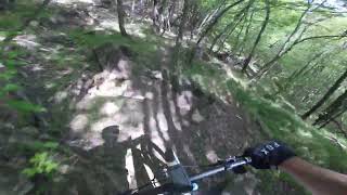
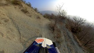
Sentiero nel bosco creato appositamente per l'uso MTB. La parte centrale presenta sezioni ripide non bypassabili. Parte terminale su panoramici panettoni di arenaria. La partenza è dalla cima di monte Castellaro in prossimità di un ometto di pietre, si scende in direzione Pineta. Uscita da fare bici a mano.

Access Info

Dal trail Monte Castellaro

Trail Supporters
  • Luca Landini
    since 2017
    Builder

Recent Activity on Trail

Past Week
  • 0 rides
  •  
6 Months
  • 4 rides
  • 19 miles avg distance
All
  • 22 rides
  • Last: Jun 6, 2026
update trails status or condition

Gugiol Trail Reports

statusdatedescription
Apr 12, 2025 @ 1:08pm
Apr 12, 2025
sporco di foglie e rametti ma comunque percorribile. Sempre bellissimo. Sono stati tolti due alberi che bloccavano il passaggio
May 22, 2024 @ 11:05pm
May 22, 2024
Ripido scivoloso
Nov 13, 2023 @ 12:57pm
Nov 13, 2023
parecchi rami che ostruiscono il sentiero, sono riuscito a toglierne, spaccarne diversi...terreno perfetto anzi, dopo la pioggia tiene meglio
Oct 30, 2022 @ 5:09am
Oct 30, 2022
Molto secco e poco grip dopo il ripido
Jan 31, 2022 @ 6:39am
Jan 31, 2022
Terreno perfetto
more »
Status:
on Apr 12, 2025
Dry
Avg: 4.13 (2 votes)
Your vote: 0

view (155)
close
      Directions to gugiol trailhead (44.485690, 10.299720)

      Photos

      No photos have been added for Gugiol yet, add a photo.

      Videos

      2 more »
      Gugiol, Monte Fuso
      mtb
      4:07 | 259 | May 2, 2024 , Parma
      Monte Fuso - Gugiol - MTB POV
      mtb
      4:02 | 226 | May 23, 2022 , Parma
      5.0
      2 Ratings
      5 100%
      4
      3
      2
      1

      2 Reviews & Comments

      maxeasy maxeasy
      LIVELLO TECNICO UNO STEP IN Più A CONFRONTO DEI PRECEDENTI ZONA FUSO, NECESSARIA UN Po' DI Capacità TECNICA.
      PERSONALMENTE PENSO SIA IL SENTIERO CHE MANCAVA ALL'AREA, E PENSO SIA UN BEL SENTIERO!
      Capataz Capataz
      Sentiero nuovo ma già molto conosciuto e frequentato. Non per tutti, occorre sicurezza di guida sul ripido. Da segnalare meglio l'attacco del sentiero data anche l'intersezione con il percorso di salita dalla Pineta al Monte Castellaro.

      We hope you've been enjoying Trailforks!

      Create a FREE account to view all trail reviews and much more.

      • By CapatazTF Pro & contributors
      • #114240 - 2,837 views

      Frequently Asked Questions

      Where is Gugiol located?
      Gugiol is located in Monte Fuso, Parma, Italy. It is part of the Monte Fuso trail network. The trailhead is located at coordinates 44.48569, 10.29972.
      How hard is Gugiol?
      Gugiol is rated as Black difficulty. The physical rating is Hard. The average grade is 24.918%.
      What is the elevation gain for Gugiol?
      Gugiol has 17 ft of elevation gain. The trail has 970 ft of elevation descent. The elevation ranges from 1,833 ft to 2,789 ft.
      Is Gugiol a point to point trail?
      Yes, Gugiol is a point to point trail. The direction is Downhill Only. The trail type is singletrack.
      How long is Gugiol?
      Gugiol is 3,825 ft long. The trail type is singletrack.
      Are dogs allowed on Gugiol?
      Yes, dogs are allowed on Gugiol. Please keep dogs on a leash where required and clean up after them.
      How do I access Gugiol? Where is the closest parking trailhead?
      The closest parking and trailhead locations to Gugiol are: View all parking locations in the area.
      How long does it take to ride Gugiol?
      Based on recorded activities, it takes an average of 6 minutes to ride Gugiol. The trail is 3,825 ft long. Actual times will vary based on fitness level, conditions, and pace. View recent activity logs for more details.
      How busy is Gugiol?
      Gugiol is a moderately popular trail. There have been 169 recorded activities on this trail. The trail has received 155 check-ins. View recent activity on this trail.

      Hit the Trail

      Open in App

      Get this trail on your phone instantly.

      open trail in app

      Download Trail

      Save to wishlist, Garmin & download.
      save the trail

      Find Related Routes

      Find routes and users activities that include this trail.
      find routes for this trail

      You must enter a description before submitting.



