
close
3D
Trail Conditions
- Unknown
- Snow Groomed
- Snow Packed
- Snow Covered
- Snow Cover Partial
- Freeze/thaw Cycle
- Icy
- Prevalent Mud
- Wet
- Variable
- Ideal
- Dry
- Very Dry
Trail Flow (Ridden Direction)
Trailforks scans users activity logs to determine the most popular direction each trail is ridden. A good flowing trail network will have most trails flowing in a single direction according to their intension.
The colour categories are based on what percentage of users are riding a trail in its intended direction.
The colour categories are based on what percentage of users are riding a trail in its intended direction.
- > 96%
- > 90%
- > 80%
- > 70%
- > 50%
- < 50%
- bi-directional trail
- no data
Trail Last Used
Trailforks scans activity logs to determine the last time a trail was ridden.
- < 2 days
- < 1 week
- < 2 weeks
- < 1 month
- < 6 months
- > 6 months
Trail Ridden Direction
The intended direction a trail should be ridden.
- Downhill Only
- Downhill Primary
- Both Directions
- Uphill Primary
- Uphill Only
- One Direction
Contribute Details
Colors indicate trail is missing specified detail.
- Description
- Photos
- Description & Photos
- Videos
Trail Popularity ?
Trailforks scans activity logs to determine which trails are ridden the most in the last 9 months.
Trails are compared with nearby trails in the same city region with a possible 25 colour shades.
Think of this as a heatmap, more activities = more kinetic energy = warmer colors.
- most popular
- popular
- less popular
- not popular
ATV/ORV/OHV Filter
Max Vehicle Width
inches
US Cell Coverage
Legend

Radar Time
Activity Recordings
Trailforks uses anonymized public activity data.
?
Activity Recordings
Trailforks uses anonymized public activity data.
?
Winter Trails
Warning
A routing network for winter maps does not exist. Selecting trails using the winter trails layer has been disabled.
Missing Trails
Most Popular
Least Popular
Trails are colored based on popularity. The more popular a trail is, the more red. Less popular trails trend towards green.
Jump Magnitude Heatmap
Heatmap of where users jump on trails. Zoom in to see individual jumps, click circles to view jump details.
BC Backroad Status
![map legend]()
Service Road Atlas is a free to use, community-driven service for viewing and creating reports on the numerous back-country service roads around B.C. and Alberta.

Slope Aspect
Direction the slope faces
Trails Deemphasized
Trails are shown in grey.
Only show trails with no bike usage.
Suggested Layers
Based on selected activity type
Save the current map location and zoom level as your default home location whenever this page is loaded.
SaveParma trails and routes are listed on Trailforks with interactive trail maps, difficulty ratings, photos, and user-reported trail conditions. The Trailforks community has shared hundreds of photos from this region. Supported activity types include Mountain Biking, Hiking, Trail Running, E-Biking, Gravel Biking, Adaptive Biking and Winter Fat Biking. Scenery includes views. Common trail features include drops, jumps and bridges. Amenities include water sources. Popular destinations include Monte Fuso.
This is an auto-generated description of Parma.
Login or register to submit a custom description.
This region uses the Uk/Euro style trail grading system.
Trail info last updated
Activities Click to view
- Mountain Bike
73 trails
- E-Bike
38 trails
- Gravel Bike
32 trails
- Adaptive Bike
32 trails
- Winter Fat Bike
30 trails
- Hike
62 trails
- Trail Running
62 trails
Region Details
- 23
- 1
- 8
- 26
- 11
- 4
Region Status
Open as of Jul 23, 2026Stats
- Avg Trail Rating
- Trails (view details)
- 73
- Trails Mountain Bike
- 73
- Trails E-Bike
- 38
- Trails Gravel Bike
- 32
- Trails Adaptive Bike
- 32
- Trails Winter Fat Bike
- 30
- Trails Hike
- 62
- Trails Trail Running
- 62
- Total Distance
- 96 miles
- Total Descent
- 27,432 ft
- Total Vertical
- 4,158 ft
- Highest Trailhead
- 4,280 ft
- Reports
- 745
- Photos
- 239
- Completed Counter
- 6,595
Sub Regions
-
Monte Fuso
- 5
- 16
- 6
- 1
Popular Parma Mountain Biking Trails
• 85 ★ 4.6 • 1 mile • 0 ft • 156 •
Single track dedicato. Segnavia 5. Discesa scorrevole con solo qualche gradino. Uno o due rampette evitabili. Tollera bene il bagnato. Arrivo sulla strada, attezione.
• 85 ★ 4.5 • 1,129 ft • 0 ft • 149 •
Traccia dedicata ricavata nella pineta. Abbastanza ripida su fondo di terra. Molto scivolosa col bagnato
• 70 ★ 4.8 • 1 mile • 0 ft • 145 •
Single track su terra con un paio di drop. Tollera bene il bagnato.
• 95 ★ 4.0 • 2,329 ft • 309 ft • 143 •
Salita diretta (la più breve) per il cippo e la partenza delle discese. Pedalabile interamente solo in condizioni di asciutto.
• 90 ★ 4.2 • 2 miles • 538 ft • 142 •
Classical singletrail in Calestano (Parma, IT). First steep ascent to top of monte Groppo with dirty terrain, then great downhill on narrow singletrack on rocks in the first section (gret view over middle Baganza Valley) then in the...
• 80 ★ 4.5 • 1,545 ft • 0 ft • 142 •
Trail molto divertente in mezzo al bosco, molto guidato con slalom tra gli alberi, drop e salti (evitabili)
• 80 ★ 5.0 • 3,002 ft • 7 ft • 132 •
Bel single track sottobosco su terra con diversi passaggi un po piu impegnativi su sassi, drop e rampe in legno
Parma Mountain Bike Routes
★ 5.0 • 16 miles • 3,615 ft • 7 • Loop •
Partenza principale PP: Calestano, Baita degli alpini Partenze alternative PA: Marzolara Colore: giallo...
17 miles • 3,292 ft • 6 • Loop •
Classico inanellalmento dei due trails più frequentati di Calestano: la Cava e Alpicella Trail. Partenza...
7 miles • 1,407 ft • 6 • Loop •
Partenza principale PP: Parco Provinciale del Monte Fuso, loc. Capetta di Scurano Partenze Alternative PA:...
15 miles • 2,319 ft • 2 • Loop •
Partenza principale PP: Calestano, Baita degli alpini Partenze alternative PA: Fragnolo Colore: azzurro...
20 miles • 3,748 ft • 4 • Loop •
Un anello di grande respiro che pur non toccando la cima del Fuso consente di fare il pieno di panorami...
14 miles • 2,251 ft • 4 • Loop •
Itinerario alla scoperta dei borghi di Scurano e del parco faunistico del Monte Fuso. E’ il percorso...
Photos of Parma Mountain Bike
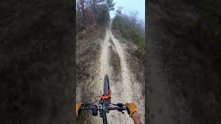
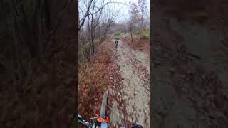
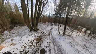
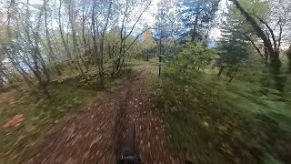
Videos of Parma Mountain Bike
Recent Trail Reports
| status | trail | date | condition | info | user |
|---|---|---|---|---|---|
| Beduzzo Secret | Jul 23, 2026 @ 9:06pm (Europe/Rome) Jul 23, 2026 | Very Dry | Albe79 | ||
| Via Crucis | May 3, 2026 @ 9:31am (Europe/San_Marino) May 3, 2026 | Ideal | andreac4 | ||
| Trasferimento per Predarezzo | May 3, 2026 @ 9:31am (Europe/San_Marino) May 3, 2026 | Dry | andreac4 | ||
| Monte Prandone to Canesano DH | May 3, 2026 @ 9:31am (Europe/San_Marino) May 3, 2026 | Ideal | andreac4 | ||
| Monte Prandone | May 3, 2026 @ 9:31am (Europe/San_Marino) May 3, 2026 | Dry | andreac4 | ||
| Vigolone 3 | May 4, 2026 @ 5:16am (Pacific/Midway) May 4, 2026 | Dry | Orso | ||
| Trasferimento per Vigolone trails | May 4, 2026 @ 5:16am (Pacific/Midway) May 4, 2026 | Ideal | Orso | ||
| Monte Bosso | Apr 25, 2026 @ 8:30am (Europe/Rome) Apr 24, 2026 | Ideal | dariomangoni | ||
| Vigolone 2 | Apr 19, 2026 @ 10:45am (Europe/Rome) Apr 19, 2026 | Ideal | giacomoferrari | ||
| Trasferimento per La Cava | Apr 18, 2026 @ 6:45pm (Europe/Rome) Apr 18, 2026 | Prevalent Mud | fabioooo |
Activity Feed
| username | action | type | title | date |
|---|---|---|---|---|
| GiacomoBafPgE | ridden | route | activity #104371993 | Sep 22, 2026 @ 12:41pm Sep 22, 2026 |
| pietroallegri | ridden | trail | activity #101690295 | Aug 17, 2026 @ 4:05am Aug 17, 2026 |
| Ilgiovannino | wishlist | route | activity #101434731 | Aug 13, 2026 @ 11:10pm Aug 13, 2026 |
| LucaHIn00Z | ridden | trail | activity #101406476 and 5 more | Aug 13, 2026 @ 1:02pm Aug 13, 2026 |
| MattiamthxaH | wishlist | trail | activity #101388021 | Aug 13, 2026 @ 8:38am Aug 13, 2026 |
Recent Comments
| username | type | title | comment | date |
|---|---|---|---|---|
| trail | Sentiero sistemato in occasione della... | May 1, 2026 @ 12:59am May 1, 2026 | ||
| trail | Discesa assurda, completamente rovinata e di... | Apr 5, 2026 @ 6:39pm Apr 5, 2026 | ||
| trail | Very nice trail! Really worth it | Aug 27, 2025 @ 6:41am Aug 27, 2025 | ||
| trail | Meno interessante della parte alta, il livello... | Nov 26, 2023 @ 3:28am Nov 26, 2023 | ||
| trail | Trail che inizia livello S3 con alcuni... | Nov 26, 2023 @ 3:24am Nov 26, 2023 |
Local Badges
-

10 Blue Trails53 awarded -

Epic Ride Climb 2k233 awarded -

Climbing 10k Badge54 awarded -

Climbing 100k Badge2 awarded -

Epic Ride Descent 2k234 awarded -

Descent 10k Badge54 awarded
Bike & Skill Parks
| name | type | city | rating |
|---|---|---|---|
| Campo scuola Parco del Monte Fuso | skill park | Parma |
Activity Type Stats
| activitytype | trails | distance | descent | descent distance | total vertical | rating | global rank | state rank | photos | reports | routes | activity logs |
|---|---|---|---|---|---|---|---|---|---|---|---|---|
| Mountain Bike | 73 | 96 miles | 27,431 ft | 41 miles | 4,157 ft | #1,616 | #53 | 233 | 745 | 21 | 3,679 | |
| E-Bike | 38 | 64 miles | 18,953 ft | 25 miles | 3,281 ft | #2,552 | #265 | 3 | 671 | 9 | 396 | |
| Gravel Bike | 32 | 62 miles | 5,699 ft | 17 miles | 3,520 ft | #1,201 | #46 | 158 | 5 | |||
| Adaptive Bike | 32 | 62 miles | 5,699 ft | 17 miles | 3,520 ft | #1,238 | #35 | 162 | ||||
| Winter Fat Bike | 30 | 40 miles | 10,666 ft | 17 miles | 3,064 ft | #1,085 | #25 | 270 | ||||
| Hike | 62 | 90 miles | 22,001 ft | 36 miles | 4,157 ft | #2,832 | #95 | 3 | 677 | 5 | 71 | |
| Trail Running | 62 | 90 miles | 22,001 ft | 36 miles | 4,157 ft | #2,287 | #73 | 677 | 4 | 14 |
Frequently Asked Questions
▼
What are the best places to ride in Parma?
Parma has 2 areas to explore for mountain biking. The top rated areas are:
▼
What are the highest rated mountain biking trails in Parma?
The highest rated mountain biking trails in Parma are:
- Magico amico (n.5A) (4.4/5)
- John Coffey (4.4/5)
- Beduzzo Secret (4.3/5)
- Cippa Lippa (4.3/5)
- Christmas Trail (4.2/5)
▼
What is the best time of the year to ride in Parma?
Based on activity log data, the most popular months to ride in Parma are:
- October (17 activities)
- May (12 activities)
- August (12 activities)
▼
Where can I park to ride in Parma?
There are 11 parking locations listed in Parma. The most popular parking spots are: View all parking and trailhead locations on the map to plan your visit.
▼
What is the longest trail in Parma?
The longest trail in Parma is Ciclovia Sinistra Parma - Parma-Castelnovo at 5.5 miles. View all trails sorted by distance.
▼
How many trails are in Parma?
Parma has a total of 73 trails. Browse top mountain biking trails in Parma to find detailed information including difficulty ratings, distances, and trail conditions.
▼
Which trail has the most elevation gain in Parma?
The trail with the most elevation gain in Parma is Collegamento Canesano M.te Montagnana with 1,137 ft of elevation gain. View all trails sorted by elevation gain.
▼
Which trail has the most elevation descent in Parma?
The trail with the most elevation descent in Parma is Montagnana DH with 2,030 ft of elevation descent. View all trails sorted by elevation descent.
▼
What activities are most popular in Parma?
Parma supports the following activities: Mountain Biking, E-Biking, Gravel Biking, Adaptive Biking, Winter Fat Biking, Hiking, Trail Running.
▼
What are the steepest mountain biking trails in Parma?
The steepest mountain biking trail in Parma is Monte Lavacchio climb with an average grade of 26.3%. View all trails sorted by grade.
▼
Are there any trails with scenic viewpoints in Parma?
Yes, there are 4 scenic viewpoints marked along trails in Parma. Some popular viewpoints include: Explore more points of interest to find trails with the best views.
▼
What trails have the biggest jumps in Parma?
The trails with the biggest jumps in Parma are: Browse all mountain bike trails to find trails with jumps and technical features.
▼
Are the trails open in Parma?
The overall region status for Parma is Clear / Green. Out of 66 trails:
- Clear / Green: 55
- Minor Issue / Yellow: 6
- Significant Issue / Amber: 5
▼
Can I ride an ebike in Parma?
Yes, Parma supports e-bike riding. There are 37 trails in Parma that allow e-bikes. Check the e-bike trails listing for specific trail access details and any local regulations.
▼
What are the most popular mountain biking routes in Parma?
The most popular mountain biking routes in Parma are: View all mountain biking routes in Parma.
▼
What type of bike is most common in Parma?
Based on activity log data, the most common bike types used in Parma are:
- AM (3 activities)
▼
What is the highest summit in Parma?
The highest summit in Parma is Monte Cavalcalupo at 4,482 ft elevation.
▼
What are the most popular Strava Segments in Parma?
The most popular Strava segments in Parma are:
- La tirata (5,669 athletes)
- Strappetto noioso (5,665 athletes)
- pioppone-calestano (5,609 athletes)
▼
Are there accessible or adaptive trails in Parma?
Yes, there are 32 accessible/adaptive trails in Parma. View all adaptive trails in Parma for specific accessibility information.
▼
What are the most popular mountain biking trails in Parma?
The most popular mountain biking trails in Parma are: View all mountain biking trails sorted by popularity.
▼
What are the best beginner ride trails in Parma?
The best beginner mountain biking trails in Parma are:
- Recinto (4/5)
- Pineta (4.7/5)
- Coll. diretto prelippo (3/5)
Activities
Trails
- By Capataz
 & contributors
- Admins: dariomangoni
- #12656 - 5,860 views
- parma activity log | embed map of Parma mountain bike trails | parma mountain biking points of interest
Downloading of trail gps tracks in kml & gpx formats is enabled for Parma.
You must login to download files.
