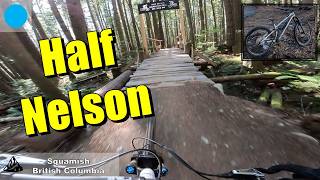
more stats
1.4 miles
Distance
31 ft
Climb
-744 ft
Descent
00:10:43
Avg time
-714 ft
Altitude change
1,129 ft
Altitude min
1,843 ft
Altitude max
1,843 ft
Altitude start
1,129 ft
Altitude end
-9.9%
Grade
-41.1%
Grade max
19.8%
Grade min
591 ft
Distance climb
1 mile
Distance down
361 ft
Distance flat
00:10:43
Avg time

Half Nelson Details

  • Activities
    • Mountain Bike
    • E-Bike
    • Adaptive Bike
  • Riding Area
    Diamond Head
    Squamish, British Columbia
  • Difficulty Rating
  • Voted Difficulty
    Blue (10 votes)
  • Local Popularity
    100 in Mountain Biking [+]
    • 100 in E-Biking
    • 5 in Adaptive Biking
  • Global Ranking
    #4 in Mountain Biking [+]
    • #33663 in E-Biking
    • #326 in Adaptive Biking
  • Provincial Ranking
    #1 in Mountain Biking · British Columbia [+]
    • #2,318 in E-Biking
    • #37 in Adaptive Biking
  • Trail Type
    Singletrack
  • Bike Type
    DH, AM
  • Direction
    Downhill Only[+]
    Popular Direction Shown
    • Downhill Only for Adaptive Biking
  • Physical Rating
    Moderate
  • Trail Visibility
    Always easy to follow
  • Season
    May - October
  • Family Friendly
    Yes
  • Dogs Allowed
    Yes
  • eBike Allowed
    Yes up to Class 1
  • TTFs on Trail
    Bridge, Jump
  • Ride in Rain
    Yes
  • Year Opened
    2009

One of Squamish's most popular trails is basically a 2km downhill pumptrack. A beginner/intermediate/advanced trail built by Big Red Ted Tempany and a cadre of local volunteers.

Not only is it Squamish’s first government-funded mountain bike trail, it is also being built with a mini-excavator and an eye for sustainability as its essential tools.

Tags

Trail Supporters

  • Dream Wizards
    Sponsor

  • Dream Wizards

    since 2009
    Builder

  • since 2009
    Maintainer

Local Trail Association

Traditionally Indigenous Territory

Recent Activity on Trail

Past Week
  • 18 rides
  • 20.4 km average
6 Months
  • 1,016 rides
  • 17.9 km avg distance
All
  • 6,419 rides
  • Last: Oct 9, 2026
c1c2c3c4
January
February
March
April
May
June
July
August
September
October
November
December
Status:
on Sep 30, 2026
Ideal
Avg: 4.59 (354 votes)
Your vote: 0

view (34,084)
close
      Directions to half-nelson trailhead (49.744540, -123.067330)

      Photos

      333 more »
      mtb
      4,464 |
      Nov 3, 2016 @ 2:25pm
      Nov 3, 2016
      mtb
      3,551 |
      Mar 17, 2016 @ 11:33pm
      Mar 17, 2016
      mtb
      2,650 |
      Nov 5, 2014 @ 12:27pm
      Nov 5, 2014
      mtb
      95 |
      May 17, 2026 @ 6:53pm
      May 17, 2026

      Videos

      106 more »
      youtuber Mountain Biking In Squamish (Half Nelson, Full...
      mtb
      10:24 | 1944 | Sep 23, 2018 , Squamish
      youtuber I didn't know SQUAMISH was this good!!!
      mtb
      15:54 | 535 | Oct 16, 2024 , Squamish
      youtuber I tried to like riding park and regretted it -...
      mtb
      26:35 | 361 | Dec 8, 2024 , Squamish
      youtuber Half Nelson, a Dream Wizards masterpiece of...
      mtb
      6:39 | 0 | Oct 23, 2026 , Squamish

      Routes with this trail

      ★ 4.0 • 13 miles • 3,289 ft • 18 • Loop •
      A great loop that covers some of the best trails of the region. The climbing is taxing but not ferocious,...
      ★ 4.5 • 8 miles • 1,873 ft • 19 •
      This is one of our favorite routes in the Squamish and is featured in Freehub Magazine's Sea to Sky Photo...
      ★ 3.5 • 15 miles • 3,736 ft • 11 •
      The climb trail is manageable, but goes on forever. Meadow of the Grizzly is long with lots of bermed...
      4.6 ★★★★★
      354 Ratings
      5 ★ 72%
      4 ★ 19%
      3 ★ 6%
      2 ★ 2%
      1 ★ 1%

      32 Reviews & Comments

      ebarnes1
      One of the best intermediate flow trails in the world!
      Ahmadyasen
      Very fun trail with beautiful work truely appreciate it.
      bigredted bigredted
      Link to Maintenance Fund. https://gofund.me/b51dedfc Thanks to everyone supporting our trail work.

      We hope you've been enjoying Trailforks!

      Create a FREE account to view all trail reviews and much more.

      • By canadakaTF Pro Trailforks & contributors
      • #876 - 130,795 views

      Frequently Asked Questions

      ▼ Where is Half Nelson located?
      Half Nelson is located in Diamond Head, Squamish, British Columbia, Canada. It is part of the Diamond Head trail network. The trailhead is located at coordinates 49.74454, -123.06733.
      ▼ How hard is Half Nelson?
      Half Nelson is rated as Blue difficulty. The physical rating is Moderate. The average grade is 9.9%.
      ▼ What is the elevation gain for Half Nelson?
      Half Nelson has 31 ft of elevation gain. The trail has 744 ft of elevation descent. The elevation ranges from 1,129 ft to 1,843 ft.
      ▼ Is Half Nelson a point to point trail?
      Yes, Half Nelson is a point to point trail. The direction is Downhill Only. The trail type is singletrack.
      ▼ How long is Half Nelson?
      Half Nelson is 1.4 miles long. The trail type is singletrack.
      ▼ Are dogs allowed on Half Nelson?
      Yes, dogs are allowed on Half Nelson. Please keep dogs on a leash where required and clean up after them.
      ▼ When is the best time of year to ride Half Nelson?
      Based on activity log data, the most popular months to ride Half Nelson are:
      • July (576 activities)
      • August (431 activities)
      • June (427 activities)
      Check the reports page for current trail conditions.
      ▼ How do I access Half Nelson? Where is the closest parking trailhead?
      The closest parking and trailhead locations to Half Nelson are: View all parking locations in the area.
      ▼ How long does it take to ride Half Nelson?
      Based on recorded activities, it takes an average of 11 minutes to ride Half Nelson. The trail is 1.4 miles long. Actual times will vary based on fitness level, conditions, and pace. View recent activity logs for more details.
      ▼ How busy is Half Nelson?
      Half Nelson is a very popular trail. There have been 32,676 recorded activities on this trail. The trail has received 34,084 check-ins. View recent activity on this trail.

      Hit the Trail

      Open in App

      Get this trail on your phone instantly.

      open trail in app

      Download Trail

      Save to wishlist, Garmin & download.
      save the trail

      Find Related Routes

      Find routes and users activities that include this trail.
      find routes for this trail

      You must enter a description before submitting.