more stats
1,749 ft
Distance
-357 ft
Descent
00:03:48
Avg time
-357 ft
Altitude change
1,294 ft
Altitude min
1,652 ft
Altitude max
1,651 ft
Altitude start
1,296 ft
Altitude end
-20.4%
Grade
-65.2%
Grade max
0.7%
Grade min
1,644 ft
Distance down
105 ft
Distance flat
00:03:48
Avg time

Hawaii 1 Details

  • Activities
    • Mountain Bike
    • E-Bike
    • Hike
    • Trail Running
  • Riding Area
    Mackenzie
    Pemberton, British Columbia
  • Difficulty Rating
  • Local Popularity
    85 in Mountain Biking heatmap [+]
    • 95 in E-Biking
    • 5 in Trail Running
    • 5 in Hiking
  • Global Ranking
    #39969 in Mountain Biking [+]
    • #14512 in E-Biking
    • #352951 in Trail Running
    • #342191 in Hiking
  • Provincial Ranking
    #1,947 in Mountain Biking · British Columbia [+]
    • #939 in E-Biking
    • #14,008 in Trail Running
    • #13,953 in Hiking
  • Hiking SAC Scale
    T1 Hiking
  • Trail Type
    Singletrack
  • Dogs Allowed
    Yes
  • eBike Allowed
    Yes up to Class 1

A black flow trail.

Tags
Flowy

Local Trail Association

Traditionally Indigenous Territory

Recent Activity on Trail

Past Week
  • 0 rides
  •  
6 Months
  • 27 rides
  • 19.4 km avg distance
All
  • 431 rides
  • Last: Nov 14, 2026
c1c2c3c4
January
February
March
April
May
June
July
August
September
October
November
December
update trails status or condition

Hawaii 1 Trail Reports

statusdatedescription
Feb 4, 2026 @ 1:31pm (America/Vancouver)
Feb 4, 2026
Tree appears to have been cleared. A bit greasy but otherwise good.
Jan 13, 2026 @ 1:44pm (America/Vancouver)
Jan 13, 2026
Large tree down across trail, blocking trail
May 13, 2025 @ 3:19pm
May 13, 2025
Buff top to bottom
Apr 11, 2025 @ 2:36pm
Apr 11, 2025
reporter
Nov 21, 2024 @ 11:36am
Nov 21, 2024
more »
Status:
on Feb 4, 2026
Ideal
Avg: 4.33 (15 votes)
Your vote: 0

view (3,243)
close
      Directions to hawaii-1 trailhead (50.336300, -122.775860)

      Photos

      10 more »
      mtb
      227 |
      Feb 4, 2021 @ 1:55pm
      Feb 4, 2021
      mtb
      241 |
      Jun 15, 2016 @ 7:46am
      Jun 15, 2016
      mtb
      494 |
      Jun 15, 2016 @ 7:46am
      Jun 15, 2016
      mtb
      253 |
      Apr 18, 2016 @ 9:18am
      Apr 18, 2016

      Videos

      9 more »
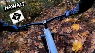
      youtuber HAWAII | Black trail | Pemberton
      mtb
      4:40 | 293 | Nov 28, 2023 , Pemberton
      Hawaii, Pemberton BC
      mtb
      4:08 | 287 | Feb 2, 2025 , Pemberton
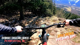
      Overnight Sensation | Hawaii feat. Hospital...
      mtb
      10:19 | 94 | Aug 31, 2024 , Pemberton
      youtuber First Time Riding Pemberton!
      mtb
      10:50 | 273 | Aug 12, 2024 , Pemberton

      Trail Lists

      Routes with this trail

      more »
      ★ 3.0 • 8 miles • 1,771 ft • 12 • Loop •
      Begin from the carpark and take the first left to join ‘Mackenzie Basin Access Road’ follow this until...
      16 miles • 3,448 ft • 18 •
      The Pemberton Off-Road Cycling Association (PORCA) presents the Spud Crusher Women’s Enduro - back from...
      6 miles • 1,914 ft • 4 •
      Our first ride over at Pemberton

      Trail Products

      4.5 ★★★★★
      15 Ratings
      5 ★ 53%
      4 ★ 40%
      3 ★ 7%
      2 ★
      1 ★

      1 Review & Comments

      cosmic-vomit cosmic-vomit
      Great trail to end off and get back to the car park. Fast fun and some nice chutes to challenge you along the way. Link all three Hawaii trails together for a good run down. One of the better trails along that side.

      We hope you've been enjoying Trailforks!

      Create a FREE account to view all trail reviews and much more.

      Nearby Trails

      • By canadakaTF Pro Trailforks & contributors
      • #53309 - 4,239 views

      Frequently Asked Questions

      ▼ Where is Hawaii 1 located?
      Hawaii 1 is located in Mackenzie, Pemberton, British Columbia, Canada. It is part of the Mackenzie trail network. The trailhead is located at coordinates 50.3363, -122.77586.
      ▼ How hard is Hawaii 1?
      Hawaii 1 is rated as Black Diamond difficulty. The average grade is 20.4%.
      ▼ What is the elevation gain for Hawaii 1?
      The trail has 357 ft of elevation descent. The elevation ranges from 1,294 ft to 1,652 ft.
      ▼ How long is Hawaii 1?
      Hawaii 1 is 1,749 ft long. The trail type is singletrack.
      ▼ Are dogs allowed on Hawaii 1?
      Yes, dogs are allowed on Hawaii 1. Please keep dogs on a leash where required and clean up after them.
      ▼ When is the best time of year to ride Hawaii 1?
      Based on activity log data, the most popular months to ride Hawaii 1 are:
      • April (52 activities)
      • March (39 activities)
      • May (25 activities)
      Check the reports page for current trail conditions.
      ▼ How do I access Hawaii 1? Where is the closest parking trailhead?
      The closest parking and trailhead locations to Hawaii 1 are: View all parking locations in the area.
      ▼ How long does it take to ride Hawaii 1?
      Based on recorded activities, it takes an average of 4 minutes to ride Hawaii 1. The trail is 1,749 ft long. Actual times will vary based on fitness level, conditions, and pace. View recent activity logs for more details.
      ▼ How busy is Hawaii 1?
      Hawaii 1 is a very popular trail. There have been 3,180 recorded activities on this trail. The trail has received 3,243 check-ins. View recent activity on this trail.

      Hit the Trail

      Open in App

      Get this trail on your phone instantly.

      open trail in app

      Download Trail

      Save to wishlist, Garmin & download.
      save the trail

      Find Related Routes

      Find routes and users activities that include this trail.
      find routes for this trail

      You must enter a description before submitting.