3.0 miles
Distance
159 ft
Climb
-1,165 ft
Descent
00:31:58
Avg time
Supporters, Builders, Maintainers & Land Managers of Hazard County Trail

  • USFS
    Land Manager

Hazard County Details

  • Activities
    • Mountain Bike
    • Hike
    • Trail Running
  • Riding Area
    La Sal Mountains
    Moab, Utah
  • Difficulty Rating
  • Voted Difficulty
    Blue (3 votes)
  • Trail Type
    Singletrack
  • Bike Type
    DH
  • Direction
    Downhill Primary
    Popular direction shown
  • Season
    June - October
  • Dogs Allowed
    Yes
  • eBike Allowed
  • TTFs on Trail
    Berm, Rock Garden
  • Global Ranking
    #185 in Mountain Biking [+]
    • #36520 in Trail Running
    • #11552 in Hiking
  • Local Popularity
    95 in Mountain Biking [+]
    • 65 in Trail Running
    • 70 in Hiking
  • Land Owner
    USFS

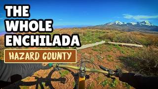
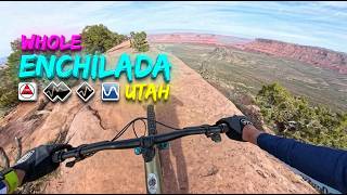
2nd ride of the Whole Enchilada. Intermediate to advanced section. All downhill except for the 1st half mile, which is a 200 ft climb. Ride is through Aspen and Oak forest with occasional meadows. Punchy climb, then a moderately technical descent, alternating between bermed sweepers, boneshaking rock gardens, and some very rutted sections. Ends at the La Sal Loop Road

Local Trail Association
Traditionally Indigenous Territory
More Stats for Hazard County mountain bike trail trail
  • Altitude change
    -1,006 ft
  • Altitude min
    8,338 ft
  • Altitude max
    9,504 ft
  • Altitude start
    9,344 ft
  • Altitude end
    8,337 ft
  • Grade
    -6.4%
  • Grade max
    -38.4%
  • Grade min
    13%
  • Distance climb
    2,533 ft
  • Distance down
    2 miles
  • Avg time
    00:31:58
  • Avg reverse time
    00:48:57
  • view trail stats
Status:
on Jun 1, 2025
Dry
Avg: 4.56 (53 votes)
Your vote: 0

view (8,239)
close
3D
Trail Conditions
  • Unknown
  • Snow Groomed
  • Snow Packed
  • Snow Covered
  • Snow Cover Partial
  • Freeze/thaw Cycle
  • Icy
  • Prevalent Mud
  • Wet
  • Variable
  • Ideal
  • Dry
  • Very Dry
Trail Flow (Ridden Direction)
Trailforks scans users ridelogs to determine the most popular direction each trail is ridden. A good flowing trail network will have most trails flowing in a single direction according to their intension.
The colour categories are based on what percentage of riders are riding a trail in its intended direction.
  • > 96%
  • > 90%
  • > 80%
  • > 70%
  • > 50%
  • < 50%
  • bi-directional trail
  • no data
Trail Last Ridden
Trailforks scans ridelogs to determine the last time a trail was ridden.
  • < 2 days
  • < 1 week
  • < 2 weeks
  • < 1 month
  • < 6 months
  • > 6 months
Trail Ridden Direction
The intended direction a trail should be ridden.
  • Downhill Only
  • Downhill Primary
  • Both Directions
  • Uphill Primary
  • Uphill Only
  • One Direction
Contribute Details
Colors indicate trail is missing specified detail.
  • Description
  • Photos
  • Description & Photos
  • Videos
Trail Popularity ?
Trailforks scans ridelogs to determine which trails are ridden the most in the last 9 months. Trails are compared with nearby trails in the same city region with a possible 25 colour shades. Think of this as a heatmap, more rides = more kinetic energy = warmer colors.
  • most popular
  • popular
  • less popular
  • not popular
ATV/ORV/OHV Filter
Max Vehicle Width
inches
US Cell Coverage
Legend
cell carrier legend

Radar Time
x Activity Recordings
Trailforks users anonymized public ridelogs from the past 6 months.
  • mountain biking recent
  • mountain biking (>6 month)
  • hiking (1 year)
  • moto (1 year)
Activity Recordings
Trailforks users anonymized public skilogs from the past 12 months.
  • Downhill Ski
  • Backcountry Ski
  • Nordic Ski
  • Snowmobile
Winter Trails
Warning A routing network for winter maps does not exist. Selecting trails using the winter trails layer has been disabled.
x Missing Trails
Most Popular
Least Popular
Trails are colored based on popularity. The more popular a trail is, the more red. Less popular trails trend towards green.
Jump Magnitude Heatmap
Heatmap of where riders jump on trails. Zoom in to see individual jumps, click circles to view jump details.
Trails Deemphasized
Trails are shown in grey.
disable
Only show trails with NO bikes.
enable

Save the current map location and zoom level as your default home location whenever this page is loaded.

Save
      Directions to hazard-county trailhead (38.525520, -109.281570)
      update trails status or condition

      Hazard County Trail Reports

      Recent Ridelog Activity on Trail

      Past Week
      • 2 rides
      • 36 miles avg distance
      6 Months
      • 48 rides
      • 26 miles avg distance
      All
      • 1,197 rides
      • Last: Jul 6, 2025

      Photos

      more »
      490 |
      Oct 10, 2016 @ 9:26am
      Oct 10, 2016
      289 |
      Nov 11, 2018 @ 9:42am
      Nov 11, 2018
      30 |
      Aug 28, 2024 @ 8:13am
      Aug 28, 2024
      90 |
      Sep 23, 2023 @ 3:08pm
      Sep 23, 2023

      Trail Lists

      Routes with this trail

      more »
      titledistance
      The Whole Enchilada to Raptor Route27 miles
      The Whole Enchilada + Jimmy Keen33 miles
      Whole Enchilada Medium20 miles
      TWE Shuttle Yourself61 miles

      9 Reviews & Comments


      We hope you've been enjoying Trailforks!

      Create a FREE account to view trail comments and much more.

      Videos

      more »
      youtuber The Whole Enchilada | Hazard County With My Bru's
      7:03 | 1008 | Mar 13, 2019 , Moab
      youtuber Hazzard County // Super Cut // Mountain Biking...
      18:21 | 730 | Oct 30, 2018 , Moab
      The Whole Enchilada (Part 4), Hazard County,...
      22:14 | 156 | Nov 4, 2023 , Moab
      youtuber Burro to Hazzard to Koko! (Whole Enchilada...
      26:46 | 219 | Oct 17, 2023 , Moab
      • By toddTF Pro Trailforks & contributors
      • #8883 - 15,650 views

      You must enter a description before submitting.