1,826 ft
Distance
8 ft
Climb
-312 ft
Descent
00:02:21
Avg time
Hell Benched Details
-
Activities
- Mountain Bike
- Hike
- Trail Running
-
Riding AreaLedgeview
Abbotsford, British Columbia -
Difficulty Rating
-
Trail TypeSingletrack
-
Bike TypeAM
-
Trail UsageBiking Primary
-
DirectionDownhill PrimaryPopular direction shown
-
Physical RatingModerate
-
Trail VisibilityAlways easy to follow
-
Dogs AllowedYes
-
eBike Allowed
-
Local Popularity50 in Mountain Biking [+]
- 40 in Trail Running
- 65 in Hiking
-
Year Opened2019
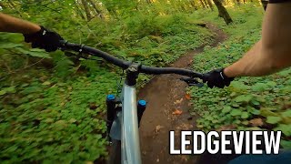
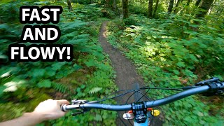
Hell Benched takes off from Charlie's Canned Chicken (Where Charlie's gets really steep) and continues straight, along the hillside in a Westerly direction. It flows in a moderate manner and connects with Grandpa's Eyebrows and Mixed Bag, just before they reach the main access road.
Access Info
Access is from Charlie's Canned Chicken.
Local Trail Association
-
Please consider joining or donating to the local trail association to supportdonate to earn trail karma!
trail development & maintenance.
Traditionally Indigenous Territory
More Stats for Hell Benched mountain bike trail trail
-
Altitude change-304 ft
-
Altitude min913 ft
-
Altitude max1,220 ft
-
Altitude start1,219 ft
-
Altitude end915 ft
-
Grade-16.675%
-
Grade max-43.182%
-
Grade min3.168%
-
Distance climb288 ft
-
Distance down1,514 ft
-
Distance flat24 ft
-
Avg time00:02:21
-
Avg reverse time00:10:10
- view trail stats
close
Trail Conditions
- Unknown
- Snow Groomed
- Snow Packed
- Snow Covered
- Freeze/thaw Cycle
- Icy
- Prevalent Mud
- Wet
- Variable
- Ideal
- Dry
- Very Dry
Trail Ridden Direction
Trailforks scans users ridelogs to determine the most popular direction each trail is ridden. A good flowing trail network will have most trails flowing in a single direction according to their intension.
The colour categories are based on what percentage of riders are riding a trail in its intended direction.
- > 96%
- > 90%
- > 80%
- > 70%
- > 50%
- < 50%
Trail Last Ridden
Trailforks scans ridelogs to determine the last time a trail was ridden.
- < 2 days
- < 1 week
- < 2 weeks
- < 1 month
- < 6 months
- > 6 months
Trail Ridden Direction
The intended direction a trail should be ridden.
- Downhill Only
- Downhill Primary
- Both Directions
- Uphill Primary
- Uphill Only
- One Direction
Contribute Details
Colors indicate trail is missing specified detail.
- Description
- Photos
- Description & Photos
- Videos
Trail Popularity ?
Trailforks scans ridelogs to determine which trails are ridden the most in the last 9 months.
Trails are compared with nearby trails in the same city region with a possible 25 colour shades.
Think of this as a heatmap, more rides = more kinetic energy = warmer colors.
- most popular
- popular
- less popular
- not popular
ATV/ORV/OHV Filter
Max Vehicle Width
inches
Radar Time
LEGEND
Trail Difficulties
Trail Report Status
- Access Road/Trail
- White
- Green
- Blue
- Black
- Double Black Diamond
Trail Report Status
- Clear / Green
- Minor Issue / Yellow
- Significant Issue / Amber
- Closed
- Land Owner Overlay
- Wilderness (typically no bikes in USA)
- BLM (public)
- USFS (Wildlife sanctuaries darker than usfs)
- State land
- Indigenous
- Military
Trail Conditions
- Unknown
- Snow Groomed
- Snow Packed
- Snow Covered
- Freeze/thaw Cycle
- Icy
- Prevalent Mud
- Wet
- Variable
- Ideal
- Dry
- Very Dry
- Map Markers
Trail Head
Photo
Directory Listing
Riding Area
TTF
Parking
Viewpoint
Information
Warning
Directions
Sight
Restrooms
eBike Charging Point
Water Fountain/Source
Gate
Trail Sign
Table or Bench
Ladder
Stairs
Bridge
Boardwalk
Camping
Cabin
Lodge
Bear Cache
Dock
Ranger Station
Summit
Other
Directions to hell-benched trailhead
(49.065220, -122.214370)
update trails status or condition
Hell Benched Trail Reports
view all reports »
Recent Ridelog Activity on Trail
Past Week
- 0 rides
6 Months
- 57 rides
- 7 miles avg distance
All
- 290 rides
Photos
more »
Trail Products
-
Fraser Valley GuideBook
-
+ 0
aearle
(May 18, 2019 at 21:49)

This will be a great trail but at the moment it is very overgrown with stinging nettle.
[Reply]
jmsjns
(Nov 23, 2020 at 12:06)
Very good trail if you wanna ride a steep blue run.
Not as good a trail if you enjoy turning.
[Reply]
Not as good a trail if you enjoy turning.
Nearby Trails
- Grampa's Eyebrows 682 ft
- Hidden Valley 745 ft
- Paper Route Steep Entry 1,063 ft
- Mixed Bag 1,099 ft
- Hidden Valley Steep Entry 1,106 ft
- embed Hell Benched trail on your website
- By brule
Plus & contributors
- #174256 - 604 views
- subscribe
- login to download gpx or kml files.
Open trail in mobile app