
more stats
1,125 ft
Distance
8 ft
Climb
-34 ft
Descent
00:02:35
Avg time
-26 ft
Altitude change
2,131 ft
Altitude min
2,161 ft
Altitude max
2,160 ft
Altitude start
2,136 ft
Altitude end
-2.3%
Grade
-15%
Grade max
5.5%
Grade min
220 ft
Distance climb
492 ft
Distance down
413 ft
Distance flat
00:02:35
Avg time

Hi Spot Details

  • Activities
    • Mountain Bike
    • Winter Fat Bike
    • Hike
    • Trail Running
  • Riding Area
    Mill Creek Ravine
    Northwest Edmonton, Alberta
  • Difficulty Rating
  • Local Popularity
    30 in Mountain Biking heatmap [+]
    • 55 in Trail Running
    • 55 in Hiking
    • 5 in Winter Fat Biking
  • Trail Type
    Singletrack
  • Bike Type
    AM, XC, Fat
  • Direction
    Both Directions
  • Climb Difficulty
    Blue
  • Physical Rating
    Moderate
  • Trail Visibility
    Always easy to follow
  • Dogs Allowed
    Yes

A short little addition by a local ride club and approved by the City of Edmonton, connecting a couple of unused trails in the area. Combine with the multi-use gravel east of the creek and you have created a short little loop which is best ridden clockwise.

source: Hi Spot
Access Info

Can be accessed from Mill Creek Drop in, head left at the intersection before you reach the gravel trail.

Tags

Local Trail Association

Recent Activity on Trail

Past Week
  • 0 rides
  •  
6 Months
  • 3 rides
  • 16 miles avg distance
All
  • 667 rides
  • Last: Oct 25, 2026
c1c2c3c4
January
February
March
April
May
June
July
August
September
October
November
December
update trails status or condition

Hi Spot Trail Reports

statusdatedescription
May 10, 2026 @ 2:59pm (America/Edmonton)
May 10, 2026
Green dot entrance is blocked off by construction. Can enter from the red dot and go back.
Sep 26, 2025 @ 8:37pm (America/Edmonton)
Sep 26, 2025
Sep 20, 2025 @ 8:32am (America/Edmonton)
Sep 20, 2025
Hard to follow some of the trail due to leaves on trail and all the braiding.
Jun 1, 2025 @ 6:42pm
Jun 1, 2025
May 2, 2025 @ 8:49pm
May 2, 2025
more »
Status:
on May 10, 2026
Dry
Avg: 4.24 (2 votes)
Your vote: 0

view (4,479)
close
      Directions to hi-spot trailhead (53.512750, -113.471480)

      Photos

      5 more »
      mtb
      91 |
      Nov 16, 2019 @ 11:30am
      Nov 16, 2019
      mtb
      128 |
      Nov 15, 2019 @ 5:34pm
      Nov 15, 2019
      mtb
      112 |
      Nov 15, 2019 @ 12:13pm
      Nov 15, 2019
      mtb
      211 |
      Sep 28, 2019 @ 3:09pm
      Sep 28, 2019

      Videos

      2 more »
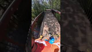
      youtuber Solo Session l Millcreek Ravine
      mtb
      4:12 | 36 | Sep 8, 2026 , Northwest Edmonton
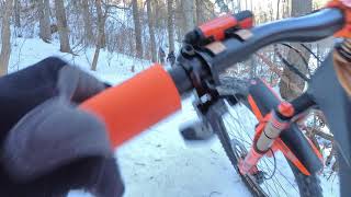
      #ridelocalyegwinter - Hi Spot
      mtb
      3:08 | 333 | Jan 10, 2021 , Northwest Edmonton

      Routes with this trail

      more »
      ★ 5.0 • 11 miles • 598 ft • 37 • Loop •
      MTB route through mill creek.
      5.0 ★★★★★
      2 Ratings
      5 ★ 100%
      4 ★
      3 ★
      2 ★
      1 ★

      2 Reviews & Comments

      easygoine
      I can't seem to find the bypass around the difficult part, it's not clear and there are too many different trails that converge. The main route is an awful climb and impassible to ride up (heading down the creek, north).
      sum333
      Its really difficult to decipher this trail nowadays among all the footpaths in the area

      We hope you've been enjoying Trailforks!

      Create a FREE account to view all trail reviews and much more.

      • By EdmontonMountainBikeAllianceTF Pro EMBA & contributors
      • #223530 - 2,896 views

      Hit the Trail

      Open in App

      Get this trail on your phone instantly.

      open trail in app

      Download Trail

      Save to wishlist, Garmin & download.
      save the trail

      Find Related Routes

      Find routes and users activities that include this trail.
      find routes for this trail

      You must enter a description before submitting.


