
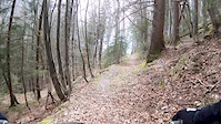
more stats
4,921 ft
Distance
35 ft
Climb
-468 ft
Descent
00:07:37
Avg time
-433 ft
Altitude change
2,909 ft
Altitude min
3,364 ft
Altitude max
3,364 ft
Altitude start
2,930 ft
Altitude end
-8.8%
Grade
-39.6%
Grade max
57.4%
Grade min
443 ft
Distance climb
4,167 ft
Distance down
312 ft
Distance flat
00:07:37
Avg time

Hundschipfi Details

  • Activities
    • Mountain Bike
    • E-Bike
    • Hike
    • Trail Running
  • Riding Area
    Haslital
    Meiringen
  • AKA
    Winterlicken Färrichstetten Bärgschwendi
  • Difficulty Rating
  • Voted Difficulty
    Blue (2 votes)
  • Local Popularity
    85 in Mountain Biking heatmap [+]
    • 50 in E-Biking
    • 5 in Trail Running
    • 5 in Hiking
  • Global Ranking
    #56068 in Mountain Biking [+]
    • #120799 in E-Biking
    • #308238 in Trail Running
    • #293952 in Hiking
  • National Ranking
    #1,297 in Mountain Biking · Switzerland [+]
    • #4,321 in E-Biking
    • #6,985 in Trail Running
    • #7,109 in Hiking
  • Trail Type
    Singletrack
  • Bike Type
    AM, XC
  • Direction
    Downhill Only
    Popular Direction Shown
  • Physical Rating
    Moderate
  • Dogs Allowed
    Yes
  • eBike Allowed
  • TTFs on Trail
    Skinny

Der Trail beginnt mit dem legendären "Bach" Abschnitt, ist eigentlich nie trocken und immer schmutzig aber nach ca 150m super flowig. Nach der dritten Strassenquerung geht es in den Föixweg, danach bei der Hütte rechts vorbei direkt in den Wald. Nun quert der Trail zum eigentlichen Hundschipfi. Bei Nässe ist das Gelände ziemlich anspruchsvoll, zwischendurch geht es auf der linken Seite ganz schön steil runter… ist aber alles fahrbar. Danach an "Bärgschwendi" vorbei und via Wylerli runter nach Meiringen.

Tags
Skinnies

Recent Activity on Trail

Past Week
  • 0 rides
  •  
6 Months
  • 9 rides
  • 24 miles avg distance
All
  • 22 rides
  • Last: Oct 12, 2026
c1c2c3c4
January
February
March
April
May
June
July
August
September
October
November
December
update trails status or condition

Hundschipfi Trail Reports

statusdatedescription
Jul 11, 2026 @ 8:50pm (Europe/Zurich)
Jul 11, 2026
Bottom section done. Very nice
Jul 18, 2024 @ 1:16am
Jul 18, 2024
May 23, 2022 @ 5:09am
May 23, 2022
Jun 15, 2021 @ 1:06pm
Jun 15, 2021
Alles wieder ok
May 24, 2021 @ 10:36am
May 24, 2021
Der Weg ist im Bereich Syten, wo man von der Forststrasse in den "Wurzelweg" einbiegt wegen Holzarbeiten bis Kreuzung Hundschipfi gesperrt! Ab...
more »
Status:
on Jul 11, 2026
Very Dry
Avg: 4.21 (9 votes)
Your vote: 0

view (222)
close
      Directions to hundschipfi trailhead (46.715290, 8.241390)

      Photos

      7 more »
      mtb
      500 |
      Oct 30, 2014 @ 12:31pm
      Oct 30, 2014
      mtb
      427 |
      Oct 30, 2014 @ 12:30pm
      Oct 30, 2014
      mtb
      630 |
      Oct 30, 2014 @ 12:29pm
      Oct 30, 2014
      report
      mtb
      128 |
      May 24, 2021 @ 10:40am
      May 24, 2021

      Videos

      1 more »
      Föhn-Bike
      mtb
      0:26 | 284 | Apr 8, 2018 , Meiringen

      Routes with this trail

      more »
      ★ 5.0 • 9 miles • 2,982 ft • 5 • Loop •
      Als alternative kann man ganz bequem mit der Gondel bis Reuti hochfahren, damit spart man die eher steilen...
      14 miles • 3,852 ft • 6 • Loop •
      Gute Frühlingsrunde, da man immer unterhalb von 1200 M.ü.M. fahren kann. Zuerst Aufstieg zum Zwirgi,...
      4.1 ★★★★★
      9 Ratings
      5 ★ 33%
      4 ★ 56%
      3 ★
      2 ★ 11%
      1 ★

      3 Reviews & Comments

      blaze-j blaze-j
      This is rather a route composed of several trails. Bottom section is really nice. In some places definitely more difficult than blue (off camber sections, exposure). Same as other other trails in the area, not entirely a singletrack - bottom part is a road.
      domimitvelo
      Cool trail, lots of roots and nice view. love it!

      We hope you've been enjoying Trailforks!

      Create a FREE account to view all trail reviews and much more.

      • By reinholdTF Pro Meiringen & contributors
      • #18870 - 2,535 views

      Frequently Asked Questions

      ▼ Where is Hundschipfi located?
      Hundschipfi is located in Haslital, Meiringen, Switzerland. It is part of the Haslital trail network. The trailhead is located at coordinates 46.71529, 8.24139.
      ▼ How hard is Hundschipfi?
      Hundschipfi is rated as Blue difficulty. The physical rating is Moderate. The average grade is 8.8%.
      ▼ What is the elevation gain for Hundschipfi?
      Hundschipfi has 35 ft of elevation gain. The trail has 468 ft of elevation descent. The elevation ranges from 2,909 ft to 3,364 ft.
      ▼ Is Hundschipfi a point to point trail?
      Yes, Hundschipfi is a point to point trail. The direction is Downhill Only. The trail type is singletrack.
      ▼ How long is Hundschipfi?
      Hundschipfi is 4,921 ft long. The trail type is singletrack.
      ▼ Are dogs allowed on Hundschipfi?
      Yes, dogs are allowed on Hundschipfi. Please keep dogs on a leash where required and clean up after them.
      ▼ When is the best time of year to ride Hundschipfi?
      Based on activity log data, the most popular months to ride Hundschipfi are:
      • August (6 activities)
      • May (2 activities)
      • June (2 activities)
      Check the reports page for current trail conditions.
      ▼ How do I access Hundschipfi? Where is the closest parking trailhead?
      The closest parking and trailhead locations to Hundschipfi are: View all parking locations in the area.
      ▼ How long does it take to ride Hundschipfi?
      Based on recorded activities, it takes an average of 8 minutes to ride Hundschipfi. The trail is 4,921 ft long. Actual times will vary based on fitness level, conditions, and pace. View recent activity logs for more details.
      ▼ How busy is Hundschipfi?
      Hundschipfi is a very popular trail. There have been 222 recorded activities on this trail. The trail has received 222 check-ins. View recent activity on this trail.

      Hit the Trail

      Open in App

      Get this trail on your phone instantly.

      open trail in app

      Download Trail

      Save to wishlist, Garmin & download.
      save the trail

      Find Related Routes

      Find routes and users activities that include this trail.
      find routes for this trail

      You must enter a description before submitting.

