

more stats
2,615 ft
Distance
4 ft
Climb
-334 ft
Descent
00:03:33
Avg time
-330 ft
Altitude change
5,865 ft
Altitude min
6,194 ft
Altitude max
6,194 ft
Altitude start
5,866 ft
Altitude end
-12.6%
Grade
-39.2%
Grade max
8.9%
Grade min
46 ft
Distance climb
2,569 ft
Distance down
00:03:33
Avg time

Iss-Flow 1 Details

  • Activities
    • Mountain Bike
    • E-Bike
  • Riding Area
  • Difficulty Rating
  • Local Popularity
    90 in Mountain Biking [+]
    • 75 in E-Biking
  • Global Ranking
    #101117 in Mountain Biking [+]
    • #34070 in E-Biking
  • National Ranking
    #639 in Mountain Biking · Austria [+]
    • #231 in E-Biking
  • Trail Type
    Singletrack
  • Bike Type
    DH, AM, XC
  • Direction
    Downhill Only
    Popular Direction Shown
  • Climb Difficulty
    Green
  • Physical Rating
    Moderate
  • Season
    May-Oct
  • Dogs Allowed
    Yes
  • eBike Allowed
    Yes up to Class 1
  • TTFs on Trail
    A-Frame
  • Land Owner
    Zeller Bergbahnen Zillertal GmbH & Co KG

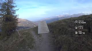
Ab der Isskogel Bergstation führt der Trail entlang der Skiabfahrt und schlängelt sich dann in den Geländebruch des Barmbaches. In einigen weiten Kurven und mit zahlreichen Wellen verliert der Trail etwas an Höhe, führt nahe an den Fahrweg heran und quert dann die Krummbachabfahrt. Vom Pisten- und Wiesenbereich geht es nun ab in den Wald. Wellen und Anliegerkurven garantieren Flow pur. Bereits nach der ersten Kurve bietet sich die Möglichkeit eine schwierigere Variante zu wählen. Der Iss-Flow führt durch einen Traumwald mit Lichtungen, verschiedenen Bäumen und vorbei an Felsen wie man sie schöner nicht hätte platzieren können. Nach der Forstweg Querung schmiegt sich der Trail an der Höhenlinie entlang hinaus bis in die Trasse der Isskogelbahn. Auch hier bietet sich wieder die Möglichkeit auf einen mittelschwierigen Trail zu wechseln. Der Iss-Flow bietet weitere Anliegerkurven mit Wellen und Sprüngen bevor der Trail auf einem Fahrweg endet, welcher direkt zur Rössl Alm führt. Wer die Schwierigkeit steigern möchte, lässt die Bremsen aus und nutzt die zahlreichen Wellen für Sprünge oder andere Tricks.

Tags
Wooden features

Recent Activity on Trail

Past Week
  • 0 rides
  •  
6 Months
  • 9 rides
  • 19 miles avg distance
All
  • 26 rides
  • Last: Jul 5, 2019
update trails status or condition

Iss-Flow 1 Trail Reports

statusdatedescription
Jun 21, 2025 @ 12:47pm
Jun 21, 2025
Sep 17, 2023 @ 5:12am
Sep 17, 2023
Nov 5, 2020 @ 11:33am
Nov 5, 2020
reporter "Das Befahren der Strecke ist nur während der Betriebszeiten der Bergbahn gestattet." --> Closed for season 2020. MTB now forbidden. See you...
Aug 15, 2020 @ 9:16am
Aug 15, 2020
Well, it was heavily (heavenly) raining
Aug 9, 2020 @ 1:15am
Aug 9, 2020
reporter dry and everything okay
more »
Status:
on Jun 21, 2025
Dry
Avg: 3.08 (5 votes)
Your vote: 0

view (207)
close
      Directions to issflow-1 trailhead (47.244230, 12.035177)

      Photos

      7 more »
      mtb
      73 |
      Aug 9, 2020 @ 10:01pm
      Aug 9, 2020
      mtb
      58 |
      Aug 9, 2020 @ 10:01pm
      Aug 9, 2020
      mtb
      74 |
      Aug 9, 2020 @ 10:00pm
      Aug 9, 2020
      mtb
      65 |
      Aug 9, 2020 @ 10:00pm
      Aug 9, 2020

      Videos

      1 more »
      youtuber Iss-Flow 1 - Zillertal | LINES
      mtb
      2:31 | 703 | Oct 20, 2018 , Gerlos
      2.0 ★★★★★
      5 Ratings
      5 ★
      4 ★ 20%
      3 ★
      2 ★ 40%
      1 ★ 40%

      4 Reviews & Comments

      PatrickyKzKac
      Hab ich mit meiner 9 jährigen Tochter getestet und für gut befunden. 😁
      Hier geht's zur Trail-Doku:
      https://youtu.be/MUkCcjOZaqg
      yommt
      The trail is not very well maintained. Berms are worn out, many loose stones and rocks make the trail less flowy than the name suggests. Very few jumps. Overall a bit disappointing for such a large ski and mountain arena.
      sputnik275wce
      So much fun, perfect to play around. Sadly way to short...

      We hope you've been enjoying Trailforks!

      Create a FREE account to view all trail reviews and much more.

      Nearby Trails

      • By emmes & contributors
      • #143091 - 1,403 views

      Frequently Asked Questions

      ▼ Where is Iss-Flow 1 located?
      Iss-Flow 1 is located in Gerlos, Austria. It is part of the Gerlos trail network. The trailhead is located at coordinates 47.24423, 12.03518.
      ▼ How hard is Iss-Flow 1?
      Iss-Flow 1 is rated as Blue difficulty. The physical rating is Moderate. The average grade is 12.6%. The climb difficulty is rated Green.
      ▼ What is the elevation gain for Iss-Flow 1?
      Iss-Flow 1 has 4 ft of elevation gain. The trail has 334 ft of elevation descent. The elevation ranges from 5,865 ft to 6,194 ft.
      ▼ Is Iss-Flow 1 a point to point trail?
      Yes, Iss-Flow 1 is a point to point trail. The direction is Downhill Only. The trail type is singletrack.
      ▼ How long is Iss-Flow 1?
      Iss-Flow 1 is 2,615 ft long. The trail type is singletrack.
      ▼ Are dogs allowed on Iss-Flow 1?
      Yes, dogs are allowed on Iss-Flow 1. Please keep dogs on a leash where required and clean up after them.
      ▼ When is the best time of year to ride Iss-Flow 1?
      Iss-Flow 1 is best visited during: May-Oct.
      ▼ How do I access Iss-Flow 1? Where is the closest parking trailhead?
      The closest parking and trailhead locations to Iss-Flow 1 are: View all parking locations in the area.
      ▼ How long does it take to ride Iss-Flow 1?
      Based on recorded activities, it takes an average of 4 minutes to ride Iss-Flow 1. The trail is 2,615 ft long. Actual times will vary based on fitness level, conditions, and pace. View recent activity logs for more details.
      ▼ How busy is Iss-Flow 1?
      Iss-Flow 1 is a very popular trail. There have been 128 recorded activities on this trail. The trail has received 207 check-ins. View recent activity on this trail.

      Hit the Trail

      Open in App

      Get this trail on your phone instantly.

      open trail in app

      Download Trail

      Save to wishlist, Garmin & download.
      save the trail

      Find Related Routes

      Find routes and users activities that include this trail.
      find routes for this trail

      You must enter a description before submitting.


