

more stats
3,425 ft
Distance
-640 ft
Descent
00:06:49
Avg time
-640 ft
Altitude change
5,324 ft
Altitude min
5,965 ft
Altitude max
5,965 ft
Altitude start
5,325 ft
Altitude end
-18.7%
Grade
-48.4%
Grade max
-7.3%
Grade min
3,425 ft
Distance down
00:06:49
Avg time

Iss-Tough Details

  • Activities
    • Mountain Bike
    • E-Bike
  • Riding Area
  • Difficulty Rating
  • Local Popularity
    80 in Mountain Biking [+]
    • 60 in E-Biking
  • Global Ranking
    #104358 in Mountain Biking [+]
    • #48478 in E-Biking
  • National Ranking
    #657 in Mountain Biking · Austria [+]
    • #344 in E-Biking
  • Trail Type
    Singletrack
  • Bike Type
    DH, AM, XC
  • Direction
    Downhill Only
    Popular Direction Shown
  • Physical Rating
    Moderate
  • Trail Visibility
    Always easy to follow
  • Season
    May-Oct
  • Dogs Allowed
    Yes
  • eBike Allowed
    Yes up to Class 1
  • TTFs on Trail
    Drop
  • Land Owner
    Zeller Bergbahnen Zillertal GmbH & Co KG

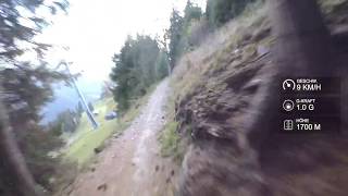
Über ein kurzes Verbindungsstück am Schotterweg gelangt man auf Höhe Seppi´s Restaurant zum Trail Iss-Tough. Mächtige Anliegerkurven, große Wellen, Sprünge und Steiles Gelände. Der Iss-Tough bietet alles was das ambitionierte Bikerherz begehrt. Nachdem man den Fahrweg gequert hat, zieht der Trail zuerst in den Wald. Über Stufen und Anliegerkurven führt er dann aber hinaus in die Liftrasse der Isskogelbahn, in welcher sich der Trail mit saftigen Anliegerkurven hin und her schlängelt. Es wird enger schneller und steiler und auch einige Stufen, Wurzeln und in den Weg gelegte Steine sorgen für reichlich Abwechslung am Weg nach unten. Vor Publikum, welches einen aus der Gondel beobachtet, sollte man sich keine Blöße geben, deshalb immer schön mit Style über die Wellen. Der Trail mündet in den Iss-Flow, kann aber auch fortgesetzt werden. Die letzten Meter zur Rössl Alm verlaufen zuerst am Iss-Flow und dann am Fahrweg.

Access Info

Isskogel Access

Disclaimer

Wearing a helmet is compulsory. Ride at your own risk.

Tags
Drops

Bike Park

Recent Activity on Trail

Past Week
  • 0 rides
  •  
6 Months
  • 3 rides
  • 73.4 km avg distance
All
  • 8 rides
  • Last: Sep 2, 2026
c1c2c3c4
January
February
March
April
May
June
July
August
September
October
November
December
update trails status or condition

Iss-Tough Trail Reports

statusdatedescription
Nov 5, 2020 @ 11:33am
Nov 5, 2020
reporter "Das Befahren der Strecke ist nur während der Betriebszeiten der Bergbahn gestattet." --> Closed for season 2020. MTB now forbidden. See you...
Aug 9, 2020 @ 1:15am
Aug 9, 2020
reporter dry (very dusty, even slippery) and everything okay
more »
Status:
on Nov 5, 2020
Avg: 3.26 (5 votes)
Your vote: 0

view (52)
close
      Directions to isstough trailhead (47.241020, 12.036760)

      Photos

      2 more »
      mtb
      110 |
      Aug 9, 2020 @ 10:03pm
      Aug 9, 2020
      mtb
      101 |
      Aug 9, 2020 @ 10:02pm
      Aug 9, 2020

      Videos

      1 more »
      youtuber Iss-Tough - Zillertal | LINES
      mtb
      4:02 | 794 | Oct 20, 2018 , My City
      2.4 ★★★★★
      5 Ratings
      5 ★ 20%
      4 ★
      3 ★ 20%
      2 ★ 20%
      1 ★ 40%

      2 Reviews & Comments

      ktm-boy-69 ktm-boy-69
      If you like some bad shaped curves, you will enjoy this track ..
      ... track-exit to "Iss-flow" is a small drop with a quite dubious flat landing ... there are also a few nicer and more flowy parts in the track, but overall there are more bad than good impressions when riding this track. Trail difficulty is quite similar to Iss-Flow, maybe a little step more difficult, but overall more or less the same level.

      We hope you've been enjoying Trailforks!

      Create a FREE account to view all trail reviews and much more.

      • By emmes & contributors
      • #143095 - 977 views

      Frequently Asked Questions

      ▼ Where is Iss-Tough located?
      Iss-Tough is located in Zillertal Arena Singletrails, Austria. It is part of the Zillertal Arena Singletrails trail network. The trailhead is located at coordinates 47.24102, 12.03676.
      ▼ How hard is Iss-Tough?
      Iss-Tough is rated as Red difficulty. The physical rating is Moderate. The average grade is 18.7%.
      ▼ What is the elevation gain for Iss-Tough?
      The trail has 640 ft of elevation descent. The elevation ranges from 5,324 ft to 5,965 ft.
      ▼ Is Iss-Tough a point to point trail?
      Yes, Iss-Tough is a point to point trail. The direction is Downhill Only. The trail type is singletrack.
      ▼ How long is Iss-Tough?
      Iss-Tough is 3,425 ft long. The trail type is singletrack.
      ▼ Are dogs allowed on Iss-Tough?
      Yes, dogs are allowed on Iss-Tough. Please keep dogs on a leash where required and clean up after them.
      ▼ When is the best time of year to ride Iss-Tough?
      Based on activity log data, the most popular months to ride Iss-Tough are:
      • September (2 activities)
      • June (1 activities)
      • October (1 activities)
      Check the reports page for current trail conditions.
      ▼ How do I access Iss-Tough? Where is the closest parking trailhead?
      The closest parking and trailhead locations to Iss-Tough are: View all parking locations in the area.
      ▼ How long does it take to ride Iss-Tough?
      Based on recorded activities, it takes an average of 5 minutes to ride Iss-Tough. The trail is 3,425 ft long. Actual times will vary based on fitness level, conditions, and pace. View recent activity logs for more details.
      ▼ How busy is Iss-Tough?
      Iss-Tough is a very popular trail. There have been 52 recorded activities on this trail. The trail has received 52 check-ins. View recent activity on this trail.

      Hit the Trail

      Open in App

      Get this trail on your phone instantly.

      open trail in app

      Download Trail

      Save to wishlist, Garmin & download.
      save the trail

      Find Related Routes

      Find routes and users activities that include this trail.
      find routes for this trail

      You must enter a description before submitting.


