more stats
1,699 ft
Distance
9 ft
Climb
-242 ft
Descent
00:06:14
Avg time
-234 ft
Altitude change
1,104 ft
Altitude min
1,340 ft
Altitude max
1,338 ft
Altitude start
1,106 ft
Altitude end
-13.7%
Grade
-43.8%
Grade max
13.1%
Grade min
210 ft
Distance climb
1,309 ft
Distance down
180 ft
Distance flat
00:06:14
Avg time

Jackoon Details

  • Activities
    • Mountain Bike
    • E-Bike
  • Riding Area
    Westwood
    Nanaimo, British Columbia
  • Difficulty Rating
  • Local Popularity
    70 in Mountain Biking [+]
    • 65 in E-Biking
  • Global Ranking
    #94673 in Mountain Biking [+]
    • #51247 in E-Biking
  • Trail Type
    Singletrack
  • Bike Type
    AM, XC
  • Dogs Allowed
    Yes
  • eBike Allowed
    Yes up to Class 1
  • TTFs on Trail
    Berm, Rock Face

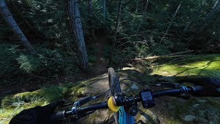
The late Daisy was a cross between a Jack Russell and a raccoon, hence the name "jackoon". She clawed this line in with her talons and dug deep so you would have it all, a climb, a descent and an aggressive trail you have to work on to make flow. Her ashes live on, hopefully in peace up there, knowing that her ambition far outweighed her talent....much like the builders.

Downhill only, no uphill riding.

This trail is unsanctioned.

Traditionally Indigenous Territory

Recent Activity on Trail

Past Week
  • 0 rides
  •  
6 Months
  • 51 rides
  • 9 miles avg distance
All
  • 284 rides
  • Last: Jun 13, 2026
c1c2c3c4
January
February
March
April
May
June
July
August
September
October
November
December
update trails status or condition

Jackoon Trail Reports

statusdatedescription
Nov 19, 2025 @ 6:28pm (America/Vancouver)
Nov 19, 2025
Oct 26, 2025 @ 11:03pm (America/Vancouver)
Oct 26, 2025
tree down just before "Danger" sign
Dec 3, 2024 @ 4:17pm
Dec 3, 2024
Good to go
Dec 3, 2024 @ 4:16pm
Dec 3, 2024
Good to go
Sep 21, 2024 @ 3:30pm
Sep 21, 2024
Dear Trail Users, Mosaic Forest Management wish to advise trail users that road construction activities of NLR47-34-27 shown above are scheduled...
more »
Status:
on Nov 19, 2025
Avg: 3.53 (9 votes)
Your vote: 0

view (1,273)
close
3D
Trail Conditions
  • Unknown
  • Snow Groomed
  • Snow Packed
  • Snow Covered
  • Snow Cover Partial
  • Freeze/thaw Cycle
  • Icy
  • Prevalent Mud
  • Wet
  • Variable
  • Ideal
  • Dry
  • Very Dry
Trail Flow (Ridden Direction)
Trailforks scans users ridelogs to determine the most popular direction each trail is ridden. A good flowing trail network will have most trails flowing in a single direction according to their intension.
The colour categories are based on what percentage of riders are riding a trail in its intended direction.
  • > 96%
  • > 90%
  • > 80%
  • > 70%
  • > 50%
  • < 50%
  • bi-directional trail
  • no data
Trail Last Ridden
Trailforks scans ridelogs to determine the last time a trail was ridden.
  • < 2 days
  • < 1 week
  • < 2 weeks
  • < 1 month
  • < 6 months
  • > 6 months
Trail Ridden Direction
The intended direction a trail should be ridden.
  • Downhill Only
  • Downhill Primary
  • Both Directions
  • Uphill Primary
  • Uphill Only
  • One Direction
Contribute Details
Colors indicate trail is missing specified detail.
  • Description
  • Photos
  • Description & Photos
  • Videos
Trail Popularity ?
Trailforks scans ridelogs to determine which trails are ridden the most in the last 9 months. Trails are compared with nearby trails in the same city region with a possible 25 colour shades. Think of this as a heatmap, more rides = more kinetic energy = warmer colors.
  • most popular
  • popular
  • less popular
  • not popular
ATV/ORV/OHV Filter
Max Vehicle Width
inches
US Cell Coverage
Legend
cell carrier legend

Radar Time
Activity Recordings
Trailforks uses anonymized public activity data. ?
Activity Recordings
Trailforks uses anonymized public activity data. ?
Personal Heatmap
Activity Types
all / none
Options
2
Date range month
Winter Trails
Warning A routing network for winter maps does not exist. Selecting trails using the winter trails layer has been disabled.
Missing Trails
Most Popular
Least Popular
Trails are colored based on popularity. The more popular a trail is, the more red. Less popular trails trend towards green.
Jump Magnitude Heatmap
Heatmap of where riders jump on trails. Zoom in to see individual jumps, click circles to view jump details.
BC Backroad Status

Service Road Atlas is a free to use, community-driven service for viewing and creating reports on the numerous back-country service roads around B.C. and Alberta.

map legend
Slope Aspect
Direction the slope faces
Flat N NE E SE S SW W NW
Trails Deemphasized
Trails are shown in grey.
disable
Only show trails with no bike usage.
Enable
Suggested Layers
Based on selected activity type

    Save the current map location and zoom level as your default home location whenever this page is loaded.

    Save
        Directions to jackoon trailhead (49.149620, -124.017410)

        Photos

        1 more »
        263 |
        Apr 29, 2020 @ 8:11pm
        Apr 29, 2020
        266 |
        Apr 29, 2020 @ 8:11pm
        Apr 29, 2020
        230 |
        Apr 29, 2020 @ 8:11pm
        Apr 29, 2020

        Videos

        1 more »
        Westwood Lake | Nanaimo, BC
        7:08 | 171 | Feb 13, 2025 , Nanaimo

        Routes with this trail

        5.0 22 miles 3,391 ft 16
        Four distinct zones, very pedalable with a few very hard climbs. Some ripper downs. Well built, modern...
        23 miles 3,880 ft 21
        Who doesn't like a good donut???
        18 miles 3,670 ft 19
        Maybe a 3.5 hour lunch break would be necessary.

        2 Reviews & Comments


        We hope you've been enjoying Trailforks!

        Create a FREE account to view trail comments and much more.

        • #277982 - 1,715 views

        Frequently Asked Questions About Jackoon

        Where is Jackoon located?
        Jackoon is located in Westwood, Nanaimo, British Columbia, Canada. It is part of the Westwood trail network. The trailhead is located at coordinates 49.14962, -124.01741.
        How hard is Jackoon?
        Jackoon is rated as Black Diamond difficulty. The average grade is 13.7%.
        What is the elevation gain for Jackoon?
        Jackoon has 9 ft of elevation gain. The trail has 242 ft of elevation descent. The elevation ranges from 1,104 ft to 1,340 ft.
        How long is Jackoon?
        Jackoon is 1,699 ft long. The trail type is singletrack.

        Hit the Trail

        Open in App

        Get this trail on your phone instantly.
        open trail in app

        Download Trail

        Save to wishlist, Garmin & download.
        save the trail

        Find Related Routes

        Find routes and users activities that include this trail.
        find routes for this trail

        You must enter a description before submitting.