
more stats
2,014 ft
Distance
-177 ft
Descent
00:03:59
Avg time
-177 ft
Altitude change
490 ft
Altitude min
668 ft
Altitude max
668 ft
Altitude start
492 ft
Altitude end
-8.8%
Grade
-31.3%
Grade max
1.9%
Grade min
1,824 ft
Distance down
190 ft
Distance flat
00:03:59
Avg time

Jammer Details

  • Activities
    • Mountain Bike
    • E-Bike
    • Hike
    • Trail Running
  • Riding Area
    Sprockids
    Gibsons, British Columbia
  • Difficulty Rating
  • Local Popularity
    45 in Mountain Biking [+]
    • 20 in E-Biking
    • 30 in Trail Running
    • 20 in Hiking
  • Global Ranking
    #273463 in Mountain Biking [+]
    • #118723 in E-Biking
    • #157891 in Trail Running
    • #158977 in Hiking
  • Provincial Ranking
    #10,104 in Mountain Biking · British Columbia [+]
    • #5,706 in E-Biking
    • #9,836 in Trail Running
    • #10,306 in Hiking
  • Trail Type
    Singletrack
  • Bike Type
    XC
  • Dogs Allowed
    Yes
  • eBike Allowed
    Yes up to Class 1

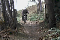
Built to avoid riding roads down to Wharf Road. The trail start from the top of the small hill off the powerline road. Go down the steep hill and a quick left once you enter the timber and BAM you're having a Jammer riding some sweet fresh single track The trail takes you into the rock quarry and onto Martins Trail.

Tags
Local Trail Association
Traditionally Indigenous Territory

Recent Activity on Trail

Past Week
  • 1 rides
  • 9 miles average
6 Months
  • 11 rides
  • 13 miles avg distance
All
  • 97 rides
  • Last: Oct 18, 2026
c1c2c3c4
January
February
March
April
May
June
July
August
September
October
November
December
update trails status or condition

Jammer Trail Reports

statusdatedescription
Sep 25, 2025 @ 6:03pm (America/Vancouver)
Sep 25, 2025
Jul 5, 2023 @ 4:22am
Jul 5, 2023
Dec 10, 2022 @ 5:36am
Dec 10, 2022
we cut through all the trees that were down. It is now open but take care. I still need to rake it. and sharpen my chain saw!
Dec 1, 2022 @ 12:03pm
Dec 1, 2022
Large tree down, chainsaw required
Jul 28, 2022 @ 1:52pm
Jul 28, 2022
more »
Status:
on Sep 25, 2025
Ideal
no votes yet
Your vote: 0

view (611)
close
      Directions to jammer trailhead (49.437170, -123.502010)

      Photos

      31 more »
      mtb
      357 |
      Dec 22, 2013 @ 7:07pm
      Dec 22, 2013
      mtb
      307 |
      Mar 14, 2006 @ 4:30pm
      Mar 14, 2006
      mtb
      291 |
      Dec 11, 2013 @ 10:21pm
      Dec 11, 2013
      mtb
      64 |
      Dec 22, 2013 @ 7:05pm
      Dec 22, 2013

      Videos

      8 more »
      Gear Jamming
      mtb
      0:57 | 1240 | Sep 28, 2013 , Gibsons
      Slow Motion Goodness on Gear Jammer SFU...
      mtb
      2:56 | 1438 | Mar 13, 2012 , Gibsons
      'Access Denied'
      mtb
      0:16 | 308 | Mar 17, 2014 , Gibsons
      SFU Gear Jammer Self Edit
      mtb
      0:08 | 387 | Sep 22, 2013 , Gibsons

      Routes with this trail

      ★ 5.0 • 63 miles • 9,130 ft • 43 •
      Route from Bikepacking.com
      28 miles • 3,930 ft • 40 •
      Sunshine Coast Challenge Course - Day 2 - This day will test your mettle with 44km and over 1500m of...
      ★ 1.0 • 59 miles • 6,326 ft • 20 • Point to Point •
      The route Matt, Jason and Andrew tackled on their first bikepacking expedition. Feel free to take this...

      Reviews / Comments

      No reviews yet, be the first to write a review or ask a question.
      Use trail reports to comment on trail conditions.


      We hope you've been enjoying Trailforks!

      Create a FREE account to view all trail reviews and much more.

      • By WabmatrixTF Pro CMBTA & contributors
      • #25706 - 2,619 views

      Frequently Asked Questions

      ▼ Where is Jammer located?
      Jammer is located in Sprockids, Gibsons, British Columbia, Canada. It is part of the Sprockids trail network. The trailhead is located at coordinates 49.43717, -123.50201.
      ▼ How hard is Jammer?
      Jammer is rated as Blue difficulty. The average grade is 8.8%.
      ▼ What is the elevation gain for Jammer?
      The trail has 177 ft of elevation descent. The elevation ranges from 490 ft to 668 ft.
      ▼ How long is Jammer?
      Jammer is 2,014 ft long. The trail type is singletrack.
      ▼ Are dogs allowed on Jammer?
      Yes, dogs are allowed on Jammer. Please keep dogs on a leash where required and clean up after them.
      ▼ How do I access Jammer? Where is the closest parking trailhead?
      The closest parking and trailhead locations to Jammer are: View all parking locations in the area.
      ▼ How long does it take to ride Jammer?
      Based on recorded activities, it takes an average of 4 minutes to ride Jammer. The trail is 2,014 ft long. Actual times will vary based on fitness level, conditions, and pace. View recent activity logs for more details.
      ▼ How busy is Jammer?
      Jammer is a moderately popular trail. There have been 538 recorded activities on this trail. The trail has received 611 check-ins. View recent activity on this trail.

      Hit the Trail

      Open in App

      Get this trail on your phone instantly.

      open trail in app

      Download Trail

      Save to wishlist, Garmin & download.
      save the trail

      Find Related Routes

      Find routes and users activities that include this trail.
      find routes for this trail

      You must enter a description before submitting.

