

more stats
2.1 miles
Distance
159 ft
Climb
-2 ft
Descent
00:29:03
Avg time
157 ft
Altitude change
1,659 ft
Altitude min
1,818 ft
Altitude max
1,659 ft
Altitude start
1,818 ft
Altitude end
1.4%
Grade
-2%
Grade max
10.4%
Grade min
1 mile
Distance climb
328 ft
Distance down
3,051 ft
Distance flat
00:29:03
Avg time

John Wert Path Details

  • Activities
    • Mountain Bike
    • E-Bike
    • Hike
    • Trail Running
  • Riding Area
    Galbraith Gap (Rothrock State Forest)
    State College, Pennsylvania
  • Difficulty Rating
  • Voted Difficulty
    Black Diamond (3 votes)
  • Local Popularity
    90 in Mountain Biking [+]
    • 80 in E-Biking
    • 80 in Trail Running
    • 5 in Hiking
  • Global Ranking
    #71626 in Mountain Biking [+]
    • #121669 in E-Biking
    • #110675 in Trail Running
    • #206481 in Hiking
  • State Ranking
    #965 in Mountain Biking · Pennsylvania [+]
    • #706 in E-Biking
    • #1,702 in Trail Running
    • #4,219 in Hiking
  • Trail Type
    Singletrack
  • Bike Type
    AM, XC
  • Direction
    Both Directions
    Popular Direction Shown
  • Climb Difficulty
    Black Diamond
  • Physical Rating
    Hard
  • Season
    Summer - Fall - Winter
  • Dogs Allowed
    Yes
  • eBike Allowed
  • Land Owner

John Wert trail is know to be one of the most technical trails in Rothrock. However there are really only two large rock gardens that cause an issue for most riders.
The trail starts at a yellow camp gate, once you ride past the camp and cross the gas line, the true singletrack begins. John Wert trail is know to be one of the most technical trails in Rothrock. However there are really only two large rock gardens that cause an issue for most riders.
The trail starts at a yellow camp gate, once you ride past the camp and cross the gas line, the true singletrack begins.

Access Info

From Thickhead Mountain Road or Bear Meadows Rd

Tags
MeadowRock gardens

Trail Supporters

  • http://nittanymba.org/
    Sponsor

Local Trail Association

Traditionally Indigenous Territory

Recent Activity on Trail

Past Week
  • 0 rides
  •  
6 Months
  • 35 rides
  • 21 miles avg distance
All
  • 224 rides
  • Last: Oct 7, 2026
update trails status or condition

John Wert Path Trail Reports

statusdatedescription
Jul 3, 2025 @ 1:49pm
Jul 3, 2025
Sep 14, 2024 @ 10:41am
Sep 14, 2024
Extremely Dry for JWP, easy pickin's through the rocks when its dry.
Sep 6, 2024 @ 4:51pm
Sep 6, 2024
Outside of a few tricky rock gardens at the very end of the trail, most of this trail is relatively tame and makes for a super fun intermediate...
Aug 11, 2024 @ 5:38pm
Aug 11, 2024
A little over grown in some sections
Jul 13, 2024 @ 11:36am
Jul 13, 2024
Tree down, can be cleared with a handsaw 40.7388512, -77.7338341
more »
Status:
on Jul 3, 2025
Variable
Avg: 3.53 (7 votes)
Your vote: 0

view (974)
close
      Directions to john-wert-path trailhead (40.745120, -77.720570)

      Photos

      36 more »
      mtb
      204 |
      Jan 9, 2023 @ 7:37am
      Jan 9, 2023
      mtb
      188 |
      Jan 9, 2023 @ 7:37am
      Jan 9, 2023
      mtb
      285 |
      Jan 2, 2020 @ 5:19am
      Jan 2, 2020
      mtb
      219 |
      Jan 2, 2020 @ 5:19am
      Jan 2, 2020

      Videos

      1 more »
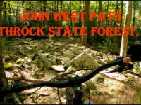
      John Wert Path - Rothrock State Forest, PA
      mtb
      659 | Sep 8, 2020 , State College

      Routes with this trail

      ★ 3.7 • 35 miles • 4,277 ft • 25 • Loop •
      Overview The 36-mile Rothrock TrailMix course provides a combination of some of the best trails within...
      32 miles • 3,879 ft • 18 • Loop •
      his is a 32 mile meander starting from Penn Roosevelt State Park will take intermediate/advanced riders...

      Trail Products

      3.2 ★★★★★
      7 Ratings
      5 ★ 14%
      4 ★ 29%
      3 ★ 29%
      2 ★ 14%
      1 ★ 14%

      9 Reviews & Comments

      Auto-XFil
      Absolutely not a double black. Rocks are not as bad as some other nearby trails like the Ridge or Sassafras. Consistent moderate rocks with a few trickier sections. Highly recommended if you like tech, and fun for any intermediate rider looking for a challenge.
      melissaalvarez melissaalvarez
      Technical rock gardens but nothing that is not doable. If you can’t make the rock garden sections, no biggie... just walk it. Disclaimer: rider from Florid here and I was able to clear all the rock gardens.
      easilygreen easilygreen
      Finally rode this trail in March '21. Great little section of rock.

      We hope you've been enjoying Trailforks!

      Create a FREE account to view all trail reviews and much more.

      • By SaclydesdaleTF Pro NMBA & contributors
      • #22515 - 4,266 views

      Frequently Asked Questions

      ▼ Where is John Wert Path located?
      John Wert Path is located in Galbraith Gap (Rothrock State Forest), State College, Pennsylvania, United States. It is part of the Galbraith Gap (Rothrock State Forest) trail network. The trailhead is located at coordinates 40.74512, -77.72057.
      ▼ How hard is John Wert Path?
      John Wert Path is rated as Double Black Diamond difficulty. The physical rating is Hard. The average grade is 1.4%. The climb difficulty is rated Black Diamond.
      ▼ What is the elevation gain for John Wert Path?
      John Wert Path has 159 ft of elevation gain. The trail has 2 ft of elevation descent. The elevation ranges from 1,659 ft to 1,818 ft.
      ▼ Is John Wert Path a point to point trail?
      John Wert Path is not a point to point trail. The direction is Both Directions. The trail type is singletrack.
      ▼ How long is John Wert Path?
      John Wert Path is 2.1 miles long. The trail type is singletrack.
      ▼ Are dogs allowed on John Wert Path?
      Yes, dogs are allowed on John Wert Path. Please keep dogs on a leash where required and clean up after them.
      ▼ When is the best time of year to ride John Wert Path?
      John Wert Path is best visited during: Summer - Fall - Winter.
      ▼ How do I access John Wert Path? Where is the closest parking trailhead?
      The closest parking and trailhead locations to John Wert Path are: View all parking locations in the area.
      ▼ How long does it take to ride John Wert Path?
      Based on recorded activities, it takes an average of 29 minutes to ride John Wert Path. The trail is 2.1 miles long. Actual times will vary based on fitness level, conditions, and pace. View recent activity logs for more details.
      ▼ How busy is John Wert Path?
      John Wert Path is a very popular trail. There have been 984 recorded activities on this trail. The trail has received 974 check-ins. View recent activity on this trail.

      Hit the Trail

      Open in App

      Get this trail on your phone instantly.

      open trail in app

      Download Trail

      Save to wishlist, Garmin & download.
      save the trail

      Find Related Routes

      Find routes and users activities that include this trail.
      find routes for this trail

      You must enter a description before submitting.

