

more stats
3.0 miles
Distance
256 ft
Climb
-125 ft
Descent
01:28:31
Avg time
133 ft
Altitude change
4,457 ft
Altitude min
4,598 ft
Altitude max
4,465 ft
Altitude start
4,600 ft
Altitude end
0.8%
Grade
-19.7%
Grade max
15.8%
Grade min
2 miles
Distance climb
3,832 ft
Distance down
3,097 ft
Distance flat
01:28:31
Avg time

Jumpingpound Loop South Details

  • Activities
    • Mountain Bike
    • E-Bike
    • Winter Fat Bike
    • Hike
    • Trail Running
    • Snowshoe
    • Backcountry Ski
  • Riding Area
    Jumpingpound Creek
    Bragg Creek, Alberta
  • AKA
    Jumpingpound Loop, Pinetop
  • Difficulty Rating
  • Local Popularity
    85 in Mountain Biking [+]
    • 95 in E-Biking
    • 80 in Trail Running
    • 90 in Hiking
    • 100 in Snowshoeing
    • 5 in Backcountry Skiing
    • 60 in Winter Fat Biking
  • Global Ranking
    #22979 in Mountain Biking [+]
    • #77473 in E-Biking
    • #77754 in Trail Running
    • #74269 in Hiking
    • #623 in Snowshoeing
    • #799 in Backcountry Skiing
    • #2503 in Winter Fat Biking
  • Provincial Ranking
    #369 in Mountain Biking · Alberta [+]
    • #757 in E-Biking
    • #1,433 in Trail Running
    • #1,193 in Hiking
    • #19 in Snowshoeing
    • #13 in Backcountry Skiing
    • #168 in Winter Fat Biking
  • Trail Type
    Singletrack
  • Snow Grooming
    Backcountry
  • Bike Type
    AM, XC, Fat
  • Direction
    Both Directions[+]
    • Both Directions for Snowshoeing
    • Both Directions for Backcountry Skiing
  • Climb Difficulty
    Blue
  • Physical Rating
    Moderate
  • Trail Visibility
    Always easy to follow
  • Dogs Allowed
    Yes
  • eBike Allowed
    Yes up to Class 1
  • TTFs on Trail
    Bridge
  • Land Owner
    Alberta Forestry and Parks

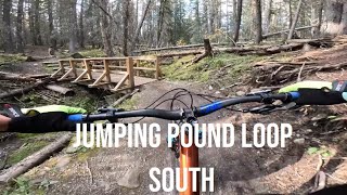
A classic Kananaskis hiking trail, the Jumpingpound Loop trail has been popular with mountain bikers too for a few decades. It really is a trail-of-two-halves with a different character north and south of the road (Sibbald Creek Trail). However, the whole loop is suitable for almost all levels and kinds of rider. The South half is a little easier than the North half, especially for less experienced riders, as it's mostly wider and less hilly/steep (although there are a few bridged creek crossings with short, steep approaches and the usual roots and rocks).

There are great views of Jumpingpound Creek to be found on the south side of the trail. In the winter, there are often ice-flows at the creek crossings, but the trail gets packed a bit by hikers and snowshoers and is great for fat-biking.

The South trail can be combined with the North for the classic loop or with the new Jumped Up Loops (Kashmir, Trampled Under Foot & Ten Years Gone) to create various figure-eights and other permutations.

This is a popular hiking trail, and cattle range here from mid-June to late September. If you hear the sound of distant gunfire, that's because there's a private shooting range a few km away.

source: ...
Access Info

Trailhead: Take the TransCanada Hwy 1 to Sibbald Creek Trail Hwy 68 and head south. Park at the Pinetop PRA and start the trail from there – either direction, you choose.

Tags
BridgesCreek crossingViews
Trail Supporters
Local Trail Association

Recent Activity on Trail

Past Week
  • 10 rides
  • 10 miles average
6 Months
  • 192 rides
  • 9 miles avg distance
All
  • 628 rides
  • Last: Sep 30, 2026
c1c2c3c4
January
February
March
April
May
June
July
August
September
October
November
December
update trails status or condition

Jumpingpound... Trail Reports

statusdatedescription
Sep 21, 2026 @ 6:16pm (America/Edmonton)
Sep 21, 2026
Large tree down across trail, blocking trail at first bridge when riding out from parking lot. One plank on the bridge has also been dislodged....
Sep 9, 2026 @ 3:13pm (America/Edmonton)
Sep 9, 2026
Mostly perfect with some minor mud and puddles
Aug 17, 2026 @ 2:00pm (America/Creston)
Aug 17, 2026
Jul 31, 2026 @ 11:37am (America/Edmonton)
Jul 31, 2026
Absolutely MINT today......cool in the trees, fast and dry throughout...awesome trail conditions once again.
Dec 31, 2025 @ 3:09pm (America/Edmonton)
Dec 31, 2025
Well packed as far as the connector (and likely beyond). All deadfall cleared to the connector except for one tree that's fairly easily stepped...
more »
Status:
on Sep 21, 2026
Variable
Avg: 4.07 (25 votes)
Your vote: 0

view (1,651)
close
      Directions to jumpingpound-loop-south trailhead (51.036800, -114.729470)

      Photos

      77 more »
      mtb
      119 |
      Jun 27, 2025 @ 5:07am
      Jun 27, 2025
      mtb
      74 |
      Jun 23, 2024 @ 7:59am
      Jun 23, 2024
      mtb
      74 |
      Sep 30, 2023 @ 12:51pm
      Sep 30, 2023
      mtb
      67 |
      Sep 30, 2023 @ 12:50pm
      Sep 30, 2023

      Videos

      3 more »
      Jumping Pound Loop (South)
      mtb
      14:08 | 177 | Oct 13, 2025 , Bragg Creek
      Joumpingpound Loop, Kananaskis, Alberta
      mtb
      21:42 | 1099 | Oct 16, 2020 , Bragg Creek
      Kananaskis - Jumping Pound Loop
      mtb
      4117 | Oct 29, 2015 , Bragg Creek

      Routes with this trail

      ★ 4.5 • 6 miles • 801 ft • 5 • Loop •
      Most riders find this to be the easiest and most fun way to ride the east loop ( & ) of the Jumped Up...
      ★ 5.0 • 9 miles • 1,138 ft • 4 • Loop •
      This route takes in the two core Jumped Up Loop trails in the shortest / fastest possible loop.
      ★ 4.0 • 9 miles • 841 ft • 4 • Loop •
      The easiest / quickest way to ride the latest addition to the Jumped Up Loops:
      4.1 ★★★★★
      25 Ratings
      5 ★ 16%
      4 ★ 76%
      3 ★ 8%
      2 ★
      1 ★

      12 Reviews & Comments

      DonYx DonYx
      CMBA cleared downed trees on June 20, 2024. Please let us know if there are any more. [email protected]
      Kickflipvince Kickflipvince
      The climbing of 154m does seem incorrect. None the less it is a fun little trail.
      RonHuizenga
      Climb is understated on here. Undulating terrain on the north part of the loop. According to Strava today it was 215 M for the full loop.

      We hope you've been enjoying Trailforks!

      Create a FREE account to view all trail reviews and much more.

      • By hehmosher & contributors
      • #19502 - 45,408 views

      Frequently Asked Questions

      ▼ Where is Jumpingpound Loop South located?
      Jumpingpound Loop South is located in Jumpingpound Creek, Bragg Creek, Alberta, Canada. It is part of the Jumpingpound Creek trail network. The trailhead is located at coordinates 51.0368, -114.72947.
      ▼ How hard is Jumpingpound Loop South?
      Jumpingpound Loop South is rated as Blue difficulty. The physical rating is Moderate. The average grade is 0.8%. The climb difficulty is rated Blue.
      ▼ What is the elevation gain for Jumpingpound Loop South?
      Jumpingpound Loop South has 256 ft of elevation gain. The trail has 125 ft of elevation descent. The elevation ranges from 4,457 ft to 4,598 ft.
      ▼ Is Jumpingpound Loop South a point to point trail?
      Jumpingpound Loop South is not a point to point trail. The direction is Both Directions. The trail type is singletrack.
      ▼ How long is Jumpingpound Loop South?
      Jumpingpound Loop South is 3.0 miles long. The trail type is singletrack.
      ▼ Are dogs allowed on Jumpingpound Loop South?
      Yes, dogs are allowed on Jumpingpound Loop South. Please keep dogs on a leash where required and clean up after them.
      ▼ How do I access Jumpingpound Loop South? Where is the closest parking trailhead?
      The closest parking and trailhead locations to Jumpingpound Loop South are: View all parking locations in the area.
      ▼ How long does it take to ride Jumpingpound Loop South?
      Based on recorded activities, it takes an average of 1 hour 27 minutes to ride Jumpingpound Loop South. The trail is 3.0 miles long. Actual times will vary based on fitness level, conditions, and pace. View recent activity logs for more details.
      ▼ How busy is Jumpingpound Loop South?
      Jumpingpound Loop South is a very popular trail. There have been 1,476 recorded activities on this trail. The trail has received 1,650 check-ins. View recent activity on this trail.

      Hit the Trail

      Open in App

      Get this trail on your phone instantly.

      open trail in app

      Download Trail

      Save to wishlist, Garmin & download.
      save the trail

      Find Related Routes

      Find routes and users activities that include this trail.
      find routes for this trail

      You must enter a description before submitting.