more stats
3,330 ft
Distance
29 ft
Climb
-32 ft
Descent
00:04:03
Avg time
-1 ft
Altitude change
570 ft
Altitude min
592 ft
Altitude max
588 ft
Altitude start
587 ft
Altitude end
-0%
Grade
-10.6%
Grade max
5.3%
Grade min
594 ft
Distance climb
505 ft
Distance down
2,195 ft
Distance flat
00:04:03
Avg time

Kathleen Details

  • Activities
    • Mountain Bike
    • Hike
    • Trail Running
  • Riding Area
    Black Diamond Open Space
    Maple Valley, Washington
  • Difficulty Rating
  • Local Popularity
    95 in Mountain Biking heatmap [+]
    • 65 in Trail Running
    • 75 in Hiking
  • Global Ranking
    #51309 in Mountain Biking [+]
    • #153893 in Trail Running
    • #144989 in Hiking
  • State Ranking
    #856 in Mountain Biking · Washington [+]
    • #4,614 in Trail Running
    • #4,887 in Hiking
  • Trail Type
    Singletrack
  • Bike Type
    AM, XC, CX
  • Direction
    One Direction[+]
    • One Direction for Trail Running
    • One Direction for Hiking
  • Climb Difficulty
    Green
  • Physical Rating
    Easy
  • Trail Visibility
    Always easy to follow
  • Dogs Allowed
    Yes
  • eBike Allowed
  • Ride in Rain
    Yes

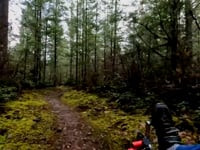
Fast loop with two entrances, with smaller berms - relatively smooth and fast rolling.

Access Info

Entrances off of Tarzan and Route 66.

Tags
Berms

Local Trail Association

Traditionally Indigenous Territory

Recent Activity on Trail

Past Week
  • 7 rides
  • 5 miles average
6 Months
  • 245 rides
  • 8 miles avg distance
All
  • 2,049 rides
  • Last: Nov 14, 2026
c1c2c3c4
January
February
March
April
May
June
July
August
September
October
November
December
update trails status or condition

Kathleen Trail Reports

statusdatedescription
Jun 11, 2026 @ 12:00pm (America/Los_Angeles)
Jun 11, 2026
Healthy looking medium sized black bear on Route 66 entrance to Kathleen. He startled me, I startled him. He ran away😄
May 12, 2026 @ 5:30pm (America/Vancouver)
May 12, 2026
Oct 31, 2024 @ 9:52am
Oct 31, 2024
Aug 25, 2024 @ 10:45am
Aug 25, 2024
Jul 26, 2024 @ 10:34am
Jul 26, 2024
more »
Status:
on Jun 11, 2026
Avg: 3.92 (8 votes)
Your vote: 0

view (6,801)
close
      Directions to kathleen trailhead (47.339930, -122.006050)

      Photos

      1 more »
      report
      mtb
      76 |
      Jan 13, 2023 @ 4:11pm
      Jan 13, 2023

      Videos

      2 more »
      Moss Ride on a Flow Trail
      mtb
      2:19 | 129 | Feb 6, 2024 , Maple Valley
      Tour of Kathleen with JJ
      mtb
      2:07 | 374 | Mar 19, 2019 , Maple Valley

      Routes with this trail

      more »
      11 miles • 667 ft • 12 • Loop •
      Fun route for groups with varied rider skill & fitness, and a good look at what's available while...
      ★ 2.0 • 24 miles • 1,242 ft • 50 •
      this site is annoying how do i use it
      10 miles • 309 ft • 10 •
      trail route test for my second ride at this spot that's similar to soaring eagle but much more trails and...
      3.9 ★★★★★
      8 Ratings
      5 ★ 38%
      4 ★ 38%
      3 ★ 13%
      2 ★
      1 ★ 13%

      5 Reviews & Comments

      MousexxxHouse
      Chill loop with very mild ups and downs. Great for beginners, or just turning XC laps. Rocky/bumpy in some sections.
      lothi192
      Straightforward loop; very good for beginners to practice fundamentals.
      bpercival
      The brush is getting thick but the trail still runs well.

      We hope you've been enjoying Trailforks!

      Create a FREE account to view all trail reviews and much more.

      • By overdrive47 & contributors
      • #34019 - 2,852 views

      Frequently Asked Questions

      ▼ Where is Kathleen located?
      Kathleen is located in Black Diamond Open Space, Maple Valley, Washington, United States. It is part of the Black Diamond Open Space trail network. The trailhead is located at coordinates 47.33993, -122.00605.
      ▼ How hard is Kathleen?
      Kathleen is rated as Green difficulty. The physical rating is Easy. The climb difficulty is rated Green.
      ▼ What is the elevation gain for Kathleen?
      Kathleen has 29 ft of elevation gain. The trail has 32 ft of elevation descent. The elevation ranges from 570 ft to 592 ft.
      ▼ Is Kathleen a point to point trail?
      Yes, Kathleen is a point to point trail. The direction is One Direction. The trail type is singletrack.
      ▼ How long is Kathleen?
      Kathleen is 3,330 ft long. The trail type is singletrack.
      ▼ Are dogs allowed on Kathleen?
      Yes, dogs are allowed on Kathleen. Please keep dogs on a leash where required and clean up after them.
      ▼ How do I access Kathleen? Where is the closest parking trailhead?
      The closest parking and trailhead locations to Kathleen are: View all parking locations in the area.
      ▼ How long does it take to ride Kathleen?
      Based on recorded activities, it takes an average of 4 minutes to ride Kathleen. The trail is 3,330 ft long. Actual times will vary based on fitness level, conditions, and pace. View recent activity logs for more details.
      ▼ How busy is Kathleen?
      Kathleen is a very popular trail. There have been 5,392 recorded activities on this trail. The trail has received 6,801 check-ins. View recent activity on this trail.

      Hit the Trail

      Open in App

      Get this trail on your phone instantly.

      open trail in app

      Download Trail

      Save to wishlist, Garmin & download.
      save the trail

      Find Related Routes

      Find routes and users activities that include this trail.
      find routes for this trail

      You must enter a description before submitting.