3,655 ft
Distance
-666 ft
Descent
00:05:04
Avg time
Supporters, Builders, Maintainers & Land Managers of Kill Bill 2 Trail
Finale Outdoor RegionLand Manager
Kill Bill 2 Details
-
Activities
- Mountain Bike
-
Riding AreaFinale Outdoor Region
Finale Ligure -
Ref Number#254
-
Difficulty Rating
-
Voted DifficultyRed (5 votes)
-
Trail TypeSingletrack
-
Bike TypeAM, XC
-
DirectionDownhill OnlyPopular direction shown
-
Climb DifficultyGreen
-
Physical RatingModerate
-
Trail VisibilitySometimes hard to follow
-
SeasonAll-year round
-
Dogs AllowedYes
-
eBike AllowedYes up to Class 1
-
TTFs on TrailBerm, Skinny
-
Global Ranking#1145 in Mountain Biking
-
Local Popularity95 in Mountain Biking
-
Land OwnerFinale Outdoor Region
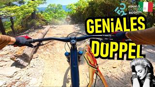
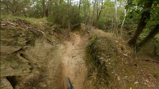
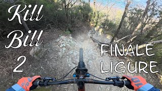
Between the 2 Kill Bills, this is the second entrance when riding under the Madonna della Guardia Church. It starts with a few steep and tight corners, before entering a flowier and faster section with a few blind compressions. It ends on a flat track that grants the access to Madonna della Guardia (link) and Cacciatore.
source: ...
Access Info
Madonna della Guardia is reachable from the E80 highway accessing Finale Ligure, then drive north on the SP490 until the brown sign on your right saying "Santuario di Madonna della Guardia".
Disclaimer
Given its nature, the trail can change after weather happenings and season changes. Always pay attention.
Local Trail Association
-
Please consider joining or donating to the local trail association to supportdonate to earn trail karma!
trail development & maintenance.
More Stats for Kill Bill 2 mountain bike trail trail
-
Altitude change-666 ft
-
Altitude min1,067 ft
-
Altitude max1,733 ft
-
Altitude start1,733 ft
-
Altitude end1,066 ft
-
Grade-18.2%
-
Grade max-55.6%
-
Grade min-3%
-
Distance down3,629 ft
-
Distance flat26 ft
-
Avg time00:05:04
-
Avg reverse time00:00:11
- view trail stats
close
3D
Trail Conditions
- Unknown
- Snow Groomed
- Snow Packed
- Snow Covered
- Snow Cover Inadequate
- Freeze/thaw Cycle
- Icy
- Prevalent Mud
- Wet
- Variable
- Ideal
- Dry
- Very Dry
Trail Flow (Ridden Direction)
Trailforks scans users ridelogs to determine the most popular direction each trail is ridden. A good flowing trail network will have most trails flowing in a single direction according to their intension.
The colour categories are based on what percentage of riders are riding a trail in its intended direction.
- > 96%
- > 90%
- > 80%
- > 70%
- > 50%
- < 50%
- bi-directional trail
- no data
Trail Last Ridden
Trailforks scans ridelogs to determine the last time a trail was ridden.
- < 2 days
- < 1 week
- < 2 weeks
- < 1 month
- < 6 months
- > 6 months
Trail Ridden Direction
The intended direction a trail should be ridden.
- Downhill Only
- Downhill Primary
- Both Directions
- Uphill Primary
- Uphill Only
- One Direction
Contribute Details
Colors indicate trail is missing specified detail.
- Description
- Photos
- Description & Photos
- Videos
Trail Popularity ?
Trailforks scans ridelogs to determine which trails are ridden the most in the last 9 months.
Trails are compared with nearby trails in the same city region with a possible 25 colour shades.
Think of this as a heatmap, more rides = more kinetic energy = warmer colors.
- most popular
- popular
- less popular
- not popular
ATV/ORV/OHV Filter
Max Vehicle Width
inches
Radar Time
x
Activity Recordings
Trailforks users anonymized public ridelogs from the past 6 months.
- mountain biking recent
- mountain biking (>6 month)
- hiking (1 year)
- moto (1 year)
Activity Recordings
Trailforks users anonymized public skilogs from the past 12 months.
- Downhill Ski
- Backcountry Ski
- Nordic Ski
- Snowmobile
Jump Magnitude Heatmap
Heatmap of where riders jump on trails. Zoom in to see individual jumps, click circles to view jump details.
Trails Deemphasized
Trails are shown in grey.
Only show trails with NO bikes.
Save the current map location and zoom level as your default home location whenever this page is loaded.
Save
Directions to kill-bill-2 trailhead
(44.205110, 8.270970)
update trails status or condition
Kill Bill 2 Trail Reports
view all reports »
Recent Ridelog Activity on Trail
Past Week
- 11 rides
- 20 miles avg distance
6 Months
- 604 rides
- 28 miles avg distance
All
- 3,494 rides
- Last: Jan 28, 2023
Photos
more »
Routes with this trail
6 Reviews & Comments
-
+ 0


Nice techy trail with some drops that are not rollable. Slippery rocks when wet, advanced riders only.
[Reply]
Arzi71
(Oct 17, 2022 at 1:23)
Uno spettacolo!!! Rispetto a suoi "vicini" della stessa gradazione (Cacciatore e Madonna della Guardia) ha una difficoltà distribuita in maniera uniforme su tutto il tracciato, mentre gli altri magari hanno un singolo passaggio molto difficile ma poi nel resto del percorso sono più semplici. Molto bella la parte iniziale con alcuni tornanti ripidi. Consigliatissimo anche per chi come me preferisce i trail senza tratti esposti.
[Reply]
benepongi
(Sep 6, 2019 at 10:45)
nice trail ! would recommend to ride madonna della guardia following
[Reply]

Definitely a Black trail with some steep sections and black style features. But good fun to ride if you like challenges. Some very special features makes it different from other trails in the area. Recommended!
[Reply]


I think its hard to know exactly which trail is which but this one (Kill Bill 2) definitely has some difficult sections near the top and bottom. The middle is more flowing with nicely bermed corners but there are some drops, rocks and g-outs that would challenge beginners
[Reply]
stefbanshee
(Jul 21, 2017 at 13:36)
Trail very flowy and fun, the corners are very well shaped.
Not technical so for me it's not a black trail, less tricky than the kill bill trail (blue)
Good job ????
[Reply]
Not technical so for me it's not a black trail, less tricky than the kill bill trail (blue)
Good job ????
Videos
more »
youtuber

5:01 |
338 |
Feb 8, 2022 , Finale Ligure
Nearby Trails
- Kill Bill 1 906 ft
- Cavatappi 1,033 ft
- Cacciatore 1,070 ft
- Access To Madonna Della Guardia/ Cacciatore 2nd Ppart 3,642 ft
- Mdg Access 4,423 ft
Finale Outdoor Region
- embed Kill Bill 2 trail on your website
- By cheorch
& contributors
- #46090 - 11,089 views
- subscribe
- login to download gpx or kml files.