more stats
2,749 ft
Distance
185 ft
Climb
-279 ft
Descent
00:05:52
Avg time
-95 ft
Altitude change
3,810 ft
Altitude min
4,014 ft
Altitude max
3,905 ft
Altitude start
3,809 ft
Altitude end
-3.5%
Grade
-57.3%
Grade max
32.4%
Grade min
912 ft
Distance climb
1,545 ft
Distance down
292 ft
Distance flat
00:05:52
Avg time

Kushiest Details

  • Activities
    • Mountain Bike
    • E-Bike
    • Hike
    • Trail Running
  • Riding Area
    Fernie Ridge (East)
    Fernie, British Columbia
  • Difficulty Rating
  • Voted Difficulty
    Blue (1 vote)
  • Local Popularity
    45 in Mountain Biking [+]
    • 5 in E-Biking
    • 60 in Trail Running
    • 35 in Hiking
  • Global Ranking
    #130964 in Mountain Biking [+]
    • #92917 in E-Biking
    • #145860 in Trail Running
    • #156623 in Hiking
  • Provincial Ranking
    #6,792 in Mountain Biking · British Columbia [+]
    • #4,853 in E-Biking
    • #8,583 in Trail Running
    • #9,955 in Hiking
  • Trail Type
    Singletrack
  • Bike Type
    AM, XC
  • Direction
    Both Directions
  • Climb Difficulty
    Blue
  • Physical Rating
    Moderate
  • Dogs Allowed
    Yes
  • eBike Allowed
    Yes up to Class 1
  • Land Owner
    Pollyco

The third (of the now four) Kushes, Kushiest takes you back above Ridgemont Road, with a bit a climb, switching in and out of forest and logged forest. Ups and downs.

Access Info

Opposite where Kushier fires you out onto Ridgemont Road.

Tags

Local Trail Association

Traditionally Indigenous Territory

Recent Activity on Trail

Past Week
  • 0 rides
  •  
6 Months
  • 14 rides
  • 15 miles avg distance
All
  • 119 rides
  • Last: Oct 21, 2026
c1c2c3c4
January
February
March
April
May
June
July
August
September
October
November
December
update trails status or condition

Kushiest Trail Reports

statusdatedescription
Apr 26, 2026 @ 6:50pm (America/Edmonton)
Apr 26, 2026
Mostly all clear, I removed 2 logs but my chainsaw ran out of power ao the large one could still use more work.
Mar 30, 2026 @ 11:43am (America/Edmonton)
Mar 30, 2026
Trail is snow covered, but ground is no longer as firm as in winter. Use caution as snow melts as riding when soft can cause trail damage.
Apr 27, 2025 @ 12:51pm
Apr 27, 2025
Trail itself is now clear other than the aforementioned issue at the road from kushier
Apr 26, 2025 @ 1:19pm
Apr 26, 2025
At the road crossing from kushier to kushiest the connection to ridgemont road needs work. Also at least one tree down that needs more than a...
May 29, 2024 @ 6:03am
May 29, 2024
Bridge at entry from Kush 2 has been replaced by FTA trail crew.
more »
Status:
on Apr 26, 2026
Variable
Avg: 3.43 (3 votes)
Your vote: 0

view (650)
close
      Directions to kushiest trailhead (49.524310, -115.020390)

      Photos

      5 more »
      report
      mtb
      46 |
      Apr 26, 2026 @ 5:50pm
      Apr 26, 2026
      report
      mtb
      47 |
      Apr 26, 2025 @ 1:19pm
      Apr 26, 2025
      report
      mtb
      41 |
      Jun 10, 2020 @ 3:12pm
      Jun 10, 2020
      report
      mtb
      41 |
      Jun 10, 2020 @ 3:12pm
      Jun 10, 2020

      Videos

      1 more »
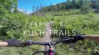
      Kush Trails - Fernie, BC | Mountain Biking
      mtb
      16:40 | 395 | Jul 23, 2018 , Fernie

      Routes with this trail

      ★ 4.0 • 30 miles • 6,600 ft • 62 •
      Here we have the 2018 Fernie Mountain Bike Club High Roller Route!
      18 miles • 3,715 ft • 21 •
      xxxxxxxxxxxxxxxxxxxxxxxxxxxxxxxxxxxxxxxxxxxx
      ★ 4.0 • 20 miles • 4,168 ft • 46 • Race •
      The 2016 Singletrack 6 will kick off with Stage 1 on the southeast side of town in the Castle and...
      2.4 ★★★★★
      3 Ratings
      5 ★
      4 ★ 33%
      3 ★
      2 ★ 33%
      1 ★ 33%

      2 Reviews & Comments

      pgodman
      Loose and dusty but great riding otherwise!

      We hope you've been enjoying Trailforks!

      Create a FREE account to view all trail reviews and much more.

      • By yulortscherTF Pro & contributors
      • #36196 - 1,786 views

      Frequently Asked Questions

      ▼ Where is Kushiest located?
      Kushiest is located in Fernie Ridge (East), Fernie, British Columbia, Canada. It is part of the Fernie Ridge (East) trail network. The trailhead is located at coordinates 49.52431, -115.02039.
      ▼ How hard is Kushiest?
      Kushiest is rated as Black Diamond difficulty. The physical rating is Moderate. The average grade is 3.5%. The climb difficulty is rated Blue.
      ▼ What is the elevation gain for Kushiest?
      Kushiest has 185 ft of elevation gain. The trail has 279 ft of elevation descent. The elevation ranges from 3,810 ft to 4,014 ft.
      ▼ Is Kushiest a point to point trail?
      Kushiest is not a point to point trail. The direction is Both Directions. The trail type is singletrack.
      ▼ How long is Kushiest?
      Kushiest is 2,749 ft long. The trail type is singletrack.
      ▼ Are dogs allowed on Kushiest?
      Yes, dogs are allowed on Kushiest. Please keep dogs on a leash where required and clean up after them.
      ▼ When is the best time of year to ride Kushiest?
      Based on activity log data, the most popular months to ride Kushiest are:
      • July (10 activities)
      • June (9 activities)
      • August (9 activities)
      Check the reports page for current trail conditions.
      ▼ How do I access Kushiest? Where is the closest parking trailhead?
      The closest parking and trailhead locations to Kushiest are: View all parking locations in the area.
      ▼ How long does it take to ride Kushiest?
      Based on recorded activities, it takes an average of 6 minutes to ride Kushiest. The trail is 2,749 ft long. Actual times will vary based on fitness level, conditions, and pace. View recent activity logs for more details.
      ▼ How busy is Kushiest?
      Kushiest is a moderately popular trail. There have been 670 recorded activities on this trail. The trail has received 650 check-ins. View recent activity on this trail.

      Hit the Trail

      Open in App

      Get this trail on your phone instantly.

      open trail in app

      Download Trail

      Save to wishlist, Garmin & download.
      save the trail

      Find Related Routes

      Find routes and users activities that include this trail.
      find routes for this trail

      You must enter a description before submitting.