more stats
1.7 miles
Distance
105 ft
Climb
-145 ft
Descent
00:12:37
Avg time
-38 ft
Altitude change
6,100 ft
Altitude min
6,222 ft
Altitude max
6,178 ft
Altitude start
6,138 ft
Altitude end
-0.4%
Grade
-17.7%
Grade max
9%
Grade min
3,596 ft
Distance climb
3,786 ft
Distance down
1,588 ft
Distance flat
00:12:37
Avg time

Lava Loop Details

  • Activities
    • Mountain Bike
    • E-Bike
    • Winter Fat Bike
    • Horse
    • Hike
    • Trail Running
  • Riding Area
    South Table Mountain Park
    Golden, Colorado
  • Difficulty Rating
  • Voted Difficulty
    Green (1 vote)
  • Local Popularity
    65 in Mountain Biking [+]
    • 55 in E-Biking
    • 75 in Trail Running
    • 35 in Hiking
    • 5 in Horseback
  • Global Ranking
    #80048 in Mountain Biking [+]
    • #61320 in Trail Running
    • #117304 in Hiking
    • #1575 in Horseback
  • Hiking SAC Scale
    T1 Hiking
  • Trail Type
    Singletrack
  • Bike Type
    AM, XC, Fat
  • Direction
    Both Directions
  • Trail Visibility
    Always easy to follow
  • Dogs Allowed
    Yes
  • eBike Allowed
    Yes up to Class 1
  • Year Opened
    2020

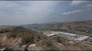
Fun and flowy U-loop. A few fun mini drops if ridden CW. Look for a spur leading to a lookout over the valley between NTM and STM.

Disclaimer

Closed annually Feb 1-July 31 for habitat protection!!

Local Trail Association
Traditionally Indigenous Territory

Recent Activity on Trail

Past Week
  • 0 rides
  •  
6 Months
  • 31 rides
  • 10 miles avg distance
All
  • 390 rides
  • Last: Sep 27, 2025
c1c2c3c4
January
February
March
April
May
June
July
August
September
October
November
December
update trails status or condition

Lava Loop Trail Reports

statusdatedescription
Apr 28, 2026 @ 5:31pm (America/Denver)
Apr 28, 2026
Closed for bird nesting
Dec 14, 2025 @ 10:55am (America/Denver)
Dec 14, 2025
Aug 29, 2025 @ 10:49am
Aug 29, 2025
Some light muddy spots
Aug 13, 2025 @ 3:56pm
Aug 13, 2025
Everything is tamped down after reopening.
May 10, 2025 @ 6:52pm
May 10, 2025
Closed until July 31st for nesting.
more »
Status:
on Apr 28, 2026
Ideal
Avg: 4.32 (3 votes)
Your vote: 0

view (3,222)
close
3D
Trail Conditions
  • Unknown
  • Snow Groomed
  • Snow Packed
  • Snow Covered
  • Snow Cover Partial
  • Freeze/thaw Cycle
  • Icy
  • Prevalent Mud
  • Wet
  • Variable
  • Ideal
  • Dry
  • Very Dry
Trail Flow (Ridden Direction)
Trailforks scans users ridelogs to determine the most popular direction each trail is ridden. A good flowing trail network will have most trails flowing in a single direction according to their intension.
The colour categories are based on what percentage of riders are riding a trail in its intended direction.
  • > 96%
  • > 90%
  • > 80%
  • > 70%
  • > 50%
  • < 50%
  • bi-directional trail
  • no data
Trail Last Ridden
Trailforks scans ridelogs to determine the last time a trail was ridden.
  • < 2 days
  • < 1 week
  • < 2 weeks
  • < 1 month
  • < 6 months
  • > 6 months
Trail Ridden Direction
The intended direction a trail should be ridden.
  • Downhill Only
  • Downhill Primary
  • Both Directions
  • Uphill Primary
  • Uphill Only
  • One Direction
Contribute Details
Colors indicate trail is missing specified detail.
  • Description
  • Photos
  • Description & Photos
  • Videos
Trail Popularity ?
Trailforks scans ridelogs to determine which trails are ridden the most in the last 9 months. Trails are compared with nearby trails in the same city region with a possible 25 colour shades. Think of this as a heatmap, more rides = more kinetic energy = warmer colors.
  • most popular
  • popular
  • less popular
  • not popular
ATV/ORV/OHV Filter
Max Vehicle Width
inches
US Cell Coverage
Legend
cell carrier legend

Radar Time
Activity Recordings
Trailforks uses anonymized public activity data. ?
Activity Recordings
Trailforks uses anonymized public activity data. ?
Personal Heatmap
Activity Types
all / none
Options
2
Date range month
Winter Trails
Warning A routing network for winter maps does not exist. Selecting trails using the winter trails layer has been disabled.
Missing Trails
Most Popular
Least Popular
Trails are colored based on popularity. The more popular a trail is, the more red. Less popular trails trend towards green.
Jump Magnitude Heatmap
Heatmap of where riders jump on trails. Zoom in to see individual jumps, click circles to view jump details.
BC Backroad Status

Service Road Atlas is a free to use, community-driven service for viewing and creating reports on the numerous back-country service roads around B.C. and Alberta.

map legend
Slope Aspect
Direction the slope faces
Flat N NE E SE S SW W NW
Trails Deemphasized
Trails are shown in grey.
disable
Only show trails with no bike usage.
Enable
Suggested Layers
Based on selected activity type

    Save the current map location and zoom level as your default home location whenever this page is loaded.

    Save
        Directions to lava-loop trailhead (39.753630, -105.193870)

        Photos

        No photos have been added for Lava Loop yet, add a photo.

        Videos

        3 more »
        Lava Loop (counterclockwise) - South Table -...
        3:40 | 55 | Sep 5, 2025 , Golden
        Lava Loop - fatty flow at South Table - Golden...
        3:55 | 151 | Aug 27, 2024 , Golden
        DON'T MESS UP! Mountain Biking at South Table...
        9:17 | 360 | Apr 12, 2023 , Golden

        3 Reviews & Comments


        We hope you've been enjoying Trailforks!

        Create a FREE account to view trail comments and much more.

        • By andylegrunge & contributors
        • #319516 - 2,784 views

        Frequently Asked Questions About Lava Loop

        Where is Lava Loop located?
        Lava Loop is located in South Table Mountain Park, Golden, Colorado, United States. It is part of the South Table Mountain Park trail network. The trailhead is located at coordinates 39.75363, -105.19387.
        How hard is Lava Loop?
        Lava Loop is rated as Green difficulty. The average grade is 0.4%.
        What is the elevation gain for Lava Loop?
        Lava Loop has 105 ft of elevation gain. The trail has 145 ft of elevation descent. The elevation ranges from 6,100 ft to 6,222 ft.
        Is Lava Loop a point to point trail?
        Lava Loop is not a point to point trail. The direction is Both Directions. The trail type is singletrack.

        Hit the Trail

        Open in App

        Get this trail on your phone instantly.
        open trail in app

        Download Trail

        Save to wishlist, Garmin & download.
        save the trail

        Find Related Routes

        Find routes and users activities that include this trail.
        find routes for this trail

        You must enter a description before submitting.