

more stats
3,156 ft
Distance
2 ft
Climb
-471 ft
Descent
00:03:46
Avg time
-468 ft
Altitude change
329 ft
Altitude min
800 ft
Altitude max
800 ft
Altitude start
331 ft
Altitude end
-14.8%
Grade
-46.1%
Grade max
4.1%
Grade min
174 ft
Distance climb
2,746 ft
Distance down
233 ft
Distance flat
00:03:46
Avg time

Lobo Details

  • Activities
    • Mountain Bike
  • Riding Area
    San Onofre
    San Clemente, California
  • Difficulty Rating
  • Local Popularity
    50 in Mountain Biking
  • Global Ranking
    #103683 in Mountain Biking
  • State Ranking
    #3,651 in Mountain Biking · California
  • Trail Type
    Singletrack
  • Bike Type
    DH, AM
  • Direction
    Downhill Only
    Popular Direction Shown
  • Physical Rating
    Moderate
  • Season
    Anytime
  • Dogs Allowed
    Yes
  • TTFs on Trail
    Bridge, Drop, Jump, Rock Garden
  • Land Owner
    City of San Clemente

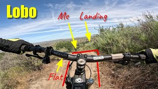
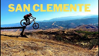
At beginning, going off to the right is full of jumps and at the junction where both of the trails go into one, the right hand side has a 13 ft. drop in to the main trail. Going off to the left hand side involves a 10ft. wood bridge across a 9 ft. sinkhole, but is mostly flat. From the point where the two trails join, there is 100ft long section with technical a rock garden and large step down and jump at bottom. Need speed to carry through the section. Once that part is over, there are several large bumps perfect for pumping for speed then a berm to the right, very small transfer, then berm to the left. After that, it is series of large jumps that you can advoid if perferred and a high speed decline down into a berm. Be careful coming out of the berm, there is 4 weeds taller than a man that have just about the same amount of spikes as a cactus. That is where the trail ends.

Access Info

Rigeline Trail or Service Road

Tags
BermsBridgesDropsJumpsRock gardens
Local Trail Association
Traditionally Indigenous Territory

Recent Activity on Trail

Past Week
  • 0 rides
  •  
6 Months
  • 5 rides
  • 12 miles avg distance
All
  • 78 rides
  • Last: Oct 2, 2026
c1c2c3c4
January
February
March
April
May
June
July
August
September
October
November
December
update trails status or condition

Lobo Trail Reports

statusdatedescription
Jan 18, 2026 @ 7:10pm (America/Los_Angeles)
Jan 18, 2026
Pretty thrashed without the sand pit in the usual spot. Worth at least one rip so you can judge it for yourself.
Jul 1, 2025 @ 4:04pm
Jul 1, 2025
Some wear and tear is showing and it's getting loose in a spot or two
May 18, 2025 @ 7:43am
May 18, 2025
Both sides are good. Thank you for the trail work about a month ago.
Jan 19, 2025 @ 3:16pm
Jan 19, 2025
Great Black trail BUT watch for 1ft deep moon dust after a drop mid-way down.
Dec 8, 2024 @ 7:31am
Dec 8, 2024
It's a bit raw but everything is now
more »
Status:
on Jan 18, 2026
Avg: 3.99 (6 votes)
Your vote: 0

view (1,955)
close
      Directions to lobo trailhead (33.433150, -117.595220)

      Photos

      4 more »
      mtb
      235 |
      Aug 25, 2016 @ 10:21am
      Aug 25, 2016
      mtb
      438 |
      May 12, 2016 @ 11:23am
      May 12, 2016
      mtb
      540 |
      Nov 13, 2015 @ 3:32pm
      Nov 13, 2015
      report
      mtb
      352 |
      Apr 27, 2016 @ 4:45pm
      Apr 27, 2016

      Videos

      10 more »
      youtuber Lobo Trail San Clemente Mountain Biking 2025
      mtb
      9:11 | 157 | May 19, 2025 , San Clemente
      Lobo DH
      mtb
      0:54 | 98 | Dec 1, 2024 , San Clemente
      Lobo - San Clemente MTB | 12/13/2023 | 4k Raw...
      mtb
      0:52 | 180 | Dec 13, 2023 , San Clemente
      youtuber Lobo
      mtb
      12:23 | 227 | Apr 11, 2023 , San Clemente

      Trail Lists

      4.0 ★★★★★
      6 Ratings
      5 ★ 50%
      4 ★ 17%
      3 ★ 17%
      2 ★ 17%
      1 ★

      2 Reviews & Comments

      Gipsea Gipsea
      Right option is open, left is, IMO, the main line. Right option has a mandatory drop right now (may erode back into a roll in over time). Make some noise to avoid a collision...
      jam263
      At the beginning you can go right or left. Right is not an option because the drop back into the main trail is completely washed out, also overgrowth is very bad. Left is the main trail, but bridge is wobbly and trail is eroded and a total mess.

      We hope you've been enjoying Trailforks!

      Create a FREE account to view all trail reviews and much more.

      • By EddMr & contributors
      • #17288 - 4,403 views

      Frequently Asked Questions

      ▼ Where is Lobo located?
      Lobo is located in San Onofre, San Clemente, California, United States. It is part of the San Onofre trail network. The trailhead is located at coordinates 33.43315, -117.59522.
      ▼ How hard is Lobo?
      Lobo is rated as Black Diamond difficulty. The physical rating is Moderate. The average grade is 14.8%.
      ▼ What is the elevation gain for Lobo?
      Lobo has 2 ft of elevation gain. The trail has 471 ft of elevation descent. The elevation ranges from 329 ft to 800 ft.
      ▼ Is Lobo a point to point trail?
      Yes, Lobo is a point to point trail. The direction is Downhill Only. The trail type is singletrack.
      ▼ How long is Lobo?
      Lobo is 3,156 ft long. The trail type is singletrack.
      ▼ Are dogs allowed on Lobo?
      Yes, dogs are allowed on Lobo. Please keep dogs on a leash where required and clean up after them.
      ▼ When is the best time of year to ride Lobo?
      Lobo is best visited during: Anytime.
      ▼ How do I access Lobo? Where is the closest parking trailhead?
      The closest parking and trailhead locations to Lobo are: View all parking locations in the area.
      ▼ How long does it take to ride Lobo?
      Based on recorded activities, it takes an average of 4 minutes to ride Lobo. The trail is 3,156 ft long. Actual times will vary based on fitness level, conditions, and pace. View recent activity logs for more details.
      ▼ How busy is Lobo?
      Lobo is a moderately popular trail. There have been 1,893 recorded activities on this trail. The trail has received 1,955 check-ins. View recent activity on this trail.

      Hit the Trail

      Open in App

      Get this trail on your phone instantly.

      open trail in app

      Download Trail

      Save to wishlist, Garmin & download.
      save the trail

      Find Related Routes

      Find routes and users activities that include this trail.
      find routes for this trail

      You must enter a description before submitting.