

more stats
1,371 ft
Distance
-191 ft
Descent
00:02:27
Avg time
-192 ft
Altitude change
6,441 ft
Altitude min
6,634 ft
Altitude max
6,634 ft
Altitude start
6,440 ft
Altitude end
-14%
Grade
-40.9%
Grade max
-4.2%
Grade min
1,329 ft
Distance down
16 ft
Distance flat
00:02:27
Avg time

Lower Lower Tyrolean Details

  • Activities
    • Mountain Bike
    • Hike
    • Trail Running
  • Riding Area
    East Shore
    Incline Village, Nevada
  • Difficulty Rating
  • Local Popularity
    45 in Mountain Biking [+]
    • 30 in Trail Running
    • 30 in Hiking
  • Global Ranking
    #110459 in Mountain Biking [+]
    • #268400 in Trail Running
    • #121741 in Hiking
  • Trail Type
    Singletrack
  • Dogs Allowed
    Yes

Steep drop in leads to a short section with lots of brush, big rocks, and other random hazards.

Local Trail Association
Traditionally Indigenous Territory

Recent Activity on Trail

Past Week
  • 2 rides
  • 6 miles average
6 Months
  • 7 rides
  • 9 miles avg distance
All
  • 96 rides
  • Last: Sep 10, 2026
update trails status or condition

Lower Lower Tyrolean Trail Reports

statusdatedescription
Oct 8, 2024 @ 10:07am
Oct 8, 2024
Jul 3, 2022 @ 9:46am
Jul 3, 2022
Sep 19, 2021 @ 10:28am
Sep 19, 2021
Power line is still down, but off the trail. Its close though, and could easily be hit
Aug 9, 2020 @ 11:08am
Aug 9, 2020
power line cleared (I didn't see it). Once muddy patch.
May 8, 2020 @ 10:34pm
May 8, 2020
There’s a electrical powerline down across the trail
more »
Status:
on Oct 8, 2024
Dry
Avg: 3.26 (5 votes)
Your vote: 0

view (371)
close
      Directions to lower-lower-tyrolean trailhead (39.250000, -119.930120)

      Photos

      3 more »
      mtb
      124 |
      Jun 5, 2020 @ 6:22am
      Jun 5, 2020
      mtb
      113 |
      Jun 5, 2020 @ 6:22am
      Jun 5, 2020
      report
      mtb
      175 |
      May 8, 2020 @ 10:34pm
      May 8, 2020

      Videos

      2 more »
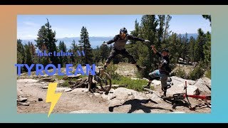
      TYROLEAN TRAIL\ LAKE TAHOE, NV \ BLACK DIAMOND...
      mtb
      18:12 | 470 | Aug 25, 2021 , Incline Village

      Routes with this trail

      4.0 11 miles 692 ft 4 Shuttled
      This ride makes the shuttle up ride longer before getting to Tyrolean DH, I added Third Creek Trail
      22 miles 1,483 ft 4
      Flume detour 2025. Flume detour 2025
      26 miles 2,675 ft 6
      Awesome Flume Trail and all its beauty with a little fun at the end.
      2.4
      5 Ratings
      5 20%
      4
      3 20%
      2 20%
      1 40%

      3 Reviews & Comments

      Cmoberg Cmoberg
      this trail is totally not worth it. The drop in is insanely loose with a bad runout. It gets worse from there with microwave to dishwasher sized boulders that are not ridable (at least by any mere mortal).
      fseminario fseminario
      Do not even attempt to ride this last lower section. It overgrown and full of small boulders that you cant ride you bike through.
      mudshoe
      Sandy and borderline dangerous! Not worth it

      We hope you've been enjoying Trailforks!

      Create a FREE account to view all trail reviews and much more.

      • By WillieBTF Pro & contributors
      • #222373 - 1,191 views

      Frequently Asked Questions

      Where is Lower Lower Tyrolean located?
      Lower Lower Tyrolean is located in East Shore, Incline Village, Nevada, United States. It is part of the East Shore trail network. The trailhead is located at coordinates 39.25, -119.93012.
      How hard is Lower Lower Tyrolean?
      Lower Lower Tyrolean is rated as Black Diamond difficulty. The average grade is 14%.
      What is the elevation gain for Lower Lower Tyrolean?
      The trail has 191 ft of elevation descent. The elevation ranges from 6,441 ft to 6,634 ft.
      How long is Lower Lower Tyrolean?
      Lower Lower Tyrolean is 1,371 ft long. The trail type is singletrack.
      Are dogs allowed on Lower Lower Tyrolean?
      Yes, dogs are allowed on Lower Lower Tyrolean. Please keep dogs on a leash where required and clean up after them.
      How do I access Lower Lower Tyrolean? Where is the closest parking trailhead?
      The closest parking and trailhead locations to Lower Lower Tyrolean are: View all parking locations in the area.
      How long does it take to ride Lower Lower Tyrolean?
      Based on recorded activities, it takes an average of 3 minutes to ride Lower Lower Tyrolean. The trail is 1,371 ft long. Actual times will vary based on fitness level, conditions, and pace. View recent activity logs for more details.
      How busy is Lower Lower Tyrolean?
      Lower Lower Tyrolean is a moderately popular trail. There have been 376 recorded activities on this trail. The trail has received 371 check-ins. View recent activity on this trail.

      Hit the Trail

      Open in App

      Get this trail on your phone instantly.

      open trail in app

      Download Trail

      Save to wishlist, Garmin & download.
      save the trail

      Find Related Routes

      Find routes and users activities that include this trail.
      find routes for this trail

      You must enter a description before submitting.