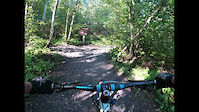
more stats
1.0 mile
Distance
-1,680 ft
Descent
00:23:02
Avg time
-1,680 ft
Altitude change
1,071 ft
Altitude min
2,752 ft
Altitude max
2,752 ft
Altitude start
1,073 ft
Altitude end
-31.2%
Grade
-100.4%
Grade max
1.5%
Grade min
23 ft
Distance climb
1 mile
Distance down
56 ft
Distance flat
00:23:02
Avg time

MAGIC Details

  • Activities
    • Mountain Bike
    • Hike
    • Trail Running
  • Riding Area
    Chilliwack Community Forest
    Chilliwack, British Columbia
  • Difficulty Rating
  • Local Popularity
    65 in Mountain Biking [+]
    • 55 in Trail Running
    • 65 in Hiking
  • Global Ranking
    #65184 in Mountain Biking [+]
    • #138173 in Trail Running
    • #138355 in Hiking
  • Provincial Ranking
    #3,169 in Mountain Biking · British Columbia [+]
    • #7,977 in Trail Running
    • #7,901 in Hiking
  • Trail Type
    Singletrack
  • Bike Type
    DH, AM
  • Direction
    Downhill Primary
    Popular Direction Shown
  • Physical Rating
    Hard
  • Dogs Allowed
    Yes

Magic is a loamy A to B downhill trail that is also gaining in popularity with trail runners (often coming up). Linking the upper half of Gloria with Thaletel it provides the crucial connection for a full mountain descent. Control your speed, keep your head up. It's steep.

Tags
Loamy

Local Trail Association

Traditionally Indigenous Territory

Recent Activity on Trail

Past Week
  • 0 rides
  •  
6 Months
  • 2 rides
  • 5 miles avg distance
All
  • 26 rides
  • Last: Sep 21, 2026
c1c2c3c4
January
February
March
April
May
June
July
August
September
October
November
December
update trails status or condition

MAGIC Trail Reports

statusdatedescription
Jun 25, 2026 @ 12:10pm (America/Vancouver)
Jun 25, 2026
There's now a (tight) ride-around the ripped up roots of the downed tree. All clear and flowing nice
Apr 26, 2026 @ 11:01am (America/Vancouver)
Apr 26, 2026
couple big trees down with roots ripped right up in the middle of the trail
Nov 9, 2025 @ 12:59pm (America/Vancouver)
Nov 9, 2025
Tree down. Otherwise sweet!
Sep 1, 2025 @ 5:42pm
Sep 1, 2025
reporter Rode from the Cougar Alley intersection down. Very dry, lots of fun, my brakes hate me.
Apr 29, 2025 @ 12:32pm
Apr 29, 2025
Cleared the tree at the top. Running well.
more »
Status:
on Jun 25, 2026
Dry
Avg: 4.35 (6 votes)
Your vote: 0

view (163)
close
      Directions to magic-281133 trailhead (49.139300, -121.783490)

      Photos

      11 more »
      mtb
      160 |
      Jul 15, 2021 @ 8:33am
      Jul 15, 2021
      mtb
      239 |
      Nov 13, 2020 @ 2:08pm
      Nov 13, 2020
      mtb
      223 |
      Nov 13, 2020 @ 2:07pm
      Nov 13, 2020
      report
      mtb
      82 |
      Nov 9, 2025 @ 12:59pm
      Nov 9, 2025

      Videos

      3 more »
      Magic is fun Sept 3, 2021
      mtb
      14:12 | 508 | Oct 10, 2021 , Chilliwack
      Magic! *sparkles*
      mtb
      23:37 | 608 | Sep 4, 2020 , Chilliwack
      Magic at Chilliwack Communty Forest
      mtb
      6:22 | 220 | May 23, 2022 , Chilliwack
      4.9 ★★★★★
      6 Ratings
      5 ★ 83%
      4 ★ 17%
      3 ★
      2 ★
      1 ★

      5 Reviews & Comments

      Wesmacaulay Wesmacaulay
      Gorgeous trail: the pics don’t do it justice. Built on some pretty wild grades, this trail traverses a lot before following the fall line lower down. The push up is often a carry as Gloria can get so steep and rough that you can’t push a bike on it. The grades on Gloria are perilous if you fall with your bike
      bessie
      Dope trail, just don’t hit when wet. If you do go when it’s wet do not hit the wooden features. They have no mesh grading on them. I learned the hard way as my tire slipped out on one of them and I flew off it.
      gasman5
      Really fun trail. Sustained steep loamer. Nothing crazy that will catch you unawares. The hike-a-bike is serious! Around 1 hour (with a few breaks) and >300m climbing.

      We hope you've been enjoying Trailforks!

      Create a FREE account to view all trail reviews and much more.

      • By marcgreyTF Pro & contributors
      • #281133 - 4,022 views

      Frequently Asked Questions

      ▼ Where is MAGIC located?
      MAGIC is located in Chilliwack Community Forest, Chilliwack, British Columbia, Canada. It is part of the Chilliwack Community Forest trail network. The trailhead is located at coordinates 49.1393, -121.78349.
      ▼ How hard is MAGIC?
      MAGIC is rated as Black Diamond difficulty. The physical rating is Hard. The average grade is 31.2%.
      ▼ What is the elevation gain for MAGIC?
      The trail has 1,680 ft of elevation descent. The elevation ranges from 1,071 ft to 2,752 ft.
      ▼ Is MAGIC a point to point trail?
      MAGIC is not a point to point trail. The direction is Downhill Primary. The trail type is singletrack.
      ▼ How long is MAGIC?
      MAGIC is 1.0 mile long. The trail type is singletrack.
      ▼ Are dogs allowed on MAGIC?
      Yes, dogs are allowed on MAGIC. Please keep dogs on a leash where required and clean up after them.
      ▼ When is the best time of year to ride MAGIC?
      Based on activity log data, the most popular months to ride MAGIC are:
      • April (3 activities)
      • January (2 activities)
      • June (2 activities)
      Check the reports page for current trail conditions.
      ▼ How do I access MAGIC? Where is the closest parking trailhead?
      The closest parking and trailhead locations to MAGIC are: View all parking locations in the area.
      ▼ How long does it take to ride MAGIC?
      Based on recorded activities, it takes an average of 23 minutes to ride MAGIC. The trail is 1.0 mile long. Actual times will vary based on fitness level, conditions, and pace. View recent activity logs for more details.
      ▼ How busy is MAGIC?
      MAGIC is a moderately popular trail. There have been 161 recorded activities on this trail. The trail has received 163 check-ins. View recent activity on this trail.

      Hit the Trail

      Open in App

      Get this trail on your phone instantly.

      open trail in app

      Download Trail

      Save to wishlist, Garmin & download.
      save the trail

      Find Related Routes

      Find routes and users activities that include this trail.
      find routes for this trail

      You must enter a description before submitting.