more stats
2,533 ft
Distance
43 ft
Climb
-147 ft
Descent
00:05:46
Avg time
-106 ft
Altitude change
643 ft
Altitude min
749 ft
Altitude max
749 ft
Altitude start
643 ft
Altitude end
-4.2%
Grade
-36.7%
Grade max
27.4%
Grade min
354 ft
Distance climb
1,565 ft
Distance down
610 ft
Distance flat
00:05:46
Avg time

Manu Details

  • Activities
    • Mountain Bike
    • E-Bike
  • Riding Area
    Ranui Farm Park
    Flemington
  • Difficulty Rating
  • Local Popularity
    5 in Mountain Biking [+]
    • 5 in E-Biking
  • Global Ranking
    #83506 in Mountain Biking [+]
    • #117770 in E-Biking
  • Trail Type
    Machine Groomed
  • Bike Type
    AM, XC
  • Direction
    Downhill Only
    Popular Direction Shown
  • Climb Difficulty
    Green
  • Physical Rating
    Moderate
  • Trail Visibility
    Always easy to follow
  • Family Friendly
    Yes
  • eBike Allowed

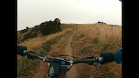
Manu is a fast-flowing track following the gully down to the bottom trailhead. Manu is family-friendly and all features are easily rollable. One of the longest tracks at Ranui Bike Park and machine built by Southstar Trails this track is great for a warm-up before the harder tracks on the farm.

Access Info

From the car park follow the main access trail to the gate at the top of the kanuka block. Follow the top track along until you reach the top of the Tu Meke uphill trail. The start of the track is signposted.

Recent Activity on Trail

Past Week
  • 0 rides
  •  
6 Months
  • 0 rides
  •  
All
  • 0 rides
  • Last: Mar 2, 2024
c1c2c3c4
January
February
March
April
May
June
July
August
September
October
November
December
update trails status or condition

Manu Trail Reports

statusdatedescription
Feb 6, 2022 @ 11:21pm
Feb 6, 2022
more »
Status:
on Feb 6, 2022
Variable
Avg: 3.84 (1 votes)
Your vote: 0

view (39)
close
3D
Trail Conditions
  • Unknown
  • Snow Groomed
  • Snow Packed
  • Snow Covered
  • Snow Cover Partial
  • Freeze/thaw Cycle
  • Icy
  • Prevalent Mud
  • Wet
  • Variable
  • Ideal
  • Dry
  • Very Dry
Trail Flow (Ridden Direction)
Trailforks scans users ridelogs to determine the most popular direction each trail is ridden. A good flowing trail network will have most trails flowing in a single direction according to their intension.
The colour categories are based on what percentage of riders are riding a trail in its intended direction.
  • > 96%
  • > 90%
  • > 80%
  • > 70%
  • > 50%
  • < 50%
  • bi-directional trail
  • no data
Trail Last Ridden
Trailforks scans ridelogs to determine the last time a trail was ridden.
  • < 2 days
  • < 1 week
  • < 2 weeks
  • < 1 month
  • < 6 months
  • > 6 months
Trail Ridden Direction
The intended direction a trail should be ridden.
  • Downhill Only
  • Downhill Primary
  • Both Directions
  • Uphill Primary
  • Uphill Only
  • One Direction
Contribute Details
Colors indicate trail is missing specified detail.
  • Description
  • Photos
  • Description & Photos
  • Videos
Trail Popularity ?
Trailforks scans ridelogs to determine which trails are ridden the most in the last 9 months. Trails are compared with nearby trails in the same city region with a possible 25 colour shades. Think of this as a heatmap, more rides = more kinetic energy = warmer colors.
  • most popular
  • popular
  • less popular
  • not popular
ATV/ORV/OHV Filter
Max Vehicle Width
inches
US Cell Coverage
Legend
cell carrier legend

Radar Time
Activity Recordings
Trailforks uses anonymized public activity data. ?
Activity Recordings
Trailforks uses anonymized public activity data. ?
Personal Heatmap
Activity Types
all / none
Options
2
Date range month
Winter Trails
Warning A routing network for winter maps does not exist. Selecting trails using the winter trails layer has been disabled.
Missing Trails
Most Popular
Least Popular
Trails are colored based on popularity. The more popular a trail is, the more red. Less popular trails trend towards green.
Jump Magnitude Heatmap
Heatmap of where riders jump on trails. Zoom in to see individual jumps, click circles to view jump details.
BC Backroad Status

Service Road Atlas is a free to use, community-driven service for viewing and creating reports on the numerous back-country service roads around B.C. and Alberta.

map legend
Slope Aspect
Direction the slope faces
Flat N NE E SE S SW W NW
Trails Deemphasized
Trails are shown in grey.
disable
Only show trails with no bike usage.
Enable
Suggested Layers
Based on selected activity type

    Save the current map location and zoom level as your default home location whenever this page is loaded.

    Save
        Directions to manu trailhead (-40.118660, 176.464390)

        Photos

        No photos have been added for Manu yet, add a photo.

        Videos

        1 more »
        Manu
        2:21 | 30 | Feb 6, 2022 , Flemington

        1 Review & Comments


        We hope you've been enjoying Trailforks!

        Create a FREE account to view trail comments and much more.

        Nearby Trails

        • By BobbytheBiker27 & contributors
        • #495563 - 427 views

        Frequently Asked Questions About Manu

        Where is Manu located?
        Manu is located in Ranui Farm Park, Flemington, New Zealand. It is part of the Ranui Farm Park trail network. The trailhead is located at coordinates -40.11866, 176.46439.
        How hard is Manu?
        Manu is rated as Blue difficulty. The physical rating is Moderate. The average grade is 4.2%. The climb difficulty is rated Green.
        What is the elevation gain for Manu?
        Manu has 43 ft of elevation gain. The trail has 147 ft of elevation descent. The elevation ranges from 643 ft to 749 ft.
        Is Manu a point to point trail?
        Yes, Manu is a point to point trail. The direction is Downhill Only. The trail type is machine groomed.

        Hit the Trail

        Open in App

        Get this trail on your phone instantly.
        open trail in app

        Download Trail

        Save to wishlist, Garmin & download.
        save the trail

        Find Related Routes

        Find routes and users activities that include this trail.
        find routes for this trail

        You must enter a description before submitting.