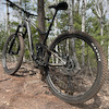
more stats
1.1 miles
Distance
115 ft
Climb
-114 ft
Descent
00:09:26
Avg time
2 ft
Altitude change
1,268 ft
Altitude min
1,331 ft
Altitude max
1,268 ft
Altitude start
1,270 ft
Altitude end
-19%
Grade max
20.1%
Grade min
1,568 ft
Distance climb
1,519 ft
Distance down
2,743 ft
Distance flat
00:09:26
Avg time

Manuel Drive Details

  • Activities
    • Mountain Bike
    • E-Bike
    • Winter Fat Bike
    • Hike
    • Trail Running
  • Riding Area
    Cuyuna Lakes - Yawkey Unit
    Crosby-Ironton, Minnesota
  • Difficulty Rating
  • Local Popularity
    85 in Mountain Biking [+]
    • 90 in E-Biking
    • 60 in Trail Running
    • 85 in Hiking
    • 95 in Winter Fat Biking
  • Global Ranking
    #33951 in Mountain Biking [+]
    • #17441 in E-Biking
    • #138903 in Trail Running
    • #128691 in Hiking
    • #431 in Winter Fat Biking
  • State Ranking
    #177 in Mountain Biking · Minnesota [+]
    • #66 in E-Biking
    • #1,149 in Trail Running
    • #1,343 in Hiking
    • #13 in Winter Fat Biking
  • Trail Type
    Singletrack
  • Bike Type
    AM, XC, Fat
  • Climb Difficulty
    Blue
  • Physical Rating
    Moderate
  • Trail Visibility
    Always easy to follow
  • eBike Allowed
    Yes up to Class 1
  • Land Owner

Fun. There's no other easy way to describe this trail other than that. It's just plain fun. The climb is mellow and fast, and the downhill is just plain fun. Like a roller coaster ribbon of dirt on the Iron Range landscape, it can't get much better than this. And with it's short length it's easy to do multiple laps until you rail that berm and pop that lip just right.

This trail is on the native lands of the Anishinabewaki, Bdewakantuwan and Ochethi Sakowin peoples.

Access Info

From Man Cage

Tags
Berms

Local Trail Association

Recent Activity on Trail

Past Week
  • 1 rides
  • 6 miles average
6 Months
  • 350 rides
  • 14 miles avg distance
All
  • 1,749 rides
  • Last: Nov 1, 2026
c1c2c3c4
January
February
March
April
May
June
July
August
September
October
November
December
update trails status or condition

Manuel Drive Trail Reports

Status:
on Nov 5, 2026
Freeze/thaw Cycle
Avg: 4.43 (11 votes)
Your vote: 0

view (11,040)
close
      Directions to manuel-drive trailhead (46.499260, -93.943180)

      Photos

      7 more »
      mtb
      126 |
      May 8, 2022 @ 9:39pm
      May 8, 2022
      mtb
      95 |
      May 8, 2022 @ 9:39pm
      May 8, 2022
      mtb
      174 |
      Oct 10, 2020 @ 11:37pm
      Oct 10, 2020
      mtb
      162 |
      Jul 14, 2019 @ 11:42am
      Jul 14, 2019

      Videos

      2 more »
      youtuber MTB Riding Manuel Drive | Cuyuna State Park...
      mtb
      10:09 | 248 | Jan 8, 2023 , Crosby-Ironton
      Manuel Drive Trail, Cuyuna, MN
      mtb
      7:53 | 274 | Aug 12, 2022 , Crosby-Ironton

      Trail Lists

      Routes with this trail

      ★ 5.0 • 102 miles • 5,825 ft • 97 • Loop •
      100+ mile MTB trail loop that could be sagged from Yawkey Trail Head
      28 miles • 2,126 ft • 30 • Loop •
      This is my favorite route to get out and enjoy what Cuyuna has to offer. Sometimes I'll bring some coffee...
      ★ 2.4 • 29 miles • 2,019 ft • 33 • Loop •
      This 20+ mile mountain biking loop takes you throughout the entire Cuyuna Lakes Mountain Bike Trail...
      4.8 ★★★★★
      11 Ratings
      5 ★ 73%
      4 ★ 27%
      3 ★
      2 ★
      1 ★

      3 Reviews & Comments

      BikingBoarderCollie BikingBoarderCollie
      Honestly lacking in features. Some nice berms though. It’s quite a rough hike up there though!
      420mtb69
      A fast, fun loop with some nice berms and tabletops at the end.
      Northsupply Northsupply
      This trail is just plain fun. In fact, if I had a carbon copy of this trail in my backyard I don’t think I would ever leave the house!

      We hope you've been enjoying Trailforks!

      Create a FREE account to view all trail reviews and much more.

      Frequently Asked Questions

      ▼ Where is Manuel Drive located?
      Manuel Drive is located in Cuyuna Lakes - Yawkey Unit, Crosby-Ironton, Minnesota, United States. It is part of the Cuyuna Lakes - Yawkey Unit trail network. The trailhead is located at coordinates 46.49926, -93.94318.
      ▼ How hard is Manuel Drive?
      Manuel Drive is rated as Blue difficulty. The physical rating is Moderate. The climb difficulty is rated Blue.
      ▼ What is the elevation gain for Manuel Drive?
      Manuel Drive has 115 ft of elevation gain. The trail has 114 ft of elevation descent. The elevation ranges from 1,268 ft to 1,331 ft.
      ▼ How long is Manuel Drive?
      Manuel Drive is 1.1 miles long. The trail type is singletrack.
      ▼ Are dogs allowed on Manuel Drive?
      There is no information about dogs being allowed on Manuel Drive. Check with local trail managers or the trail page for the latest access rules.
      ▼ When is the best time of year to ride Manuel Drive?
      Based on activity log data, the most popular months to ride Manuel Drive are:
      • August (203 activities)
      • June (170 activities)
      • July (154 activities)
      Check the reports page for current trail conditions.
      ▼ How do I access Manuel Drive? Where is the closest parking trailhead?
      The closest parking and trailhead locations to Manuel Drive are: View all parking locations in the area.
      ▼ How long does it take to ride Manuel Drive?
      Based on recorded activities, it takes an average of 9 minutes to ride Manuel Drive. The trail is 1.1 miles long. Actual times will vary based on fitness level, conditions, and pace. View recent activity logs for more details.
      ▼ How busy is Manuel Drive?
      Manuel Drive is a very popular trail. There have been 9,063 recorded activities on this trail. The trail has received 11,040 check-ins. View recent activity on this trail.

      Hit the Trail

      Open in App

      Get this trail on your phone instantly.

      open trail in app

      Download Trail

      Save to wishlist, Garmin & download.
      save the trail

      Find Related Routes

      Find routes and users activities that include this trail.
      find routes for this trail

      You must enter a description before submitting.