more stats
1.2 miles
Distance
563 ft
Climb
-365 ft
Descent
00:24:18
Avg time
198 ft
Altitude change
7,686 ft
Altitude min
7,902 ft
Altitude max
7,689 ft
Altitude start
7,887 ft
Altitude end
3.028%
Grade
-36.52%
Grade max
33.595%
Grade min
3,839 ft
Distance climb
2,330 ft
Distance down
375 ft
Distance flat
00:24:18
Avg time

McKay Details

  • Activities
    • Mountain Bike
    • E-Bike
    • Hike
    • Trail Running
  • Riding Area
    Panorama Mountain Resort
    Panorama, British Columbia
  • Difficulty Rating
  • Local Popularity
    35 in Mountain Biking [+]
    • 65 in E-Biking
    • 55 in Trail Running
    • 50 in Hiking
  • Global Ranking
    #120184 in Mountain Biking [+]
    • #45864 in E-Biking
    • #124849 in Trail Running
    • #106280 in Hiking
  • Hiking SAC Scale
    T1 Hiking
  • Trail Type
    Singletrack
  • Bike Type
    AM, XC
  • Direction
    Downhill Primary
    Popular Direction Shown
  • Climb Difficulty
    Black Diamond
  • Physical Rating
    Hard
  • Season
    July-Sept
  • Dogs Allowed
    Yes
  • eBike Allowed
    Yes up to Class 1
  • Land Owner

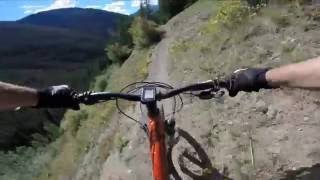
Multi-Use singletrack from the end of Outback Ridge, past Goldie Lake to the col and old McKay Cabins. Not part of the main Bike Park. Remote, backcountry location. Be prepared to be self sufficient.

Access Info

Upon arrival at the pass and old cabins (McKay Cabins): Right turn (north) for the Hopeful trail back to the Panorama Bike Park. The left hand option (south) for the Brewer Creek drainage. This trail eventually (4.2km from the McKay cabins) intersects with a BC Rec Sites and Trails designated trail (RSTBC - the BC Government body that is trusted by the public to manage lands responsibly). This this trail is non-mechanized use only (aka - no mountain bikes). Please be aware of this. Link for trail information: https://bit.ly/2JARbK0

Bike Park

Recent Activity on Trail

Past Week
  • 0 rides
  •  
6 Months
  • 0 rides
  •  
All
  • 26 rides
  • Last: Oct 5, 2025
c1c2c3c4
January
February
March
April
May
June
July
August
September
October
November
December
update trails status or condition

McKay Trail Reports

statusdatedescription
May 20, 2026 @ 11:53am (America/Edmonton)
May 20, 2026
reporter
Sep 19, 2025 @ 9:03am (America/Creston)
Sep 19, 2025
Jun 20, 2025 @ 9:46am
Jun 20, 2025
Apr 30, 2025 @ 6:31am
Apr 30, 2025
Aug 25, 2024 @ 11:22am
Aug 25, 2024
Reports of significant number of trees down after major storm. Use caution. Please report specific locations using Trailforks.
more »
Status:
on May 20, 2026
Avg: 3.86 (2 votes)
Your vote: 0

view (265)
close
3D
Trail Conditions
  • Unknown
  • Snow Groomed
  • Snow Packed
  • Snow Covered
  • Snow Cover Partial
  • Freeze/thaw Cycle
  • Icy
  • Prevalent Mud
  • Wet
  • Variable
  • Ideal
  • Dry
  • Very Dry
Trail Flow (Ridden Direction)
Trailforks scans users ridelogs to determine the most popular direction each trail is ridden. A good flowing trail network will have most trails flowing in a single direction according to their intension.
The colour categories are based on what percentage of riders are riding a trail in its intended direction.
  • > 96%
  • > 90%
  • > 80%
  • > 70%
  • > 50%
  • < 50%
  • bi-directional trail
  • no data
Trail Last Ridden
Trailforks scans ridelogs to determine the last time a trail was ridden.
  • < 2 days
  • < 1 week
  • < 2 weeks
  • < 1 month
  • < 6 months
  • > 6 months
Trail Ridden Direction
The intended direction a trail should be ridden.
  • Downhill Only
  • Downhill Primary
  • Both Directions
  • Uphill Primary
  • Uphill Only
  • One Direction
Contribute Details
Colors indicate trail is missing specified detail.
  • Description
  • Photos
  • Description & Photos
  • Videos
Trail Popularity ?
Trailforks scans ridelogs to determine which trails are ridden the most in the last 9 months. Trails are compared with nearby trails in the same city region with a possible 25 colour shades. Think of this as a heatmap, more rides = more kinetic energy = warmer colors.
  • most popular
  • popular
  • less popular
  • not popular
ATV/ORV/OHV Filter
Max Vehicle Width
inches
US Cell Coverage
Legend
cell carrier legend

Radar Time
Activity Recordings
Trailforks uses anonymized public activity data. ?
Activity Recordings
Trailforks uses anonymized public activity data. ?
Personal Heatmap
Activity Types
all / none
Options
2
Date range month
Winter Trails
Warning A routing network for winter maps does not exist. Selecting trails using the winter trails layer has been disabled.
Missing Trails
Most Popular
Least Popular
Trails are colored based on popularity. The more popular a trail is, the more red. Less popular trails trend towards green.
Jump Magnitude Heatmap
Heatmap of where riders jump on trails. Zoom in to see individual jumps, click circles to view jump details.
BC Backroad Status

Service Road Atlas is a free to use, community-driven service for viewing and creating reports on the numerous back-country service roads around B.C. and Alberta.

map legend
Slope Aspect
Direction the slope faces
Flat N NE E SE S SW W NW
Trails Deemphasized
Trails are shown in grey.
disable
Only show trails with no bike usage.
Enable
Suggested Layers
Based on selected activity type

    Save the current map location and zoom level as your default home location whenever this page is loaded.

    Save
        Directions to mckay trailhead (50.426790, -116.188300)

        Photos

        10 more »
        34 |
        Oct 31, 2025 @ 12:51pm
        Oct 31, 2025
        191 |
        Aug 29, 2016 @ 10:33am
        Aug 29, 2016
        275 |
        Jun 23, 2016 @ 6:50am
        Jun 23, 2016
        239 |
        Jun 13, 2016 @ 6:47am
        Jun 13, 2016

        Videos

        1 more »
        Alpine BC | Epic Views | Hopeful Trail |...
        604 | Aug 30, 2016 , Panorama

        Routes with this trail

        2.2 14 miles 3,647 ft 10 Loop
        Use the Mile One Express lift to take a bite out of the significant climb to Panorama's summit ridge. From...
        15 miles 3,864 ft 9 Loop
        THE JACK PINE CHALLENGE...A beer worthy way to spend a day! The Challenge: New for Summer 2022, The Jack...
        1.0 15 miles 4,653 ft 18 Loop
        A good long climb from Panorama's main village up the summer service road (expect maintenance and rescue...

        Reviews / Comments

        No reviews yet, be the first to write a review or ask a question.
        Use trail reports to comment on trail conditions.


        We hope you've been enjoying Trailforks!

        Create a FREE account to view trail comments and much more.

        • By racerfacerTF Pro & contributors
        • #32897 - 3,843 views

        Frequently Asked Questions About McKay

        Where is McKay located?
        McKay is located in Panorama Mountain Resort, Panorama, British Columbia, Canada. It is part of the Panorama Mountain Resort trail network. The trailhead is located at coordinates 50.42679, -116.1883.
        How hard is McKay?
        McKay is rated as Black Diamond difficulty. The physical rating is Hard. The average grade is 3.028%. The climb difficulty is rated Black Diamond.
        What is the elevation gain for McKay?
        McKay has 563 ft of elevation gain. The trail has 365 ft of elevation descent. The elevation ranges from 7,686 ft to 7,902 ft.
        Is McKay a point to point trail?
        McKay is not a point to point trail. The direction is Downhill Primary. The trail type is singletrack.

        Hit the Trail

        Open in App

        Get this trail on your phone instantly.
        open trail in app

        Download Trail

        Save to wishlist, Garmin & download.
        save the trail

        Find Related Routes

        Find routes and users activities that include this trail.
        find routes for this trail

        You must enter a description before submitting.