

more stats
5,115 ft
Distance
30 ft
Climb
-357 ft
Descent
00:16:58
Avg time
-327 ft
Altitude change
698 ft
Altitude min
1,057 ft
Altitude max
1,026 ft
Altitude start
699 ft
Altitude end
-6.4%
Grade
-49.9%
Grade max
9.9%
Grade min
633 ft
Distance climb
3,763 ft
Distance down
335 ft
Distance flat
00:16:58
Avg time

Megalithic Details

  • Activities
    • Mountain Bike
    • E-Bike
    • Hike
    • Trail Running
  • Riding Area
    Finale Outdoor Region
    Finale Ligure
  • Ref Number
    #57
  • Difficulty Rating
  • Voted Difficulty
    Proline (2 votes)
  • Local Popularity
    40 in Mountain Biking [+]
    • 40 in E-Biking
    • 65 in Trail Running
    • 70 in Hiking
  • Global Ranking
    #74344 in Mountain Biking [+]
    • #62461 in E-Biking
    • #128809 in Trail Running
    • #136165 in Hiking
  • National Ranking
    #6,198 in Mountain Biking · Italy [+]
    • #7,508 in E-Biking
    • #4,151 in Trail Running
    • #4,456 in Hiking
  • Hiking SAC Scale
    T2 Mountain Hiking
  • Trail Type
    Singletrack
  • Bike Type
    DH, AM, XC
  • Direction
    Downhill Only
    Popular Direction Shown
  • Climb Difficulty
    Green
  • Physical Rating
    Moderate
  • Trail Visibility
    Sometimes hard to follow
  • Season
    All-year round
  • Dogs Allowed
    Yes
  • eBike Allowed
    Yes up to Class 1
  • TTFs on Trail
    Rock Face
  • Land Owner
    Finale Outdoor Region

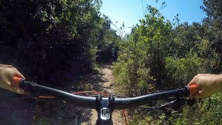
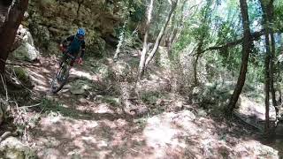
More technical alternative to La Ruggetta.
It features plenty of natural steep and bouldery lines.

Many tight rocky switchbacks for a physical experience, perfect for a pretty skilled rider that enjoys trialistic sections in a unique-dense forest environment.

source: ...
Access Info

San Bernardino Area is reachable from the E80 highway accessing Finale Ligure, drive towards the sea cross the bridge on Via XXV Aprile.

Disclaimer

Tree in the middle of the trail at around 800m from the start Given its nature, the trail can change after weather happenings and season changes. Always pay attention.

Tags
BridgesFaint trailRock slabs

Trail Supporters

Local Trail Association

Recent Activity on Trail

Past Week
  • 2 rides
  • 22 miles average
6 Months
  • 17 rides
  • 13 miles avg distance
All
  • 156 rides
  • Last: Oct 28, 2026
c1c2c3c4
January
February
March
April
May
June
July
August
September
October
November
December
update trails status or condition

Megalithic Trail Reports

Status:
on Jan 2, 2026
Ideal
Avg: 4.22 (26 votes)
Your vote: 0

view (927)
close
      Directions to megalithic trailhead (44.198130, 8.338050)

      Photos

      9 more »
      mtb
      386 |
      Dec 9, 2017 @ 2:21pm
      Dec 9, 2017
      mtb
      320 |
      Nov 15, 2017 @ 1:42pm
      Nov 15, 2017
      mtb
      295 |
      Nov 15, 2017 @ 1:42pm
      Nov 15, 2017
      mtb
      350 |
      Nov 15, 2017 @ 1:42pm
      Nov 15, 2017

      Videos

      4 more »
      La Ruggetta Trail - Finale Ligure, Italia...
      mtb
      8:24 | 1361 | Feb 10, 2020 , Finale Ligure
      La Rugetta trail samples
      mtb
      0:00 | 763 | May 12, 2019 , Finale Ligure
      youtuber Finale Ligure - La Ruggetta POV
      mtb
      1854 | Jan 2, 2018 , Finale Ligure
      Finale Ligure - Camporotondo 2017 (Ruggetta)
      mtb
      1132 | Jul 12, 2017 , Finale Ligure
      4.3 ★★★★★
      26 Ratings
      5 ★ 50%
      4 ★ 27%
      3 ★ 23%
      2 ★
      1 ★

      7 Reviews & Comments

      crisotop crisotop
      Top section sort of boring (fast / straight). Gets more interesting lower down. Nice finale „coast rocky tech flow“, couple of tight steep switchbacks. Similar, but a bit slower than the two trails to the west side of the cuco hill
      Manuel-DA
      Old pathway for pedestrians. Definitely need some good skilled rider to take all switchbacks.
      robertellisw robertellisw
      Made a wrong turn onto this trail and should have turned around. I like tech, but not like this. Hard pass for future rides.

      We hope you've been enjoying Trailforks!

      Create a FREE account to view all trail reviews and much more.

      • By finaleoutdoorregion FOR & contributors
      • #79607 - 6,623 views

      Frequently Asked Questions

      ▼ Where is Megalithic located?
      Megalithic is located in Finale Outdoor Region, Finale Ligure, Italy. It is part of the Finale Outdoor Region trail network. The trailhead is located at coordinates 44.19813, 8.33805.
      ▼ How hard is Megalithic?
      Megalithic is rated as Black difficulty. The physical rating is Moderate. The average grade is 6.4%. The climb difficulty is rated Green.
      ▼ What is the elevation gain for Megalithic?
      Megalithic has 30 ft of elevation gain. The trail has 357 ft of elevation descent. The elevation ranges from 698 ft to 1,057 ft.
      ▼ Is Megalithic a point to point trail?
      Yes, Megalithic is a point to point trail. The direction is Downhill Only. The trail type is singletrack.
      ▼ How long is Megalithic?
      Megalithic is 5,115 ft long. The trail type is singletrack.
      ▼ Are dogs allowed on Megalithic?
      Yes, dogs are allowed on Megalithic. Please keep dogs on a leash where required and clean up after them.
      ▼ When is the best time of year to ride Megalithic?
      Based on activity log data, the most popular months to ride Megalithic are:
      • October (14 activities)
      • April (13 activities)
      • May (13 activities)
      Check the reports page for current trail conditions.
      ▼ How do I access Megalithic? Where is the closest parking trailhead?
      The closest parking and trailhead locations to Megalithic are: View all parking locations in the area.
      ▼ How long does it take to ride Megalithic?
      Based on recorded activities, it takes an average of 17 minutes to ride Megalithic. The trail is 5,115 ft long. Actual times will vary based on fitness level, conditions, and pace. View recent activity logs for more details.
      ▼ How busy is Megalithic?
      Megalithic is a moderately popular trail. There have been 978 recorded activities on this trail. The trail has received 927 check-ins. View recent activity on this trail.

      Hit the Trail

      Open in App

      Get this trail on your phone instantly.

      open trail in app

      Download Trail

      Save to wishlist, Garmin & download.
      save the trail

      Find Related Routes

      Find routes and users activities that include this trail.
      find routes for this trail

      You must enter a description before submitting.