more stats
1.2 miles
Distance
12 ft
Climb
-585 ft
Descent
00:15:20
Avg time
-573 ft
Altitude change
445 ft
Altitude min
1,018 ft
Altitude max
1,018 ft
Altitude start
446 ft
Altitude end
-8.9%
Grade
-57.2%
Grade max
9%
Grade min
246 ft
Distance climb
1 mile
Distance down
00:15:20
Avg time

Ruggetta Details

  • Activities
    • Mountain Bike
    • E-Bike
    • Hike
    • Trail Running
  • Riding Area
    Finale Outdoor Region
    Finale Ligure
  • Ref Number
    #56
  • AKA
    La Ruggetta Original
  • Difficulty Rating
  • Voted Difficulty
    Secondary Access Road/Trail (8 votes)
  • Local Popularity
    55 in Mountain Biking [+]
    • 60 in E-Biking
    • 95 in Trail Running
    • 55 in Hiking
  • Global Ranking
    #19838 in Mountain Biking [+]
    • #17240 in E-Biking
    • #64145 in Trail Running
    • #116865 in Hiking
  • National Ranking
    #1,945 in Mountain Biking · Italy [+]
    • #2,014 in E-Biking
    • #1,379 in Trail Running
    • #3,878 in Hiking
  • Hiking SAC Scale
    T2 Mountain Hiking
  • Trail Type
    Singletrack
  • Bike Type
    AM, XC
  • Direction
    Downhill Only
    Popular Direction Shown
  • Climb Difficulty
    Green
  • Physical Rating
    Moderate
  • Trail Visibility
    Sometimes hard to follow
  • Season
    All-year round
  • Dogs Allowed
    Yes
  • eBike Allowed
    Yes up to Class 1
  • Land Owner
    Finale Outdoor Region

This track was used as a stage of the EWS 2018 for the Challenger race.
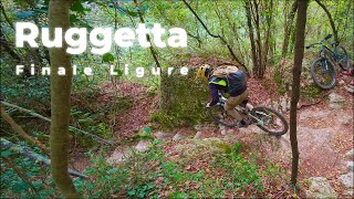
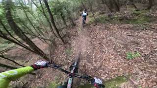
It follows an ancient public way used with donkeys to transport salt in the inland. Now it comprises of plenty of different lines in a rather tight track. It follows a pedalling section in the middle of it, just after a 15m techy section on natural steps.

source: ...
Access Info

San Bernardino Area is reachable from the E80 highway accessing Finale Ligure, drive towards the sea cross the bridge on Via XXV Aprile.

Disclaimer

This trail is not recommended after days of rain, being too wet and slippery. Given its nature, the trail can change after weather happenings and season changes. Always pay attention.

Tags
BridgesFaint trail

Trail Supporters

Local Trail Association

Recent Activity on Trail

Past Week
  • 8 rides
  • 53.5 km average
6 Months
  • 41 rides
  • 36.5 km avg distance
All
  • 374 rides
  • Last: Oct 29, 2026
c1c2c3c4
January
February
March
April
May
June
July
August
September
October
November
December
update trails status or condition

Ruggetta Trail Reports

statusdatedescription
Oct 19, 2026 @ 9:28am (Europe/Monaco)
Oct 19, 2026
Sep 25, 2026 @ 7:53am (Europe/Rome)
Sep 24, 2026
They cleaned it very good - thank you guys. Allways a good ride here.
Sep 24, 2026 @ 4:17pm (Europe/Rome)
Sep 24, 2026
good condition. The sighn says S3. harder thank the Megalithic with S2
May 30, 2026 @ 4:54pm (Europe/Monaco)
May 30, 2026
Premium
Apr 4, 2026 @ 12:05pm (Europe/Monaco)
Apr 4, 2026
more »
Status:
on Oct 19, 2026
Variable
Avg: 4.38 (51 votes)
Your vote: 0

view (2,326)
close
      Directions to ruggetta trailhead (44.198130, 8.338050)

      Photos

      23 more »
      mtb
      50 |
      Aug 17, 2026 @ 7:35am
      Aug 17, 2026
      mtb
      117 |
      Apr 22, 2025 @ 12:41pm
      Apr 22, 2025
      mtb
      159 |
      Jul 8, 2024 @ 8:13am
      Jul 8, 2024
      mtb
      150 |
      Jul 8, 2024 @ 8:12am
      Jul 8, 2024

      Videos

      12 more »
      youtuber Finale Ligure - La Ruggetta  (NEW)  - MTB Beds...
      mtb
      5:47 | 1481 | Oct 3, 2018 , Finale Ligure
      Ruggetta
      mtb
      8:41 | 165 | Jan 11, 2026 , Finale Ligure
      RUGGETTA | FINALE LIGURE | ITALY
      mtb
      9:11 | 152 | Feb 23, 2025 , Finale Ligure
      youtuber #MTB Finale Ligure
      mtb
      3:00 | 562 | Oct 2, 2020 , Finale Ligure

      Routes with this trail

      ★ 5.0 • 48 miles • 9,389 ft • 51 •
      A mish mash of trails all over Finale
      ★ 4.0 • 33 miles • 4,462 ft • 6 • Loop • Race •
      ★ 3.0 • 45 miles • 7,783 ft • 13 • Race •
      Trophy of Nations 2019
      4.5 ★★★★★
      51 Ratings
      5 ★ 59%
      4 ★ 27%
      3 ★ 12%
      2 ★ 2%
      1 ★

      14 Reviews & Comments

      OliverMbBysq
      Qualcuno sa perché il vecchio sentiero Ruggetta non è più mantenuto? è sempre stato divertente e ora è quasi invaso dalla vegetazione.
      Morrrice
      Not sure who marked this trail as blue. But it's definitely a red, in parts black(ish).
      Very technical rock sections that need a lot of bike control, brake control and balance. Slippery when wet.
      Beautiful nature, though. The caves and the forest are amazing.
      Stevenk007
      One of the best i know so far. Some technical sections with rollable steps. Solid red.

      We hope you've been enjoying Trailforks!

      Create a FREE account to view all trail reviews and much more.

      • By kaiser81TF Pro & contributors
      • #78697 - 10,712 views

      Frequently Asked Questions

      ▼ Where is Ruggetta located?
      Ruggetta is located in Finale Outdoor Region, Finale Ligure, Italy. It is part of the Finale Outdoor Region trail network. The trailhead is located at coordinates 44.19813, 8.33805.
      ▼ How hard is Ruggetta?
      Ruggetta is rated as Red difficulty. The physical rating is Moderate. The average grade is 8.9%. The climb difficulty is rated Green.
      ▼ What is the elevation gain for Ruggetta?
      Ruggetta has 12 ft of elevation gain. The trail has 585 ft of elevation descent. The elevation ranges from 445 ft to 1,018 ft.
      ▼ Is Ruggetta a point to point trail?
      Yes, Ruggetta is a point to point trail. The direction is Downhill Only. The trail type is singletrack.
      ▼ How long is Ruggetta?
      Ruggetta is 1.2 miles long. The trail type is singletrack.
      ▼ Are dogs allowed on Ruggetta?
      Yes, dogs are allowed on Ruggetta. Please keep dogs on a leash where required and clean up after them.
      ▼ When is the best time of year to ride Ruggetta?
      Based on activity log data, the most popular months to ride Ruggetta are:
      • October (51 activities)
      • April (39 activities)
      • May (29 activities)
      Check the reports page for current trail conditions.
      ▼ How do I access Ruggetta? Where is the closest parking trailhead?
      The closest parking and trailhead locations to Ruggetta are: View all parking locations in the area.
      ▼ How long does it take to ride Ruggetta?
      Based on recorded activities, it takes an average of 15 minutes to ride Ruggetta. The trail is 1.2 miles long. Actual times will vary based on fitness level, conditions, and pace. View recent activity logs for more details.
      ▼ How busy is Ruggetta?
      Ruggetta is a moderately popular trail. There have been 2,408 recorded activities on this trail. The trail has received 2,326 check-ins. View recent activity on this trail.

      Hit the Trail

      Open in App

      Get this trail on your phone instantly.

      open trail in app

      Download Trail

      Save to wishlist, Garmin & download.
      save the trail

      Find Related Routes

      Find routes and users activities that include this trail.
      find routes for this trail

      You must enter a description before submitting.