4,336 ft
Distance
11 ft
Climb
-501 ft
Descent
00:05:15
Avg time
Mikes Details
-
Activities
- Mountain Bike
- Hike
- Trail Running
-
Riding AreaPineview
Kamloops, British Columbia -
Difficulty Rating
-
Trail TypeSingletrack
-
Bike TypeAM, XC
-
DirectionDownhill OnlyPopular direction shown
-
Dogs AllowedYes
-
Global Ranking
-
Local Popularity100 in Mountain Biking [+]
- 90 in Trail Running
- 90 in Hiking
-
Land OwnerKamloops Performance Cycling Centre
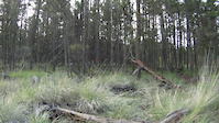
Main downhill route for the eastern side of the Pineview Classic trail network. A "dark blue" because of steeper sections, but beginner/intermediates will enjoy the wider and non-technical descent if taken slowly.
Local Trail Association
-
Please consider joining or donating to the local trail association to supportdonate to earn trail karma!
trail development & maintenance.
Traditionally Indigenous Territory
More Stats for Mikes mountain bike trail trail
-
Altitude change-492 ft
-
Altitude min2,524 ft
-
Altitude max3,023 ft
-
Altitude start3,018 ft
-
Altitude end2,526 ft
-
Grade-11.343%
-
Grade max-36.385%
-
Grade min6.876%
-
Distance climb429 ft
-
Distance down3,685 ft
-
Distance flat222 ft
-
Avg time00:05:15
-
Avg reverse time00:01:56
- view trail stats
close
3D
Trail Conditions
- Unknown
- Snow Groomed
- Snow Packed
- Snow Covered
- Snow Cover Inadequate
- Freeze/thaw Cycle
- Icy
- Prevalent Mud
- Wet
- Variable
- Ideal
- Dry
- Very Dry
Trail Flow (Ridden Direction)
Trailforks scans users ridelogs to determine the most popular direction each trail is ridden. A good flowing trail network will have most trails flowing in a single direction according to their intension.
The colour categories are based on what percentage of riders are riding a trail in its intended direction.
- > 96%
- > 90%
- > 80%
- > 70%
- > 50%
- < 50%
- bi-directional trail
- no data
Trail Last Ridden
Trailforks scans ridelogs to determine the last time a trail was ridden.
- < 2 days
- < 1 week
- < 2 weeks
- < 1 month
- < 6 months
- > 6 months
Trail Ridden Direction
The intended direction a trail should be ridden.
- Downhill Only
- Downhill Primary
- Both Directions
- Uphill Primary
- Uphill Only
- One Direction
Contribute Details
Colors indicate trail is missing specified detail.
- Description
- Photos
- Description & Photos
- Videos
Trail Popularity ?
Trailforks scans ridelogs to determine which trails are ridden the most in the last 9 months.
Trails are compared with nearby trails in the same city region with a possible 25 colour shades.
Think of this as a heatmap, more rides = more kinetic energy = warmer colors.
- most popular
- popular
- less popular
- not popular
ATV/ORV/OHV Filter
Max Vehicle Width
inches
Radar Time
x
Activity Recordings
Trailforks users anonymized public ridelogs from the past 6 months.
- mountain biking recent
- mountain biking (>6 month)
- hiking (1 year)
- moto (1 year)
Activity Recordings
Trailforks users anonymized public skilogs from the past 12 months.
- Downhill Ski
- Backcountry Ski
- Nordic Ski
- Snowmobile
Jump Magnitude Heatmap
Heatmap of where riders jump on trails. Zoom in to see individual jumps, click circles to view jump details.
Trails Deemphasized
Trails are shown in grey.
Only show trails with NO bikes.
Save the current map location and zoom level as your default home location whenever this page is loaded.
Save
Directions to mikes trailhead
(50.646980, -120.407330)
update trails status or condition
Mikes Trail Reports
view all reports »
Recent Ridelog Activity on Trail
Past Week
- 0 rides
6 Months
- 344 rides
- 10 miles avg distance
All
- 5,015 rides
- Last: Jan 10, 2023
Routes with this trail
Videos
more »
Nearby Trails
- Miner 29'er 0 ft
- Lockie Lake Lane 719 ft
- Lockie Lake Lane East 719 ft
- Down The Hatch 1,138 ft
- Y Knot ? 1,755 ft
- embed Mikes trail on your website
- By chesnuts
& contributors
- #33926 - 3,231 views
- subscribe
- login to download gpx or kml files.