more stats
4.2 miles
Distance
324 ft
Climb
-330 ft
Descent
00:24:37
Avg time
-6 ft
Altitude change
141 ft
Altitude min
209 ft
Altitude max
163 ft
Altitude start
157 ft
Altitude end
-0%
Grade
-13.5%
Grade max
20.7%
Grade min
2 miles
Distance climb
2 miles
Distance down
4,738 ft
Distance flat
00:24:37
Avg time

Millstone Details

  • Activities
    • Mountain Bike
    • E-Bike
  • Riding Area
    Pocahontas State Park
    Chesterfield, Virginia
  • Difficulty Rating
  • Voted Difficulty
    Blue (4 votes)
  • Local Popularity
    95 in Mountain Biking [+]
    • 95 in E-Biking
  • Global Ranking
    #22543 in Mountain Biking [+]
    • #3294 in E-Biking
  • State Ranking
    #132 in Mountain Biking · Virginia [+]
    • #9 in E-Biking
  • Trail Type
    Singletrack
  • Bike Type
    XC
  • Climb Difficulty
    Black Diamond
  • Physical Rating
    Hard
  • Season
    Year round
  • Dogs Allowed
    Yes
  • eBike Allowed
    Yes up to Class 1
  • TTFs on Trail
    Berm, Jump, Rock Garden, Roller Coaster
  • Year Opened
    2018
  • Land Owner
    DCR

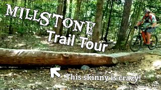
This trail has a most difficult rating due to there are several difficult rock gardens and two wood skinnies. This trail nicely follows the terrain contours on the north east side of the park. It is 4 miles long and has serval steep climbs and downhills. Be prepared to hit several difficult rock gardens that come up quickly.

Tags

Trail Supporters

Local Trail Association

Recent Activity on Trail

Past Week
  • 5 rides
  • 15 miles average
6 Months
  • 159 rides
  • 17 miles avg distance
All
  • 2,022 rides
  • Last: Nov 2, 2026
c1c2c3c4
January
February
March
April
May
June
July
August
September
October
November
December
update trails status or condition

Millstone Trail Reports

statusdatedescription
Oct 21, 2026 @ 11:17am (America/New_York)
Oct 21, 2026
Tree down on Millstone
Oct 8, 2026 @ 3:00pm (America/New_York)
Oct 8, 2026
reporter Dead pine across the trail
Aug 20, 2026 @ 1:47pm (America/New_York)
Aug 20, 2026
Aug 10, 2026 @ 10:37am (America/New_York)
Aug 10, 2026
Large tree down across trail, blocking trail just past the trail sign.
Jul 28, 2026 @ 2:57pm (America/New_York)
Jul 28, 2026
Good trail with some technical. Mostly a blue with a few techy spots. Nothing serious.
more »
Status:
on Oct 21, 2026
Avg: 4.2 (24 votes)
Your vote: 0

view (16,136)
close
      Directions to millstone trailhead (37.385240, -77.546530)

      Photos

      133 more »
      mtb
      209 |
      Mar 23, 2023 @ 10:46am
      Mar 23, 2023
      mtb
      205 |
      Nov 3, 2020 @ 10:21am
      Nov 3, 2020
      mtb
      435 |
      Mar 10, 2020 @ 9:58am
      Mar 10, 2020
      mtb
      425 |
      Jun 24, 2019 @ 1:26pm
      Jun 24, 2019

      Videos

      1 more »
      Pocahontas State Park Mountain Bike Trails:...
      mtb
      38:30 | 1893 | Oct 9, 2019 , Chesterfield

      Routes with this trail

      ★ 4.0 • 14 miles • 884 ft • 14 • Loop •
      Good loop of all the cross country trails (except Corkscrew) in the Swift Creek trail system.
      18 miles • 1,284 ft • 20 • Out & Back •
      A longer version of the Tour de Swift Creek, starting down at the main parking and including some trails...
      47 miles • 3,089 ft • 71 • Loop •
      Want to hit every trail in PSP from the pool parking lot? This is one way to do it. It may not be the most...
      4.3 ★★★★★
      24 Ratings
      5 ★ 50%
      4 ★ 38%
      3 ★ 8%
      2 ★
      1 ★ 4%

      7 Reviews & Comments

      rodelloro
      Compared to the rest of the trails it could be considered black but not to west coast black. If anyone could share some black trails close to Richmond area?
      OwenscD4Ys
      Not a black at all. The very end with the jump line can be considered low black but it isn’t worth riding to get too it. If you want to ride the jump line I recommend taking the fire road down too it instead of taking the trail.
      O2fill
      Agree on blue rating. There is a very large declining rock garden with significant risk but there is a b-line that bypasses it

      We hope you've been enjoying Trailforks!

      Create a FREE account to view all trail reviews and much more.

      • By Stinky-DeeTF Pro RVA MORE & contributors
      • #109464 - 8,061 views

      Frequently Asked Questions

      ▼ Where is Millstone located?
      Millstone is located in Pocahontas State Park, Chesterfield, Virginia, United States. It is part of the Pocahontas State Park trail network. The trailhead is located at coordinates 37.38524, -77.54653.
      ▼ How hard is Millstone?
      Millstone is rated as Black Diamond difficulty. The physical rating is Hard. The climb difficulty is rated Black Diamond.
      ▼ What is the elevation gain for Millstone?
      Millstone has 324 ft of elevation gain. The trail has 330 ft of elevation descent. The elevation ranges from 141 ft to 209 ft.
      ▼ How long is Millstone?
      Millstone is 4.2 miles long. The trail type is singletrack.
      ▼ Are dogs allowed on Millstone?
      Yes, dogs are allowed on Millstone. Please keep dogs on a leash where required and clean up after them.
      ▼ When is the best time of year to ride Millstone?
      Millstone is best visited during: Year round.
      ▼ How do I access Millstone? Where is the closest parking trailhead?
      The closest parking and trailhead locations to Millstone are: View all parking locations in the area.
      ▼ How long does it take to ride Millstone?
      Based on recorded activities, it takes an average of 25 minutes to ride Millstone. The trail is 4.2 miles long. Actual times will vary based on fitness level, conditions, and pace. View recent activity logs for more details.
      ▼ How busy is Millstone?
      Millstone is a very popular trail. There have been 11,986 recorded activities on this trail. The trail has received 16,136 check-ins. View recent activity on this trail.

      Hit the Trail

      Open in App

      Get this trail on your phone instantly.

      open trail in app

      Download Trail

      Save to wishlist, Garmin & download.
      save the trail

      Find Related Routes

      Find routes and users activities that include this trail.
      find routes for this trail

      You must enter a description before submitting.