more stats
2,628 ft
Distance
52 ft
Climb
-261 ft
Descent
00:05:43
Avg time
-209 ft
Altitude change
2,878 ft
Altitude min
3,136 ft
Altitude max
3,087 ft
Altitude start
2,877 ft
Altitude end
-7.9%
Grade
-45%
Grade max
34.5%
Grade min
361 ft
Distance climb
2,178 ft
Distance down
89 ft
Distance flat
00:05:43
Avg time

Mimsy Trail Details

  • Activities
    • Mountain Bike
  • Riding Area
    Ashland Watershed
    Ashland, Oregon
  • Difficulty Rating
  • Voted Difficulty
    Green (3 votes)
  • Local Popularity
    90 in Mountain Biking
  • Global Ranking
    #56190 in Mountain Biking
  • Trail Type
    Singletrack
  • Bike Type
    DH, AM, XC
  • Direction
    Downhill Only
    Popular Direction Shown
  • Physical Rating
    Moderate
  • Trail Visibility
    Always easy to follow
  • Season
    All Season
  • TTFs on Trail
    Jump
  • Ride in Rain
    Yes
  • Land Owner
    Rogue River Siskiyou Ranger District

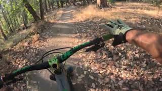
Alice in Wonderland is composed of mainly decomposed granite and can be ridden year round and in wet weather. During the summer months the granite acts like tiny marbles and can be slick. It is a short connection trail from the White Rabbit Trailhead parking lot to BTI.

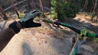
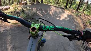
The trail starts off fairly flat before getting steeper and narrower. The trail will twist slightly through the manzanita and offer some small rollers, small dips and some smaller jumps. The trail becomes steeper as it descends to BTI. Either take BTI on the left or stay straight and the trail will end at the Ashland Loop Rd near Morton St.

Access Info

Starting in Lithia Park follow Winburn Wy to the intersection of Granite St. Continue on Granite St to the Granite St reservoir and keep left onto Glenview Dr. After the rock pit take the Ashland Loop Rd on the right for a steep climb to the Crowson Reservoir tower. Continue uphill on the paved road and when it turns to dirt the climb is only one more mile to the parking lot of Alice in Wonderland/White Rabbit Trail parking lot. This area is as far as vehicles can travel before reaching a locked Forest Service gate. Alice begins on the west side of the parking lot.

Trail Supporters

  • USFS
    Land Manager
Local Trail Association

Recent Activity on Trail

Past Week
  • 5 rides
  • 16 miles average
6 Months
  • 53 rides
  • 12 miles avg distance
All
  • 638 rides
  • Last: Jun 1, 2026
c1c2c3c4
January
February
March
April
May
June
July
August
September
October
November
December
update trails status or condition

Mimsy Trail Trail Reports

statusdatedescription
Aug 28, 2025 @ 9:05am
Aug 28, 2025
reporter
May 31, 2025 @ 12:31pm
May 31, 2025
Feb 25, 2025 @ 4:26pm
Feb 25, 2025
Trail was in pretty good shape and drained well from yesterday's rain. Good riding conditions.
Feb 20, 2025 @ 2:07pm
Feb 20, 2025
reporter One large tree blocking the trail. Lots of low lying brush blocking the trail at head level.
Nov 11, 2024 @ 3:56pm
Nov 11, 2024
more »
Status:
on Aug 28, 2025
Very Dry
Avg: 3.79 (13 votes)
Your vote: 0

view (5,599)
close
3D
Trail Conditions
  • Unknown
  • Snow Groomed
  • Snow Packed
  • Snow Covered
  • Snow Cover Partial
  • Freeze/thaw Cycle
  • Icy
  • Prevalent Mud
  • Wet
  • Variable
  • Ideal
  • Dry
  • Very Dry
Trail Flow (Ridden Direction)
Trailforks scans users ridelogs to determine the most popular direction each trail is ridden. A good flowing trail network will have most trails flowing in a single direction according to their intension.
The colour categories are based on what percentage of riders are riding a trail in its intended direction.
  • > 96%
  • > 90%
  • > 80%
  • > 70%
  • > 50%
  • < 50%
  • bi-directional trail
  • no data
Trail Last Ridden
Trailforks scans ridelogs to determine the last time a trail was ridden.
  • < 2 days
  • < 1 week
  • < 2 weeks
  • < 1 month
  • < 6 months
  • > 6 months
Trail Ridden Direction
The intended direction a trail should be ridden.
  • Downhill Only
  • Downhill Primary
  • Both Directions
  • Uphill Primary
  • Uphill Only
  • One Direction
Contribute Details
Colors indicate trail is missing specified detail.
  • Description
  • Photos
  • Description & Photos
  • Videos
Trail Popularity ?
Trailforks scans ridelogs to determine which trails are ridden the most in the last 9 months. Trails are compared with nearby trails in the same city region with a possible 25 colour shades. Think of this as a heatmap, more rides = more kinetic energy = warmer colors.
  • most popular
  • popular
  • less popular
  • not popular
ATV/ORV/OHV Filter
Max Vehicle Width
inches
US Cell Coverage
Legend
cell carrier legend

Radar Time
Activity Recordings
Trailforks uses anonymized public activity data. ?
Activity Recordings
Trailforks uses anonymized public activity data. ?
Personal Heatmap
Activity Types
all / none
Options
2
Date range month
Winter Trails
Warning A routing network for winter maps does not exist. Selecting trails using the winter trails layer has been disabled.
Missing Trails
Most Popular
Least Popular
Trails are colored based on popularity. The more popular a trail is, the more red. Less popular trails trend towards green.
Jump Magnitude Heatmap
Heatmap of where riders jump on trails. Zoom in to see individual jumps, click circles to view jump details.
BC Backroad Status

Service Road Atlas is a free to use, community-driven service for viewing and creating reports on the numerous back-country service roads around B.C. and Alberta.

map legend
Slope Aspect
Direction the slope faces
Flat N NE E SE S SW W NW
Trails Deemphasized
Trails are shown in grey.
disable
Only show trails with no bike usage.
Enable
Suggested Layers
Based on selected activity type

    Save the current map location and zoom level as your default home location whenever this page is loaded.

    Save
        Directions to mimsy-trail trailhead (42.172070, -122.706070)

        Photos

        2 more »
        222 |
        Sep 10, 2019 @ 12:32am
        Sep 10, 2019
        319 |
        Dec 28, 2015 @ 10:58am
        Dec 28, 2015

        Videos

        5 more »
        youtuber Alice in Wonderland to BTI Trail - Mt. Ashland, OR
        7:01 | 1083 | Sep 14, 2018 , Ashland
        THE SICKEST MTB JUMP TRAIL THAT ISN'T EVEN ON...
        4:46 | 30 | Nov 28, 2025 , Ashland
        Super FAST EASY TRAIL That ANYBODY Can Ride!...
        2:37 | 24 | Oct 13, 2025 , Ashland
        Short, Fast MTB Trail with Lots of Berms...
        2:20 | 16 | Aug 23, 2025 , Ashland

        Routes with this trail

        5.0 14 miles 3,262 ft 7 Loop
        Overview Get to know the Ashland area with this fine sampling of near-town trails. The green and blue...
        12 miles 2,793 ft 8
        Enduro Sport/YES Intermediate course
        4 miles 1,005 ft 4
        Route proposal for cascadia dirt cup

        Reviews / Comments

        No reviews yet, be the first to write a review or ask a question.
        Use trail reports to comment on trail conditions.


        We hope you've been enjoying Trailforks!

        Create a FREE account to view trail comments and much more.

        • By snl1200TF Pro & contributors
        • #19905 - 4,331 views

        Frequently Asked Questions About Mimsy Trail

        Where is Mimsy Trail located?
        Mimsy Trail is located in Ashland Watershed, Ashland, Oregon, United States. It is part of the Ashland Watershed trail network. The trailhead is located at coordinates 42.17207, -122.70607.
        How hard is Mimsy Trail?
        Mimsy Trail is rated as Green difficulty. The physical rating is Moderate. The average grade is 7.9%.
        What is the elevation gain for Mimsy Trail?
        Mimsy Trail has 52 ft of elevation gain. The trail has 261 ft of elevation descent. The elevation ranges from 2,878 ft to 3,136 ft.
        Is Mimsy Trail a point to point trail?
        Yes, Mimsy Trail is a point to point trail. The direction is Downhill Only. The trail type is singletrack.

        Hit the Trail

        Open in App

        Get this trail on your phone instantly.
        open trail in app

        Download Trail

        Save to wishlist, Garmin & download.
        save the trail

        Find Related Routes

        Find routes and users activities that include this trail.
        find routes for this trail

        You must enter a description before submitting.