
more stats
1.9 miles
Distance
76 ft
Climb
-1,882 ft
Descent
00:30:57
Avg time
-1,806 ft
Altitude change
1,838 ft
Altitude min
3,704 ft
Altitude max
3,644 ft
Altitude start
1,837 ft
Altitude end
-17.6%
Grade
-59.8%
Grade max
21.4%
Grade min
1,145 ft
Distance climb
2 miles
Distance down
43 ft
Distance flat
00:30:57
Avg time

Missing Link Details

  • Activities
    • Mountain Bike
    • Hike
    • Trail Running
  • Riding Area
  • Difficulty Rating
  • Local Popularity
    100 in Mountain Biking [+]
    • 95 in Trail Running
    • 90 in Hiking
  • Global Ranking
    #48362 in Mountain Biking [+]
    • #21477 in Trail Running
    • #135087 in Hiking
  • Hiking SAC Scale
    T1 Hiking
  • Trail Type
    Singletrack
  • Bike Type
    DH, AM
  • Direction
    Downhill Primary
    Popular Direction Shown
  • Physical Rating
    Moderate
  • Trail Visibility
    Always easy to follow
  • Dogs Allowed
    Yes
  • TTFs on Trail
    Berm, Jump, Rock Garden

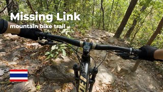
3 kilometers of leg burning fun. This trail has it all: punchy climbs, flowy downhill, hairpin corners, small jumps, steep lines, and a nasty rock-garden. The trail starts on nice loam and ends on loose rocky terrain. Average grade is -19%. A trail that should not be missed when riding on Doi Suthep.

Access Info

From the Village: follow the road that goes past the temple down to the first major junction and then turn back to your right. The trail starts by going up on the right.
From School House Trail: when you get to the dirt road/double track - turn left like you are going to Gee's House Trail. Go past Gee's House Trail about .5 km and look for the trail head on your right.

Trail Supporters
Local Trail Association

Recent Activity on Trail

Past Week
  • 0 rides
  •  
6 Months
  • 8 rides
  • 13 miles avg distance
All
  • 42 rides
  • Last: Jul 29, 2026
update trails status or condition

Missing Link Trail Reports

Status:
on Dec 16, 2025
Ideal
Avg: 4.13 (1 votes)
Your vote: 0

view (276)
close
      Directions to missing-link-234163 trailhead (18.845040, 98.918400)

      Photos

      1 more »
      mtb
      64 |
      May 26, 2026 @ 5:03am
      May 26, 2026

      Videos

      2 more »
      youtuber NEW MTB Trails in Chiang Mai Thailand
      mtb
      9:17 | 382 | Oct 19, 2022 , Chiang Mai
      Missing Link
      mtb
      13:19 | 74 | Jan 12, 2025 , Chiang Mai
      5.0
      1 Ratings
      5 100%
      4
      3
      2
      1

      2 Reviews & Comments

      amak34
      What a blast ! It has 2 short portions that are even steeper than the rest. Make sure your brakes work before dropping in ahah
      CMjunglesnake
      Steeper than Gee's House Trail to the south. If you're ascending the K2 trail from Navamin Reservoir (behind the 700-Year Anniversary Stadium), don't cross the river at the junction and take a right. Keep going uphills and you will reach the road that connects Huay Tung Tao lake with the Hmong village of Khun Chang Khian.

      Mostly clear and passable, and not a lot of fallen trees which tend to mostly be at the top of the trail.

      We hope you've been enjoying Trailforks!

      Create a FREE account to view all trail reviews and much more.

      • By RyanVarsTF Pro & contributors
      • #234163 - 1,626 views

      Frequently Asked Questions

      Where is Missing Link located?
      Missing Link is located in Doi Suthep Pui National Park, Chiang Mai, Thailand. It is part of the Doi Suthep Pui National Park trail network. The trailhead is located at coordinates 18.84504, 98.9184.
      How hard is Missing Link?
      Missing Link is rated as Blue difficulty. The physical rating is Moderate. The average grade is 17.6%.
      What is the elevation gain for Missing Link?
      Missing Link has 76 ft of elevation gain. The trail has 1,882 ft of elevation descent. The elevation ranges from 1,838 ft to 3,704 ft.
      Is Missing Link a point to point trail?
      Missing Link is not a point to point trail. The direction is Downhill Primary. The trail type is singletrack.
      How long is Missing Link?
      Missing Link is 1.9 miles long. The trail type is singletrack.
      Are dogs allowed on Missing Link?
      Yes, dogs are allowed on Missing Link. Please keep dogs on a leash where required and clean up after them.
      How long does it take to ride Missing Link?
      Based on recorded activities, it takes an average of 19 minutes to ride Missing Link. The trail is 1.9 miles long. Actual times will vary based on fitness level, conditions, and pace. View recent activity logs for more details.
      How busy is Missing Link?
      Missing Link is a very popular trail. There have been 273 recorded activities on this trail. The trail has received 276 check-ins. View recent activity on this trail.

      Hit the Trail

      Open in App

      Get this trail on your phone instantly.

      open trail in app

      Download Trail

      Save to wishlist, Garmin & download.
      save the trail

      Find Related Routes

      Find routes and users activities that include this trail.
      find routes for this trail

      You must enter a description before submitting.