3,859 ft
Distance
149 ft
Climb
-177 ft
Descent
00:09:13
Avg time
Missing Link Details
-
Riding AreaCumberland Forest
Cumberland, British Columbia -
Difficulty Rating
-
Trail TypeSingletrack
-
Bike TypeAM, XC
-
Physical RatingModerate
-
SeasonYear round
-
Dogs AllowedYes
-
TTFs on TrailRock Face
-
Ride in RainYes
-
Global Ranking#12664 in Mountain Biking
-
Local Popularity80 in Mountain Biking [+]
- 5 in Trail Running
- 80 in Hiking
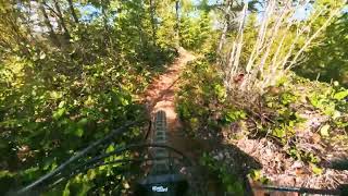
New part of the lower trail network. A good example of the regeneration of the forest and how trails can grow with the trees around them.
Access Info
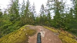
Turn right 100m above the chlorine shack.
Local Trail Association
-
United Riders of Cumberland
(www.unitedridersofcumberland.com) Please consider joining or donating to the local riding association to support trail development & maintenance.donate to earn trail karma!
More Stats for Missing Link bike trail
-
Altitude change-29 ft
-
Altitude min700 ft
-
Altitude max860 ft
-
Altitude start728 ft
-
Altitude end700 ft
-
Grade max-59.519%
-
Grade min41.657%
-
Distance climb1,596 ft
-
Distance down1,915 ft
-
Distance flat347 ft
-
Avg time00:09:13
-
Avg reverse time00:03:48
- view trail stats
close
Trail Conditions
- Unknown
- Snow Groomed
- Snow Packed
- Snow Covered
- Freeze/thaw Cycle
- Icy
- Prevalent Mud
- Wet
- Variable
- Dry
- Very Dry
Trail Ridden Direction
Trailforks scans users ridelogs to determine the most popular direction each trail is ridden. A good flowing trail network will have most trails flowing in a single direction according to their intension.
The colour categories are based on what percentage of riders are riding a trail in its intended direction.
- > 96%
- > 90%
- > 80%
- > 70%
- > 50%
- < 50%
Trail Last Ridden
Trailforks scans ridelogs to determine the last time a trail was ridden.
- < 2 days
- < 1 week
- < 2 weeks
- < 1 month
- < 6 months
- > 6 months
Trail Ridden Direction
The intendid direction a trail should be ridden.
- Downhill Only
- Downhill Primary
- Both Directions
- Uphill Primary
- Uphill Only
- One Direction
ContributeDetails
Colors indicate trail is missing specified detail.
- Description
- Photos
- Description & Photos
- Videos
LEGEND
Trail Difficulties
Trail Report Status
- Access Road/Trail
- White
- Green
- Blue
- Black
- Double Black Diamond
Trail Report Status
- Clear / Green
- Minor Issue / Yellow
- Significant Issue / Amber
- Closed or Major Issue / Red
- Land Owner Overlay
- Wilderness (typically no bikes in USA)
- BLM (public)
- USFS (Wildlife sanctuaries darker than usfs)
- State land
- Indigenous
- Military
Trail Conditions
- Unknown
- Snow Groomed
- Snow Packed
- Snow Covered
- Freeze/thaw Cycle
- Icy
- Prevalent Mud
- Wet
- Variable
- Dry
- Very Dry
- Map Markers
Trail Head
Photo
Directory Listing
Riding Area
TTF
Parking
Viewpoint
Information
Warning
Directions
Water Fountain/Source
Sight
Restrooms
Gate
Camping
Trail Sign
Table or Bench
eBike Charging Point
Other
Directions to missing-link trailhead
(49.609040, -125.036770)
update trails status or condition
Missing Link Trail Reports
view all reports »
Recent Ridelog Activity on Trail
Past Week
- 0 rides
6 Months
- 115 rides
- 10 miles avg distance
All
- 1,083 rides
Photos
more »
Routes with this trail
more »
Trail Products
Reviews / Comments
No reviews yet, be the first to write a review or ask a question.
Use trail reports to comment on trail conditions.
Videos
more »
Nearby Trails
- spanker connector 13 ft
- six pack 892 ft
- spanker 1,325 ft
- after school special 1,362 ft
- kitty litter 1,404 ft
- embed Missing Link trail on your website
- By skifreak Plus & contributors
- #1432 - 3,289 views
- subscribe
- login to download gpx or kml files.
Open trail in mobile app